
29 October 2014
Day 1. Cape Reinga to Twilight Camp
Today 12 km. Total 12 km. 4 hours (1220-1620).
I was picked up at 0850 by a very friendly lady with Sand Safaris. As she had a pickup at the Waipapakauri holiday park she offered to take me there to show me how to get to it when I came back down the beach. She then dropped us off at the bus. I was allowed to sit in the front seat so had fantastic views of the beach. We drove up the beach to Te Paki Steam in just 1 hour and then drove up the steam to the dunes where people Sand boarded down. As I did not want sand everywhere before starting, and did not want an injury, I stayed in the truck.


We then drove up Te Paki steam until coming out onto the road and then it was another 15 minutes to Cape Reinga.
Unfortunately the weather was crap with high winds, poor visibility and sporadic rain. On the way down to the lighthouse I saw two guys walking back up with huge packs and wondered if they were also doing TA. At the lighthouse I asked some people to take photos and attracted a bit of interest when they found out what I was doing. Just as I was about to leave the mist lifted and the sun almost came out so I took some more photos.

As I was looking at the sign pointing to Bluff I had several competing emotions. I was excited to be starting, I felt trepidation at the huge task ahead and how my body would cope, I was satisfied that I had made it to this point and I was proud of having the courage to try such a big task. Excitement won as I walked back up to the turnoff and saw my first TA sign.

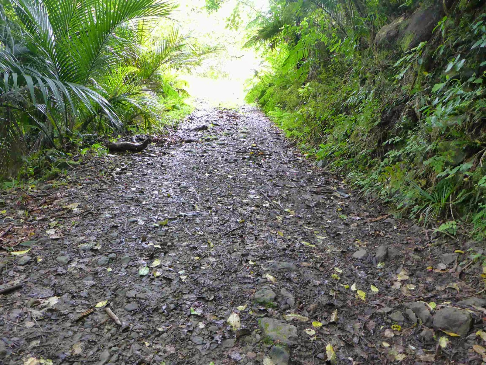
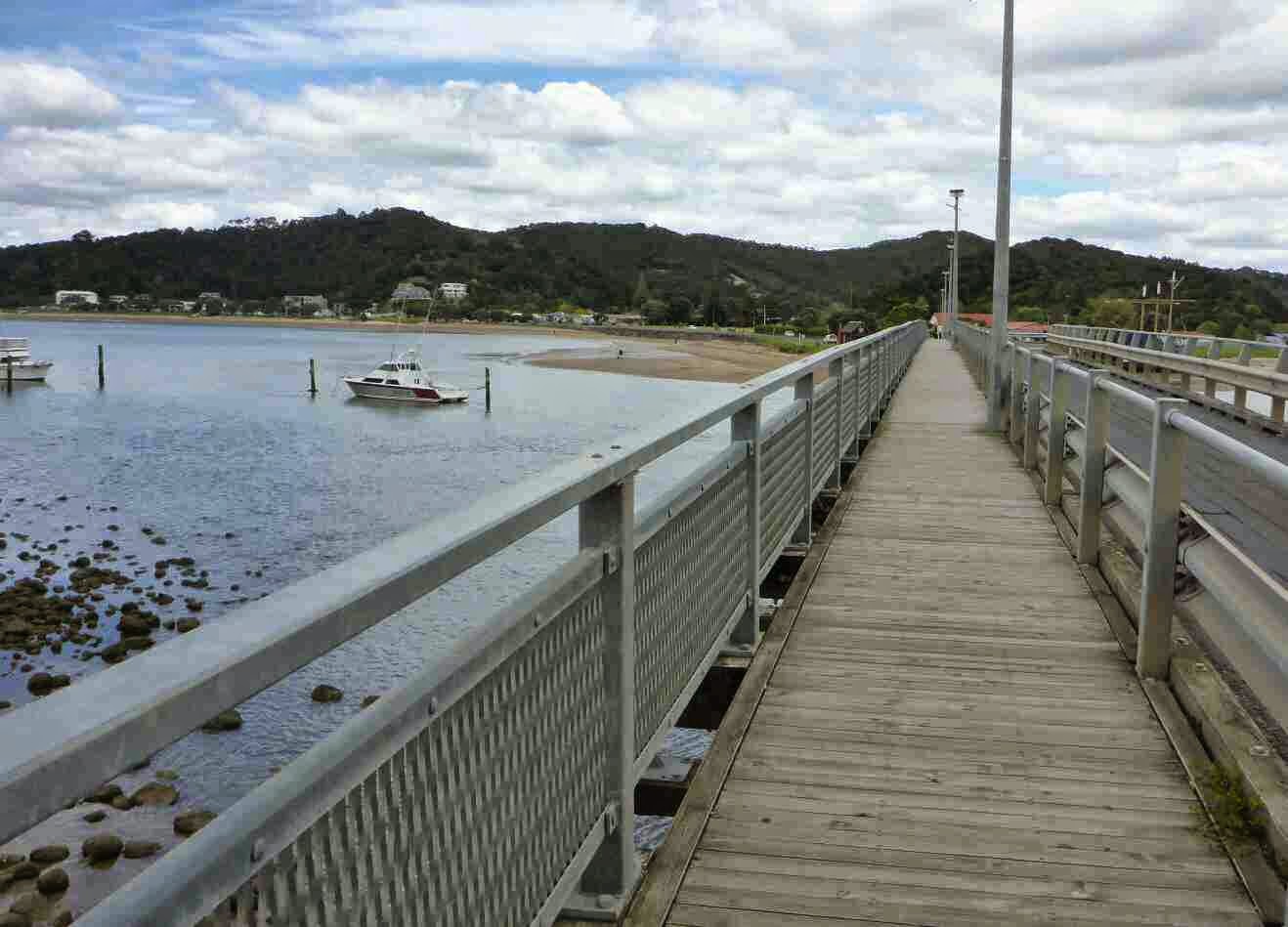
From the turnoff the track dropped down to the beach via a beautiful trail complete with steps. I wonder how many people think that is what the whole trail will be like.

Heading down to the first beach


As I reached the beach I saw the two hikers with big packs from the lighthouse sitting off to the side of the track. I could see the tide was too high to walk around the rocks so planned to walk the first bit then head up into the Hill. As I was about to start the two guys waved me over so I headed over to them and they told me the tide was too high to get around. I explained to them that I was going to go above the rocks and carried on. It was good they called me over as there was a track marked with blue tape that went over the hill above the rocks so I didn’t have to bush bash


Once on the beach it was a long slog. While it was raining the good thing was the wind was coming from North West so it was mainly behind me. At the end of this beach was a river which I had to cross. Unfortunately with the tide so far in the crossing was too deep for me so I had to head upstream to a crossing point. Where I crossed was nearly hip deep in parts but very slow flowing. I then the walked back up the steam to get to the exit point.
Now the track headed up a small grassy bit before heading into the dunes. I was very relieved to be off the beach as my left knee had started to twinge. The markers were set very far apart so I made sure I had a good sighting of the next marker before leaving the marker I was beside.


It was neat to be in the sand dunes and the views were fantastic. While I knew there were sand dunes in the north I didn’t realise how extensive they are.
Eventually I make my way out of the dunes and walked along the top of a Ridge on a grassy 4wd track until hitting the last beach of the day.


I was starting to feel a tight hamstring so stopped to stretch several times and decided to walk backwards a few times just to use some different muscles. I wondered what the two guys would make of my tracks but when I asked them later they hadn’t noticed. The hardest thing about walking along the beach was forcing myself to walk at an easy pace and not rush. I am sure this is going to be a constant struggle as my body remembers the pace I used to Tramp at but is forgetting my lack of fitness.
As I was walking along the beach I could see two man made objects in the distance where the camp was meant to be. They looked like cars but I was sure there was no road there. As I got closer the mystery was solved. They were the campsite toilets.
The sun came out for the last hour as I was walking down this beach and the memories of constant rain faded away as I dried out completely.


I reached the campsite at 1620 which made it an even 4 hour walk for 12 km. Not bad considering the amount of time I was stuffing around taking photos. The campsite is great. It is right above the beach and has an open sided shelter for cooking, a tap and two lovely toilets, complete with toilet paper- luxury.
I took my shoes off to try and dry them and was pleasantly surprised at the good state my feet were in. No blisters yet. I set my tent up and needed a little stuffing around to get it up but that is to be expected for only the third time putting it up. I then fluffed around drying things and getting ready for dinner.
Just after 6 the two guys arrived. They looked a little tired. Rob came over to talk and a little later Joss introduced himself. It turns out that Rob and I had read each others blog. I was amazed at the size of their packs and the huge weight they were carrying. No wonder Joss was a little tired. It didn’t help that they had difficulties in the sand dunes where the markers are so far apart and walked a little further than intended. They are both from the UK though Rob has been living in NZ for 10 months. They were great company for dinner. I laughed when they said they choose 29 Oct as start date thinking no one else would as I did the same thing wanting the start of the walk to myself.


Rob came to the rescue twice for me. When I connected my gas cylinder the gas started coming out which it is not meant to do. As this was the first time I had used the cylinder, and it was brought from The Warehouse, I thought something was wrong. Rob instantly offered me his spare cylinder which was very generous as I did not fancy cold meals for the next 4 days (I have a reserve of 2 meals with meths). When I put his cylinder on it did the same thing so I now thought the stove had gotten damaged on the way to the start. Then Rob suggested I check it was turned off and that solved the problem. With my old stove the is no way you can accidentally turn it on but I now know my new one can and I will now check this before using in future. What could have been a major inconvenience was easily solved by some logic from Rob.
My dinner was a success. Boil water. Pour into plastic bag with noodles, surprise peas, coconut powder and curry paste. Put plastic bag inside metal foil bag to keep warm and leave for 15 minutes. Open bag and eat. Tasted good and used very little gas.

Just as we decided to go to bed it started raining.
Hints of the day
1. From Cape Reinga once you get down the hill to the beach check if the rocks are passable. If the tide is high you will need to take the track above them. Walk along the beach 30 meters. There is a gully to your left. At the southern edge of the gully head up about 10 meters and you should see the start of the track on your right. Look for the Blue tape tied to branches and follow until the markers run out. Then follow the tracks until you come down onto a beach past the rocky part. There were Blue ribbons for the last 50 meters of the track.
2. In the dunes do not leave the marker post until you can see the next one. Look in all directions not just where you think the track should go.
3. Entrance to Twilight is easy to see. You will see the tops of the toilets 30 minutes before reaching the camp. When you get below the toilets look for the wooden stairs and go up them to get to the camp.
Disclaimer – Please excuse the multiple spelling mistakes. This blog is typed on a small phone every night after long days tramping and this is not condusive to accurate spelling or grammer.
30 October 2014
Day 2. Twilight Camp to forest camp just past The Bluff.
Today 28km. Total 40km. 10 hours (0820-1820)
I had an okay sleep with the normal first night in a sleeping bag always being restless. I did get a visitor in the night though. I could hear footsteps around me and thought an animal was trying to get in. It sounded big and I thought it may have been a goat but I saw in the gap under my door it was a possum. I made some noise and it left. If it came back again it was quiet as it did not wake me and my stuff was in one piece in the morning. It was surprisingly cold during the night and I had to fully zip up my sleeping bag.I woke as the sun hit my tent at 0730 and at a leisurely morning pack up I was on my way at 0830. The first part was through scrub following a Ridge.


There were heaps of Paradise Ducks all trying their best to lead me away from their nests. I counted 6 pairs. There were a few steep hills in the track which have me a good reminder of my lack of fitness but the view from the top was worth it. The first view of 90 Mile Beach.


I know I will be sick of the sight of this beach shortly but it was great to see it for the first time. I took a few photos with my homemade camera attachment on my trekking pole before going down lots of steps to get down to the beach.
The wind on the beach was cold so I had to put my jacket on. Once on the beach I tried to get into a rhythm but found it hard to keep my pace easy and my steps short to try and prevent sore shins as I often get. I also tried a new technique of loosening to my shoe laces. This seemed to work as I only got occasional twinges which disappeared after stretching. I did a lot of stretching. Anytime one part of my leg would stay hurting I would stretch and it would get better. At Te Paki steam I took off my shoes as I wanted to keep my feet dry. A tour bus drove up to the steam and entered it just as I was crossing and I got a few waves. It was then more beach walking with the excitement being the streams. As I approach each steam I am trying to work out if it is crossable without having to take my shoes off. Even when it is obvious it is to deep I still dither trying to find a way.
At one point there was a big expanse to cross. As at was high tide I had to take my shoes of and walk quite a way. At the far end was a River and I could see the waves were starting to go upstream a little but were still at the River mouth so it was only shin deep. Just as I reached the far side a massive wave came surging up the river so I scrambled up the bank. When I turned around the whole area I had crossed was now under water.


I then sat down on the bank and started the ritual of carefully drying my feet which involved removing all the sand from my feet, socks and shoes before applying some anti chafe cream, then putting on my Gaiters, socks and shoes. I was just up to the removing sand part when I looked up and saw a wall of water busting over the river bank and coming straight for me. In a flurry I grabbed every thing and climbed as high up the nearby cliff as I could. When the waste receded I decided to stay in bare feet until I could find a safer place much higher up to put my shoes back on.
As the tide was so high I found myself scrambling frequently up the cliff to avoid incoming waves for the next few hundred meters until the beach widened more. Even then I was nearly caught several times as there would be a random wave that would come so much further in than the rest. The closest time was when I was taking photos and looked up to see the wave coming rapidly. It was then a mad sprint (really a brisk shuffle with a pack on and tired legs) to get clear.

One of the main reasons I didn’t want to get caught was the waves had a horrible Green foam in them. The must be an algae bloom that has been pushed in with the strong winds though the waves further out we’re clean. This left big lines of geen slime and foam all along the beach.


Matapia Island was visible from the start of the beach but it was like an optical illusion and never got closer and never got bigger. I found the beach distorted things and things further away seemed bigger in the distance than they were. Several times I was sure I could see a couple of people ahead only for them to be birds when I got closer. The Island has a hole through it which you couldn’t see until you came along beside it.
Once I was opposite the Island I had lunch. It was tortilla with cheese, Salami and Sundried Tomatoes. I am guessing from the reaction of the seagulls they have either visited populated areas or get lots of tourists as the was one in sight when I sat down for lunch had grown to 20 by the time I finished. It was now warning up and I was able to take my jacket off.

Because the tide was high I am sure I walked a lot further than the TA map says I did as I had to go in and out of every little bay as I had to hug the cost to get away from the waves. I laughed when I saw a car coming towards me trying to stay on the narrow bit of beach left. I hoped they were locals who knew what they were doing as the bit they were about to drive on was very narrow. As they did not stop to talk I couldn’t check on this.
There was not much of interest blown up on the beach but I did find a float that I amused myself with by creating goalposts with my walking poles to kick through.

Apart from that there was beach, more beach, and even more beach. I was very glad to see The Bluff as I was really looking forward to stopping. In the bus on the way North I had seen a camp on the south side of the Bluff but when I looked at it it didn’t appeal so I walked up the beach a bit more to a stream which I walked up 50 metres to the forest where I set up camp.


Much quicker tonight. Dinner was potato flakes with surprise peas, parsley, garlic powder, onion flakes and bacon bits. Very nice and filling. Still no blisters or injuries and the old body seems to be forgiving me for this punishment I am putting it through. I went to sleep with the soothing sound of the waves crashing onto the beach.
Hints of the day-
1. The track continues through Twilight Camp heading away from the sea following the orange market posts. It quickly swings to the right and you are on your way.
2. Don’t underestimate the waves. They will randomly come faster than normal and huge than normal.
31 October 2014
Day 3. Bluff to 3 km past Hukatere
Today 33km. Total 73 km. 8 1/4 hours (0815 – 1730)
Today was the first full day of all beach and nothing but beach and I was a little concerned about how it would go. My plan was to get to Hukatere Lodge but if I didn’t make it that far I would just camp in the trees again.Last night I was restless again. I think I have my pillow and mattress inflated too much so I will try it differently tonight. My body felt ok when I woke up which surprised me. It took me an hour to get ready in the morning as I was taking it easy.
Once on my way it took a little while for my body to get back into it and I had to stop often to stretch. After about 30 minutes I was back in a routine. There were a couple of cars on the beach and I was offered a ride by some locals which I turned down. My intent at this stage is to do a pure hike where I walk every step of the way.

I was expecting to see all the tour buses around 10 but there was only one nearly empty one at 1020. Later at around 1100 there were three more so they must have made a 1000 start as opposed to the 0900 stay when I did it.
As the tide was out and this was a wider bit of beach there was nothing to look at. Thank goodness for driftwood without which there could not be the driftwood game. What is this game you ask. Well it is the height of entertainment on 90 Mile Beach. What you do is as soon as you see a dark shape in the distance is guess what it is. After 5 minutes you can usually tell if it is a car, a bus, a bird or driftwood. If you still can’t make it out you can change your guess again. After another 5 minutes of intently starting it is usually clear what it is and then you start the “what does the driftwood look like” part of the game. My choices today included ostrich, cow on its back, car with people beside having picnic (I think that one was wishful thinking that I might be able to cage some food) . As you can see this is highly entertaining and wastes 10 to 30 minutes depending how big the driftwood is. I was amazed how far off I could spot things. Several times I thought there were a couple of people ahead but they were just birds.
I did have one entertaining soap opera that had me laughing. A bird (like a seagull but Brown) saw something in the water and landed to catch it and ended up surfing in on the wave. When the wave reached the end the bird tried to pick up the fish but the fish got swept back out with the retreating wave. The bird flew back out to where the fish got dumped and was just about to grab it when another bird flew in to grab it. The first bird sorted out this intruder and finally picked up the fish only to drop it as it flew away and the second bird got the fish. Talk about edge of your seats thriller.


Just before lunch it felt like I had a massive stone in my right shoe and I recognised the feeling as a problem with the muscle or tendon in my foot. I started to think how bad this walk would be with a foot issue. I had been very lucky until then with no blisters and no continuous niggles. All the niggles seemed to go away after stretching. My foot got really bad and I was limping so I decided to stop and have lunch to rest it. After lunch I also changed out the shoe inner as I am carrying spares due to not having long to wear in my new orthotics. After lunch it was a struggle to get going again as every part of my body was making themselves known but this settled down again. My foot still hurt a lot but then after 15 minutes started to come right again to my huge relief. I stayed to get chafing on my thighs but liberal application of my marvellous anti-chafe cream got that under control.
The afternoon was long and the tide stayed coming in meaning no short cutting across the bays anymore. It also meant the return of the snot green foam again.

My excitement of the afternoon cane as I was taking a break sitting on a bank. The waves were coming in about 30 meters away and I kept glancing at them in between looking at my maps and eating Scroggin. I thought that much of a buffer would keep me safe. I saw a wave coming towards me and wasn’t worried as it looked like it would stop well before me and I was up a bank even if it did come. Suddenly the wave was reinforced and came surging towards me at great speed and I had to scramble up the bank. Unfortunately I was not fast enough. I just managed to grab my poles as the wave came gushing over the bank. Both my shoes got soaked and as I turned around I saw my maps floating away. Luckily I am in the habit of doing my pouches up every time I get something out or I would have lost some important things. It shook me up a little just how fast that wave came. Unfortunately I was on a narrow bit of beach so for the next 30 minutes I kept a constant eye on the waves and went running up the bank at anything that looked slightly bigger than normal.
In the distance I saw the big hill that meant Hukatere was close. 30 minutes later I arrived and took the road of the beach. I came across two ladies who looked surprised when I appeared. They asked where I came from and were impressed when I told them. They then asked where I was going and oh so causally I said Bluff. No reaction from one as she was from UK but the Kiwi did a double take at that. Nice reaction that I guess I better get used to.
I walked past the lodge that seems closed given the massive sand slide over the road in several places. I continued along the 4wd tracks to the end. It was so nice to be going in a straight line and be off the beach. After 3 km I was thankful the steam I had been relying on was full so I could grab and purify some water and duck off into the trees to make camp.


The routine is getting faster. Dinner was pumpkin soup, followed by Back Country Cuisine Freeze Dry meal of Thai Green Curry Chicken. Unfortunately it was to spicy for me and I can usually handle a bit of spice. Luckily I had also prepared instant pudding which was really nice and banana chips to finish it off. I have the pre blister signs on the ball of my right foot up near the toes so I put some blister patches on.
1 November 2014
Day 4. Hukatere to Ahipara.
Today 28km. Total 101km. 9 hours (0815-1720).
I had a better night sleep with my pillow and mattress not blown up as much. I woke at 0730 to lots of birds chirping away and another nice day thought there were a few clouds but they just made it much nicer temperature.I kept on the road between the dunes and the forest for the first couple of hours before heading back out onto the beach.

Unfortunately only 30 minutes in there was a boggy steam across the road that I had to cross and I wasn’t willing to go barefoot through it. I did try to make a bridge with pine branches but it was too wide and deep. Within 5 minutes of crossing it was obvious the bluster patches had come lose so I had to dry my foot and put on something else. I used my Kinesio Tape which is great as it is flexible so easy to apply with no wrinkles or bunching and it stays on really well.

There were more cars today being a Saturday which I was thankful for as it was low tide on a wide beach which was lacking anything of interest to look at. Even driftwood was very rare so my favorite driftwood game was a no go. I found myself zoning out for much of the time and I couldn’t tell you what I was thinking about as I can’t remember. Every now and again I would tune in to my body and do corrective stretching or take a break as required. The only trouble with taking a break was getting going again. First my feet had to get used to the weight and the blood rushing back down to them. Then the muscles had to get the blood pumping back through them and the tendons and ligaments had to stretch back out again. From my hips down every part was telling me they were not happy with this punishment but after 5 minutes everything settled down again.
There were a few streams which required getting wet get but I just went through them today as my feet were already wet. I was impressed at how fast my shoes drained and my socks dried.


I reached Waipapakauri at 1215 and decided it was to early to stop. After a quick calculation I realised I could make it into Ahipara today. I picked up the pace a bit with the thought of fish and chips for diner but my body quickly told me to not be stupid. My feet were starting to hurt a bit and were really sore after stopping each time. it felt like my blisters were getting bigger but there wasn’t much I could do. In hindsight I should have stopped more often to get rid of the sand. The problem was by this stage the sand was engrained in my socks and would not come out no matter how much I shook them which turned the socks a little like sandpaper.
For the last 10 km you could see where Ahipara was and this seems to make the time go slower though I did have a good rhythm going and was moving at a steady pace. 3 km out I spotted what looked like people but wasn’t gong to be fooled this time and assumed they were birds. However this time they actually were people. 2 couples taking their dogs for a walk. They guessed straight away what I was doing and congratulated me for getting this far. They gave me directions to the Holiday Park which thankfully was closer than the houses on the Hill that I thought I had to walk to.
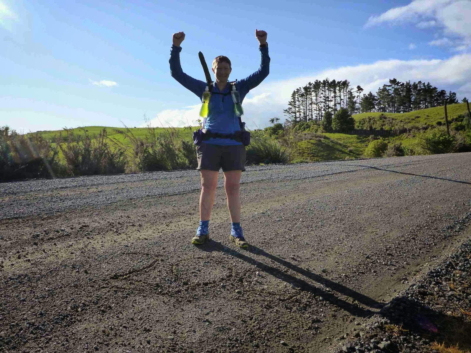
500m from the end of the beach I made a 100 km sign in the sand and took some photos.

Finally I reached the end of the beach
and then it was a walk up the road to my accommodation. By this time my feet were very sore so walking on hard road was not fun. It was a great feeling walking through the Ahipara Holiday Park gates knowing I had conquered 90 Mile Beach.

As I was a day earlier than planned I asked if I could swich my booking days and luckily it wasn’t a problem. In my accommodation I emptied my pack and hit the shower before settling down for some well deserved chips and Ginger Beer. I relaxed for a while then walked (hobbled) down the road for fish and chips and a cheese burger.
On reflection I have really enjoyed this tramp. I know I was incredibly lucky to not have blisters or injuries and to have a light pack. I am sure this contributed to my enjoyment and I can imagine how painful the walk could be with a heavy pack and blisters. I loved the thought that this was the start of a long journey and how relaxed I was knowing I did not have to think about anyone else or about work. I loved stopping when I felt like it and not having to stick to a schedule. I loved randomly picking campsites. I loved the freedom to just stop wherever I was to have a pee though it did feel exposed the first few times. I gained a better appreciation for the life on the beach. The is a lot more happening than we normally notice. Overall I am really glad I decided to do Te Araroa and I am looking forward to the bush legs coming up.
2 November 2014
Day 5. Apihara
Zero Day (no walking)
After sleeping in I did my washing and gave my gear a good scrub to get rid of the sand and salt water spray. I then just relaxed reading and recovering. My feet feel much better and no other aches.


-
 Anonymous 13 November 2014 at 16:00 How did you go resupplying in Ahipara? Is it worth hitching Kaitaia or did Ahipara have enough options?
 -
Restless Kiwi: Walking the Te Araroa Trail 14 November 2014 at 15:17 I sent a resupply package to myself before leaving for Cape Reinga. The campground has a small selection of things and there is a grocery store but I didn’t go inside so not sure what their range is like.
3 November 2014
Day 6. Ahipara to Takahue. (Herekino Forest)
Today 30 km. Total 131km. 11hrs (0730-1750).
I woke up at 0700 and was ready to go by 0730. It is much easier when you don’t have to pack everything up. The weather was overcast and it had obviously rained over night.
I started walking through Ahipara and was surprised that the body felt so good. I could feel the extra weight of the resupply but only noticed it for 10 minutes. My feet felt fine as well despite walking on sealed road.

After 2 km the rain started. For the first 10 minutes it was light drizzle which I was fine with then someone turned on the tap and it got really heavy. My top half stayed nice and dry but my shoes, socks and shorts got drenched. It stayed like this all the way to the track start. I had two offers of a lift. One guy was so confident I would take it he emptied out his boot so my pack would fit and was waiting under his boot door for me. I thanked him and explained what I was doing and that I had to walk every bit of the trail. He had never heard of the trail but was interested. Lovely guy and one of the few willing to pick up a wet hiker. The other person stopped their car and put down their window to ask and looked confused when I said no thanks.
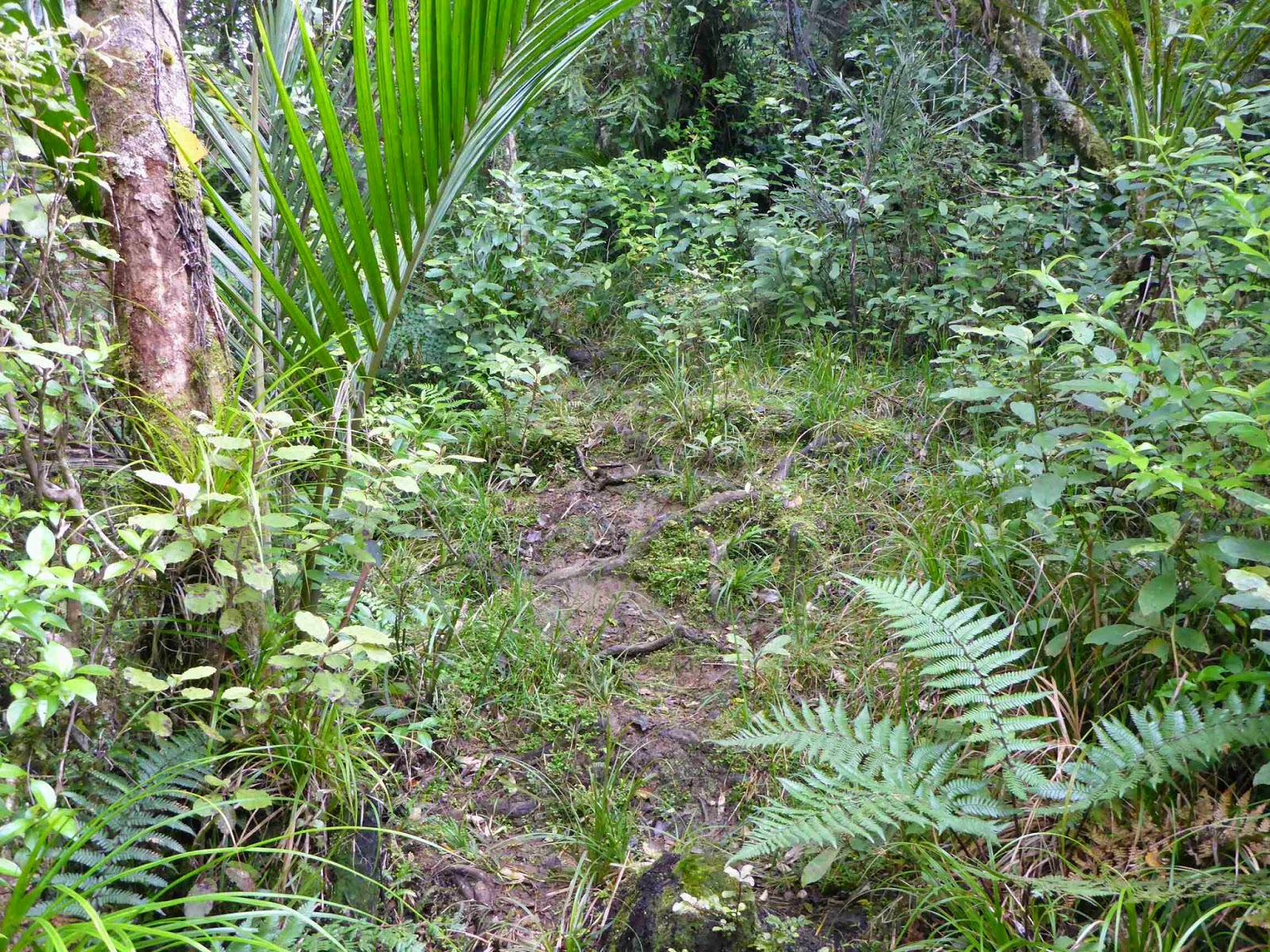
At the start of the track I had a break before advancing into the thick jungle of Northland bush… via the beautifully constructed wooden steps.

The first part of the track is a typical NZ backcountry tramping track but it was well maintained and well marked.


I loved being back in the bush again. The colours, textures, smells and sounds are distinctly NZ Bush and it was great. I had a smile on my face as i was loving it so much. At least in the bush there are no surprises and no rouge waves out to get me.
The rain stopped and I quickly got hot so the jacket came off though I stayed wet for a while by brushing past the wet trees. Every now and again I caught glimpses of a view. The beach to one side and bush ranges the other side. I could still hear the beach for a while and then there was silence for the first time in 4 days no sound of the waves. Instead I now had the more delicate sound of the water dropping off leaves and birds chirping though I couldn’t see any.
After 1 1/2 hours I arrived at the Kaouri Grove and there were heaps of these majestic trees. I always forget how amazing they are with their age and size. Makes you realise how short a time we (humans) have been in NZ.


For some reason as I was walking I got a saying in my head that at would probably make a good chorus for a song about TA. It was very simple and went like this “up and down, up and down, why go around when you can go up and down”. It was in reference to normal ridge travel where you are always going up and down. I managed to get through all of 90 Mile Beach without something stuck in my head but 2 hours in the bush and there it is.
The track started to get a little boggy and then more and more so. It also passed through another stand of Kauri.

The track continued to an old 4wd track which was largely steam for most of it.


There was lots of mud as well. There had been muddy patches but this took it to a whole new level. It was interesting the different coloured mud on this track. There was brown, yellow, orange, red and white mud.


I then came to a signpost which said 4 hours to Diggers Road and 4 hours back the way I had come so this was the half way point. I was 1 hour under the DOC estimate time already
The track then became even more wet and muddy as it went along a ridge then climbed to the high point at 567m. This was marked by a trig but this was not much use as a navigation aid as it was dwarfed by the trees around it. Just before this there was an opening in the trees and the view was back over Ahipara and the ocean.


The track then went down very steeply and there was some evidence of the damage from the recent storm but DOC have done a fantastic job fixing it or re-routing the track. The last 300 metres were unbelievably slippery. I could not get any traction and was sliding a lot. I had to hang on to tree trunks and Supple Jack (a vine) to safely make my way down. Thankfully I managed this without any falls.

It was then down a farm track to Diggers Road and the end of the Herekino Track. I completed this in 6 hours exactly (DOC estimate 8 hours).

I then followed this gravel road for 1.5 km to the turnoff to the forest though one side of the road had been cut down. Along this bit of road I saw a Tui, Pheasant, Yellow Head, Wood Pigeon and Fantail. Not bad for a 3 km stretch of pine forest.


Though the forest was a gravel road there were meant to be orange markers but I only saw the one at the start. I came to a skid site and the road then headed up hill and to the right which I was not expecting. I stopped and washed the mud off my legs and shoes then headed up the hill.

Half way up I thought I should have checked for markers at the skid site but I wasn’t going back down. I went past a road not on the map and kept climbing before heading back down and I noticed an older looking track heading left which I figured was the original one on the map and the main track was new, probably put in during the recent logging. The old track headed down to a beautiful grassy meadow which would have been lovely to camp at. I wanted to keep going another hour so I passed this up though when stopping for some water I got attacked by Sandflys so was glad to keep going. The track crossed a creek up to my mid thigh which I guess is why they re routed the road. It then headed uphill and there was an orange marker which was a relief. 50 meters on was the road and I headed left intending to walk another 40 minutes.
Both sides of the road had bush but I struggled to find a campsite as it was either to steep or to wet. Eventually I scrambled up a bank to what looked good but was too wet. I decided to go further up and found a nice spot but across the fence was the perfect spot so I climbed over and set up camp.

As I was limited on water I went for a small pumpkin soup followed by Bobotie freezedry, which was lovely, followed by a lollie for desert.
As I write this I can hear a Kiwi calling which is fantastic
Lots of other birds were making a racket but now it has gone dark they have gone quiet.
Answer: Kauri bark
Hints of the day
1. Water. There is a stream after the Kaouri Grove. There were also a couple of streams just off the 4wd track, With all the recent reason water is not a problem anywhere on the track and there is something every few km along the track.
2. The is a nice campspot at the trig 567m just before the down Hill bit.
3. When walking look 2-3 metres ahead. This lets you plan ahead where you are going to step. The human mind is amazing and it memorizes the 2 meters and reacts as required while you are looking ahead.
4. When your walking poles get stuck in the mud just rotate them before you pull and this releases the suction.
4 November 2014
Day 7. Takahue to near Mangamuku. (Raetea Forest)
Today 23km. Total 154km. 10 1/2 hours (0730-1800)
I was woken this morning by a very loud and varied dawn chorus at 0615 this morning which was very of nice but slightly earlier than I planned. I left camp at 0730 and had a road walk in the rain start for 5 km then onto an old road heading up to the saddle where the bush track started.


I filled up with water at the bottom as I had heard there was no water up top only to be crossing streams nearly all the way up the hill. I guess it is better to be sure and it was only 2 kg extra. On the way up I scared a big wild pig who thankfully ran away. There were some other unexpected sights too.


Once on the bush track it is clear this is a very different track than Herekino yesterday. Much rougher, more climbing and lots more roots. This made it fun in a challenging way. The first climb up to 580 metres was almost harder than the 744 meter climb as it was consistently step. The other climb was not as step but took ages as there were so many false summits.


As I stopped for a break at 580 I realised I was under observation by the enemy – a Possum. I had dropped a nut from my Scroggin but seeing the possum picked it up, wiped it and ate it as I was not going to let the possum have any thing mine. All I could do was yell at it to hope it had a heart attack. For non NZers possums are devastating our native birds and forests and millions is spent a year to get rid of them.

There was one patch of about 20 minutes where I got sick of the roots and bogs but a Fantail (cute little bird that often follows trampers) arrived and I felt better. There were also heaps of Wood pigeon which often gave me a fright a they burst out of the trees.


I was making good time until the descent started. The track dropped off the ridge and didn’t seem a well travelled track. It also got really boggy. I had been thinking that today wasn’t as boggy as yesterday and the roots were actually helpful to get over them. However the descent was very boggy, very steep and very slippery and I took my time to avoid falling over.


I then emerged onto a Farm track which was to take me all the way down and I thought great this will be a nice easy descent. This lasted until I came around the corner and the tracks true nature was exposed – bog. From then it was a long slog through the continuous bog which went on and on and on. The worst thing is the track was not dropping. It was continuous down and up so we were staying at the same level. After 90 minutes it finally started going down – straight down. The bulk of the descent was done in 15 minutes then there was more bog.


I was well and truly over the bog by now and it was with great relief that I finally came out into the farmland for the final descent.

I stopped at the first Creek and gave every thing a good wash. It is amazing how much mud I was carrying around in my shoes. The Velcro sticking my Gaiter to the back of my shoe was victim to the fearsome Raetea Forest. In 10 minutes I was at the end of the track.
The Raetea Track took me 7 hours and 55 minutes. The DOC time was 8 hours.
I walked another 1 km then set up camp in the forest beside the road.

I was pretty tired as all of today was a hard long slog. However lack of fitness didn’t seem to be a big a factor. I had to stop a couple of times climbing the hills but felt good otherwise with lots of energy. I am happy that my skills moving through the bush are still there.
Dinner tonight was a 3 course affair of soup, curry Noodles and instant Butterscotch pudding which set perfectly. I had laksa curry today and did not like it as much as the red Curry.
Hints of the day.
1. There was a nice campspot just before the climb to 744.
2. There are several streams by the road leading up to the track start. They stop about 1 km from the top. After a dry spell some may not be there anymore more.
3. When going down hill look for the irregularities in the ground and put your feet on these which will stop you slipping.
4. Accept the wet and mud. Don’t try to keep your feet dry or clean on standard NZ tramping tracks. Just keep your shoes on and accept you will frequently have wet feet. For these Northland tracks accept the mud. You will save heaps of time going through the bogs rather than trying to go around them, which also causes damage to the tracks as they keep getting wider as people trample the vegetation on the edges.
3 comments:
-
Andrea Henderson 7 November 2014 at 23:55 Just left a comment but it seemed to disappear so I will try again.. Am enjoying reading your blog so far, looking forward to the next installment!
-
MikeG 12 January 2015 at 20:50 Northland, land of the bog. Enjoying the read. Very entertaining.
5 November 2014
Day 8. Mangamuka-Pukete Forest HQ
Once again I was woken by the dawn chorus. I was marginally quicker with my morning routine and on the road by 0720. It was a short walk to SH1 and on the way I passed a man walking his two goats. He knew about the track I had been on and how muddy it is.From there it was an easy walk down the highway. All the cars and trucks were great giving me heaps of room and I got one offer of a ride.

At Mangamuka I stopped at the dairy and had a pie and chocolate milk which went down very quickly. The lady obviously saw many TA walkers as she recognised what I was immediately and mentioned seeing a group of four recently.
From there was the turnoff to a gravel Road. This was the decision point to continue on the trail which had river walking, or to take the detour. The notes said if it is raining to take the detour. Just as I was checking on the map at that point it started raining. I assessed that it was just a shower and continued on the main route.
I just put my umbrella up but then it started raining harder so I put on my jacket and 5 minutes later the rain stopped – typical. It was 5 km up this gravel Road before turning onto Kauri Pa Road which I followed for 8 km constant uphill.


As I was having a break it started raining really hard. I put my jacket on but stayed under the tree and it eased off to just a drizzle which I headed into. 5 minutes later it stopped again. I reached a sign leading to the giant stump and as it was only 70 meters off the path I had a look. It was huge.

5 minutes later I reached the Kauri Sanctuary but as there was no distance shown I did not go. I was surprised how quickly the last road had seemed to pass. It was only 12 o’clock and I had already done 20 km.
I continued up the road for another km before turning into a nice road with the tyre tracks gravel and the middle grass.
While this was only 2 km on the map it seemed to take ages.

I then turn turned off into a 4wd track that lead down to Mangapukahukahu Stream. For the next 2.5 km there was no track. Instead I had to walk in the stream and on the rocks which was fun.


I was interested that the rocks had some unusual colours including purple
It was not easy travel but the stream was low. The highest it got was knee height.


The stream then joined a bigger river. I was not comfortable with the depth of this so I took the alternate track. It started nicely though I was surprised to see horse hoof prints.

The track then deteriorated to plain scary in bits. It was basically just single foot wide with dropoffs in some places. It is supposed to be the wet weather alternative but there is way I would be comfortable doing it in the wet.


The track then left the river and headed up steeply. The first km was a lovely track which then went back to an average track though thankfully it was not boggy.

On the way up there were several stands of Kauri. At the top was a fantastic Kauri Grove.


There was the perfect campsite under one Kauri I was out of water so I had to push on to the bottom to the and DOC camp.

At the camp I met 4 other TA walkers. They were from Belgium, Norway, USA and Canada. We had dinner together telling stories of the trail. Funny thing is we did not exchange names so I can’t say who they were. 3 of them started the trail on Saturday and one on Sunday. That night it was very cold again.
No camp site photo today as forgot in the excitement of having people to talk with.
Hints of the day.
1. Definitely visit the great stump as it is very impressive.
2. The Kauri Sanctuary is 1 km down the road and according to the others well worth the visit.
3. When travelling in the river momentum will keep you stable. Poles are a huge advantage in keeping balance. Look forward not at your feet.
4. There is a great campsite on Patea Ridge just before first Track junction on the top. Just make sure you refill in the river before heading up.
6 November 2014
Day 9. Pukete Forest – Kerikeri
I was woken at 0600 by rain so I decided to stay in bed a bit longer. It was heavy rain but only lasted 15 minutes. Just enough time to get everything wet just before it needed to be packed up. There was also a lot of condensation inside my tent which was partly the location we were in. I would have chosen a different campsite but I didn’t want to be anti social and set up elsewhere.The other difference camping with others is it seems to take more time to do normal routines. It is not that other people are doing anything to interfere, just more distractions. It was nice to talk with other people who have experienced what I have, though I have struck much better weather than they have. They were the ones I saw walking down the beach when I was driving up to Cape Reinga.
It was also good to have a look at a similar tent to mine made by Tarptents however it would be much to big for my needs and is heavier than mine. I will stick with my little tent. It was the first heavy rain on my tent and it stood up well with no leaks. The best thing is as it is Cuben Fibre it does not absorb water so you can shake it and it is nearly dry and you don’t need to worry about touching the sides which effects just about every other tent material. It was fun having a night with other walkers but I was happy to leave by myself.
I left at 0745 and it was only 2.5 km to the 200 km mark which I celebrated with a photo.
After another km it was onto a farm track which was the most difficult navigation so far. They must have had a very tight budget for track makers. The usual trick of don’t leave your current maker until you see the next didn’t work because you could not see the next often. Instead it was follow your gut and keep looking around, even backwards, until you spotted the next one. Often looking at the back of the market gave you some idea of which angle it was meant to be seen by. I managed to get through without any mistakes.


It was still really cold with an icy wind that felt like it was coming straight from the Antarctic so I put on my jacket.
Next was a 5 km walk on a nice gravel road with lots of cows and sheep in lovely green farmland for scenery. Along this stretch there were some showers which were heavy for a few minutes then petered out. Just enough to get my shorts wet and then dry before the next shower.

Then the track turned into more farmland. A Ute pulled up beside me and it was the Farm manager. He said he tries to talk to all the walkers. There doesn’t seem to be many kiwis doing this walk from his encounters.
From the top of the hill was beautiful views of Kerikeri and the ocean, the Pacific, now I have nearly finished crossing the country.


On the way down from the hill I started getting a ping from the thigh of my left leg. I stopped and stretched but it got worse down each hill so I took a break. When I started again I was fine on the flats but it got worse on the downhills. Unfortunately there were several steep downhills at this stage. At the same time the were a quick succession of heavy colds showers with strong winds so I was not in a happy place.
Once at the bottom the track followed the river in a narrow band between the water and the fence. It did not look like the track is well used as it was a little overgrown in some places.

I was using my walking poles like crutches for the frequent little ups and downs and then I got a prickle in my right hand in a place that is on constant contact with the pole. Unfortunately I couldn’t get it out so I had to modify how I held the poles. Not my day!
The track crossed a swing bridge (the first of many to come) and went under the highway Bridge before continuing beside the river though there were now frequent electric fences to deal with.

The path was not great until we got to the rich people’s houses where their ride-on mowers cut the grass all the way to the river making for nice walking. The track then joined the Kerikeri River Walk. My thigh was sore on the flats by this stage so I was going pretty slowly. I was impressed at Rainbow Falls which were very picturesque. It was a lovely track, well maintained, wide and through bush with the river beside. Despite this I just wanted it to end.


I was originally going to push past Kerikeri and camp in Waitangi Forest but with my leg playing up I decided I would stop early in Kerikeri to rest it a bit. However this meant a 2 km walk to get to the town. I tried hitchhiking but no one was interested. As I walked through town I spotted the Pizza Hut so that was dinner sorted and I stopped at McDonald’s for lunch. I eventually found a backpackers. They were full but the lovely lady, Faye, put me in her emergency bunk in her office. I was happy as I got a single room for only $27.

The backpackers was great and everyone very friendly. It is mainly full of holiday workers who stay for long periods so it was like a little community but still welcoming for the visitors, even old ladies like me. Faye was very friendly and helpful. She had done a bit of hiking herself including the coast to coast section I had just completed. I strongly recommend Keri Central Lodge to TA walkers.
After a relaxing night and after polishing off the whole pizza I climbed into bed and lights out at 2200, late by my now normal standards.
Hints of the day
1. Take care with navigation through the farmland. If you cannot see the next marker look at the back of the marker you are at. That will give you the direction the marker was meant to be seen from so you can concentrate on that direction.
2. Keri Central Lodge is a great place to spend the night in Kerikeri. Close to supermarket, Pizza Hut, Subway etc.
7 November 2014
Day 10. Kerikeri to Paihia.
After the luxury of taps and a kettle to get breakfast ready Faye dropped me off at the Stone House which was fantastic service.
I walked 30 meters back up the road to get back to the exact spot I left the trail yesterday and then back to the car park. I could see where the trail went but it was completely blocked off with a construction storage site. You have to wonder why they would completely block off the path. I tried a couple of approaches to find alternate paths but they dead ended in thick scrub and the stairs let to a cemetery. In the end as no one was there I walked right up to the construction area and saw I could squeeze through on the left through some gorse. In the other side is a nice sign explaining the access is closed and giving two alternatives. Would be nice to have that on the other side too.

The trail went over an open field, through some trees, over a bridge and then between two fences to get to a road.
I then followed the road for 1 km before turning left onto the main road and followed a footpath for 1.6 km. The local council must have a lot of money to afford a footpath through a rural area which looked like orchards. When the footpath ended I followed the road for another 1.5 km with lovely views of the Bay.

My thigh seems to have recovered completely which I am relieved about. Unfortunately I was now having problems with the tendon from my upper foot to lower shin – grrrr! It was sore if I strode out and going downhill so I dropped the pace. I had a short day today so quite happy to take it easy. After slowing down the tendon was making itself felt but not really painful.
The trail now turned into Waitangi Forest and I really enjoyed this part.


I walked just to the side of the road where there is an accumulation of pine needles which made for nice cushioned walking which was easy on my feet. There was heaps of birds around and I was treated to two Fantails putting on a dance display. I am not sure if they were competing for a mate or having a territorial dispute but great to watch. There were also some Tui doing a flying display.


I laughed at the track names. The mountain bike tracks had names like “Dead Possum”and “Nigels Nostril” while the forestry road names were like “Swamp Road” in the swap area.
I was impressed that rather than draining the wetlands to plant more trees the have actually protected them by convents.
Once we got high there were fantastic views of the bays complete with old fashioned 3 mast Schooner.

I passed the Te Araroa Trail foundation marker which has obviously had some recent maintenance. My question is why did they put it there in the middle of the trail?


Once leaving the forest it was a 6 km walk down a gravel road to Waitangi.


The road went through the golf course where there was a big tournament. I am guessing national champs as people were in regional colours. It was a bit disconcerting walking along with golf balls landing only 30 meters away. I passed the memorial for William Hobson who was instrumental in the Treaty of Waitangi between the Maori and British 6 Feb 1840.

Down at the treaty grounds I stopped at the cafe for a very nice lunch before the final km on footpaths beside the beach to Paihia.

I stopped at the chemist for more anti chafe cream and then to the supermarket for supplies for the next leg. It was then one more km to the YHA backpackers where I was booked.

I had two resupply parcels waiting for me that my wonderful parents had mailed for me. After a long shower I washed my clothes and shoes and set up my tent to dry it.


I had a great dinner at the Saltwater Lodge where they have a great meal deal of garlic bread, salad, gourmet pizza and drink for $17.50. It was fantastic and went down very quickly. I am not actively hungry all the time yet but I am able to eat large quantities.
The evening was spent watching movies and working on my blog. The wifi speed here is fantastic.
Overall despite the sore tendon I really enjoyed today. I like the vibe of Paihia.
Hints of the day.
1. Plenty of great camping spots in Waitangi Forest.
2. No streams in Waitangi Forest. There are the water supply ponds and the Wetland ponds but definitely need a good filter as they are manky.
3. In the forest walk on the very edges of the roads where there is an accumulation of pine needles as it is easier on your feet.
-
Kimo 8 November 2014 at 21:03 The monument is at that point because it was the very first section of the track built. It was opened by the Prime Minister Jim Bolger. Strange as it may seem we did not build the track sequentially like a railroad!Restless Kiwi: Walking the Te Araroa Trail 8 November 2014 at 21:19 Thanks for the explanation Kimo. Just seemed strange that it was not at the road end
-
Mick 13 November 2014 at 16:15 Looking forward to following your journey. I’ve just started my 12 month count down for Te Araroa.Restless Kiwi: Walking the Te Araroa Trail 14 November 2014 at 15:19 Hi Mick. Good to hear, you have made a good decision to do the trail as it is great. I hope you get some good points from this blog.
8 November 2014
Day 11. Paihia. Zero Day
9 November 2014
Day 12. Paihia to Papakauri (km 271.3).
From Paihia I made my way to Opua enjoying the great sea views.


My timing in Opua was perfect as the ferry was coming in I had enough time to buy a pie and chocolate milk and board the Fri which left 2 minutes later. The vehicle ferry costs $1. There is not much you can get for $1 anymore so this is fantastic value. It is a 5 minute journey to the other side.


It was then a 4.5 km Road walk to the next junction. My right calf was really tight and stretching wasn’t relieving it. It wasn’t actively painful, just really distracting. At the junction I indulged in an ice cream for energy before tackling the next 10 km road leg. While it was a road leg the scenery was lovely and I got in a good zone I had to keep my pace easy due to my super tight calf.


It was then onto a gravel road for the next 7 km. This road went up and down continuously with some big ups and downs. After 10 minutes my left thigh issue reappeared and was really painful going up and down the hills. This was my whole focus this leg though the scenery was still pretty good. One thing I did notice is the was an exodus from Waikare. There was a vehicle every 5 minutes and for nearly 2 hours every car was leaving Waikare. That gave a good distraction thinking up scenarios which would cause the people to flee Waikare.


Once in Waikare it flattened out a bit and my legs and I came to an understanding. As long as I kept the pace below 3.5 km/h they would grumble quietly.
Just short of the Bridge over the Waikare river 4 kids came racing down their driveway and surrounded me. They were firing questions at a rapid rate to find out what I was up to and how I lived. They took my poles for a try and were fascinated with the maps. It was a nice distraction and they were polite and no trouble at all.
I then continued along the road, crossing one creek where my feet got wet. The trail notes mentioned a concrete pole that could be used to cross but this was on the other side of the creek and only went half way across. The road continued to a stile. Just as I was about to climb the stile I saw movement in the shadows and a horse and foal became visible and started walking off. Once over the stile I saw the afterbirth and thought it was no more than an hour old so it was a brand new foal. The track was narrow and I couldn’t get past so I took a break to see if they would dissappear but they did not. I then climbed a bank to get some distance and got around them.


The track changed from 4wd track past some abandoned caravan and sheds to single track. Shotly after the single track ran out and it was up the river again. This river seemed easier that the last one. Randomly there would be an orange marker taking you away from the river for a while then back into the river.

After an hour there were more tracks that were cutting the corners of the river which meant a lot of crossings but fast travel. Then after only 1 hour 15 I got to the sign. Due to closing a track because of Kauri Dieback Disease the original track is not being used. Someone Had crossed out the TA logo to Papakauri and put another up pointing the other way to Ng..(something- I didn’t write it down). The notes on my maps had not mentioned this but I went with the new sign which matched the route marked on my map.
From here it got a little boggy but most of the mud was drying and I did not get mud in my shoes. We came back to the river again and I filled up with water and cleaned all the little river gravel out of my shoes.
The route then went up a lovely track that used to be 4wd but is now single track and obviously popular for mountain biking. This track was at a lovely gradient that climbed steadily but not to steep. There were several nice campsites which I resisted until I came to a track junction that I turned into home for the night.

The ground was gravelly and it was hard to put the tent pegs in. That is why I carry two types of pegs and the skinny ones were needed today.
Dinner was chicken noodle soup followed by satay noodles with surprise peas and Salami and a lollie for desert.
10 November 2014
Day 13. Papakauri to Whananaki Holiday Park.
Today 37 km. Total 308 km (+10). 11 hours 45 minutes (0730-1815).
I woke to the birds again and was on my way by 0730. It was a nice easy downhill for 15 minutes before joining the road.


After about 30 minutes on the road I saw someone coming out of a drive way who looked familiar. When the walking pole was raised I realised it was Patrick and the other 3 who I had called with at Pukete Forest HQ. They had also taken a rest day in Paihia but took the water taxi which is how they got ahead of me
I thought the footprints in the river were quite fresh yesterday.
I decided to walk with them for a while and their pace was perfect. It was nice to have the distraction of people to talk with for the road walk. I even remembered to ask their names and learnt the American was Patrick and the Canadian called Serena. After a while we took a break to wait for the other two to catch up and I continued on by myself.


I continued to take it easy as my calf was still really tight but my thigh seemed okay.
The road turned to gravel after Teal Bay and was nice and flat until turning a corner and seeing a road at the top of a very large Hill in the distance and I realised there was a bit of climbing ahead.


Thankfully the gradient wasn’t too steep and my fitness had improved so I was able to make it up without resting and without puffing too much. At the top I passed a road works crew who looked at me really strangely as I walked past. I guess it is not really on the normal beaten track to get people walking there.
I was looking for the track start and it seemed I had gone further than I should. I was a little worried as the track notes did say the track was unsigned but eventually I came to lovely TA and Whangarei Council maker at the turnoff. The trail was beautiful to walk. It was an old 4wd track that was clear underfoot and despite what the notes said very well marked. The only trouble was my thigh was starting to hurt again.


The track followed a ridge line then started going steeply down hill. I passed the 300 km mark so built a little marker for the obligatory photo.


The trail crossed into private land and continued steeply down to some streams and then all the way back up, 170 meters of climb, however this felt less than it was. At the top we joined farm and forest tracks and then back down to sea level.


My thigh was screaming by the time I reached the bottom and it was a painful limp the rest of the way which was road for a few km then a lovely, though rough, walk around the estuary. Normally that walk would not have been an issue but with my sore thigh I was noticing every irregularity on the terrain. I then came around the final corner to see the Whananaki Footbridge.


After taking some photos I hobbled to the Whananaki Holiday Park which is right by the Bridge. Things then got better as Matthew and Tracey welcomed me warmly. Mathew explained that as I tramper I got free wifi, hot shower and discounted camping rate. He then offered me to use the Naki’d Inn, a former DOC office he was converting to a hut for the TA walkers. As it wasn’t finished he gave it to me for a great rate. It is cosy with bunk beds, a shelf, hooks and power which is everything a hiker needs. As the store had shut by the time I arrived he offered to cook me a burger or Pizza for a good price. Also they had a fruit bowl for the walkers to help themselves.

After a shower I selected my pizza ingredients and it was cooked in the Pizza oven. It was fantastic. I then talked with Mathew, Tracey and some tourists and later with Alan and Lauren, an Irish couple doing TA for Irish Heart Foundation. I have been reading their blog and it is entertaining (Trek3000.wordpress.com).
I ended up having a late night as the conversation was good.
11 November 2014
Day 14. Whananaki to Riverbank Homestay, Ngunguru.
After a great nights sleep in the Naki’d Inn I packed quickly and went to the kitchen where Tracey had left me some eggs to cook and some lovely fruit for breakfast. After saying goodbye and thanking Tracey and Mathew for their great hospitality I was off and walked a whole minute before stopping again to take photos of the Whananaki Footbridge which is the longest on the Southern Hemisphere. Unfortunately the tide was out but it was still spectacular. It is one long Bridge!


Once over the other side the trail followed the estuary before heading inland and following a sandy road which then changed to grass tracks.


For the next few hours The track followed the coast on lovely trails with stunning views around every corner. Unusually for NZ tracks the track was contorting around the hills rather than the usual straight line up and over so this kept the gradient for ups and downs to a nice comfortable level. I loved this part and for the first time in several days I was pain free with no shin, thigh or calf issues.


The trail then joined a road which went in and out of these gorgeous bays. It was so hard trying to limit my taking photos because everywhere was so spectacular.


In one of the bays was a beach walk for a km which was interesting as the tide was coming in quickly leaving me scrambling occasionally to avoid the waves – hmm that sounds familiar.

It was back on the road for another km before taking a fantastic trail to Matapouri. It was a wide and perfect condition trail which the guys were working on. I asked of they would mind extending the great trail to Bluff but they just laughed- no ambition obviously
At Matapouri I stopped for a pie and chocolatand the lady was kind enough to fill my waste bottles for me. I am now only carrying 1 litre and refilling as I go. Funny one of the questions she asked me was where do I go to the toilet to which I replied wherever I want (note I do carry a trowel to bury my waste properly). I guess that is a stange concept to people who are never away from proper toilets.
It was then a 2 km walk down a pretty gravel road to the Matariki Forest. The next 2 hours were fanatic with lovely tracks through bush and forest. I really enjoyed this part.


Then it was forestry roads, some more great views and a giant Kauri tree called Tane Moana. This tree was spectacular.


The trail then followed forest roads down to the bottom of the hill and then gravel roads into Ngunguru, a cute little Seaside town.


I stopped for a drink and Ice cream before the final 3 km. Walking through the town was great as the was a lovely grass strip to walk on. My feet were a little sore with all the road walking.


I arrived at The Riverside Homestay where trail angels Hilton and Melva Ward have created a place for TA walkers to camp. They have even built a toilet by the campsite for the walkers.
As the forecast was for rain overnight, and there was just me, Melva suggested that I sleep on their lounge floor which I didn’t argue about. She then proceeded to feed me fantastic crunch slice and tea and we had a good conversation until Hilton returned from work. They then went to a meeting and I relaxed and cooked dinner. On their return was more tea, orange (I am starting to crave fresh fruit), macadamia nuts and more great conversation. As my resupply parcel had still not turned up we came up with options to deal with this. Tomorrow I will wait for the mail at 12 to see if it arrives. If not we will enact one of several plans with the best being Hilton gives it to a guy at his work who lives in Waipu where I will pass through in 3 days. Luckily I have another 2 days food left due to having pies for lunch and having pizza at Whananaki.
Overall it was a really great day. Because it was a short day I took my time and enjoyed the views. The best thing was remaining pain free. The only downer was my resupply packages not arriving.
Answer : Grass hill with terracing made by animals.
12 November 2014
Day 15. Ngunguru to Patua.
I woke just after 6 after a warm and comfortable sleep on the carpet in the lounge. I joined Hilton and Melva when they invited me for breakfast. It was nice to have a healthy breakfast of Muslea, apricots and yoghurt. I then settled down on the couch to wait for the mail. The time passed quickly and I managed to post some more blogs and sort my photos.At 1140 I checked the mail but no luck. At 12 Melva offered to make lunch and when she explained the salad she was making how could I resist. At this stage of walking I am starting to crave fresh things like salads and fruit so her carrot, lettuce, tuna and orange salad was fantastic and I inhaled the whole bowl before she was even quarter finished. I then checked the mail again and success, two parcels for me. I repacked my pack and really noticed the extra weight.
I said goodbye to Melva and left just after one. Melva and Hilton you are true trail angels. Thank you so much for looking after me so well. What you are doing for TA Walkers is great and I hope others copy your great example.

I had a 12 km road walk to start with. The road was busy but I was pleasantly surprised at the wide road edges that made nice of road walking.

If it wasn’t for the headwind i may have made good time. While sealed roads may sound nice they are really hard on your feet so the little gravel just off the seal is much easier walking. Unfortunately once off the main road the Ngunguru Ford Road did not have these verges so it was seal walking all the way. Also it started raining on and off but light rain and for short periods so I didn’t really get wet.

At the junction it was onto forest tracks to go down and then following a pretty river valley before climbing back up the other side.


I was through the forest section by 1715 and saw it was only 14 km to Patua so I decided to make a push for it to set me up for the early morning tide for tomorrow’s estuary walk. I made it by 2015 though my feet were a little sore from the road pounding by the end.


I did see a couple of trampers camped up in the forest just short of TA km 361 but I didn’t see any movement so I did not shout out.
I arrived in Patua and made my way to the caravan park. There was no one around so I wandered looking for the toilets but couldn’t find them so I just set up camp by the entrance. It was a lovely sheltered spot.


I had laksa soup and then lemon Couscous for diner. I set my alarm for 0530 as I wanted to be on my way by 0630 for low tide.
13 November 2014
Day 16. Patua to Marsden-ish (TA km 396.4).
I woke early today about 15 minutes before my alarm went off. Looking out the tent it looked like a nice day. I started getting ready and didn’t heat water for my normal breakfast of Complan and milk powder thinking this would save time but it still took the same amount of time. I was just finishing packing my tent when Patrick appeared. He has left the other 3 who he has been with some the beach to pick up the pace. He did a massive 43 km yesterday and arrived only an hour before I did at the campground.We walked together and it was nice having someone to talk to. First there was a short 2 km on the road then we walked on the mudflats for 2 1/2 km.
This stayed out okay with the mud not to bad though we did have to cross a steam to get to firmer ground then we had a slightly larger stream that only came to mid shin. After that the mud got a bit deeper until we made it to the exit point.


Unfortunately there was no stream to wash off our shoes and I could feel an accumulation of mud inside. Luckily after a km I found a manky looking creek which did a good enough job to get the worst of the mud off.
It was then a steady climb up a gravel road. Interestingly after the sign that said “Council maintenance ends here” the road turned into seal. Not long after this a lady pulled her car over and offered us a lift as she could see it was going to rain. When we declined she offered her house to shelter in of it did rain which was nice. The gradient then increased and we left the seal for a grass and then bush track to reach the summit. There were fanatic views including the beach we were about to walk. The descent was easy as there were steps for the steep bits.


It was then a quick 2 km down to the beach which went really quickly, I think because of being distracted by conversation. There was a really steep entry onto the beach and just as we started descenting this it started to rain and then hail but only for a short time and then the sun came out again. This was to continue for much of the morning.


At the first river we stopped for another wash of the shoes and I had to walk a little way to disappear into a bush to go to the toilet, the first time in ages I had to worry about privacy. Just as we were ready to go the dark clouds came quickly. I was just going to put up with the wet knowing the shower would not last long however the wind picked up and the rain started and it was really cold so i scrambled to put my jacket on with Patrick providing shelter best he could with his body. It then rained heavily for a short time but the wind stayed strong and there were some vicious gusts that drove the sand into us with force and it was like sandpaper on my skin. This wind continued to randomly blast us with sand.
On the beach the tide was coming in and to get firm sand we had to walk on a steep angle which was a little awkward but better than the soft sand. Unfortunately even that ran out and we had to walk on the soft sand which was hard work. It made me realise how lucky we were to have firm sand on 90 Mile Beach. The first bit of beach was 5 km then we went through a small rocky bit then another km and a half of beach before a steep climb over a little peninsular and down a dune before the final 600 meters of beach.

We could see the steep climb ahead and I foolishly said I would be taking my jacket off regardless of the rain as it was going to be hot work going up that hill. Less than a minute later it started bucketing down and the sandpaper winds near continuous. It was a relief to be away from the sand and start climbing and of course the rain now stopped.
I was climbing strongly up the nice grass path and started leaving Patrick behind, probably due to his 43 km yesterday and his large pack. The views were fantastic as we were climbing and we could see all of the beaches we had walked already.


I decided not to wait for Patrick as he was intending a shorter day than me and I wanted to make good time. I took my jacket off at the bush line as the sun was out again and the bush would protect me from the cold wind. The track continued up steeply and narrowed to a rooty and rocky path. Randomly stairs would appear for stretches which were nice to start then annoying as it was harder to use poles meaning the legs were doing all the work.


The up seemed to go on and on. I was getting really tired and was having to rest more and more. I came to an unmarked track junction and I looked at the left one and followed for 10 meters before determining it woud not swing around to the right direction. The straight option was over a huge boulder that I did not feel comfortable doing. To the rightand back down the stairs a little was what looked like a disused track but it was going in the right direction so I followed it and eventually saw the orange marker. However not long after it started heading steeply down hill and I checked and rechecked my map and couldn’t see any descents. I hadn’t seen a junction so I persevered and eventually it started heading back up to the ridge. It must have been impressive peak for the track to actually go around rather than over.

After what felt like ages I arrived at a junction and saw where I was on the map. Da dum went my heart when I realised how little ground I had covered. I was sure I had gone much further. The good news is the track turned 5 star and I thought great now I will make up some time. Unfortunately this dream track only lasted until the junction with Peach Cove 5 minutes later and then turned back to a normal track though better than the earlier one. The track now went up and down continuously for the next 90 minutes. I kept thinking there could not be any more hills but there was. I was really tired by this stage and finding this walk very physical. This is the most physically tired I have been on this journey. The one bright note was seeing a Kaka which is a large Brown parrot which is fairly rare in the north.


Finally there were no more hills and down I went, straight down by stairs which was very tiring on the knees and thighs. Finally at the bottom it was a short walk through farm land to Urquharts Bay. The was a lovely toilet that I would have been comfortable sleeping in and they had a 3 nozzle drinking fountain that I was thankful to see as I had run out of water.

I was hoping to get a ride across the channel here but the town was deserted. I finally found one local and asked about getting across to Marden but she said it was too rough because of the high winds and no one was gong on the water and this would continue for the next few days.
I decided to walk another 3 km to the shop to see if they had anything different to say. The guy said I needed to go another 10 km to where the fishing boats left from. I asked of he knew anyone with working at the refinery and he didn’t. Luckily another guy overheard this and told me when the Marsden workers left from so I went to Reatahi Bay and waited for one of the workers as they came back from work and arranged a ride for the morning.
I then went back up the track to the reserve and found a great stealth camp spot.

After seeing up camp I went to the toilets to wash the mud and sand out of my shoes and socks before selling in for the night. Dinner was chicken soup, mashed potatoes and chocolate fudge and coconut instant pudding
14 November 2014
Day 17. Opposite Marsden to Waipu.
I woke up a little early to be sure I would be on time for my ride and without trying had my fastest morning routine yet. I emerged from my bush hideaway and walked down to the boat ramp to wait for my ride. the wind was a little less than yesterday but still a little rough. The guys have their routine down and it was less than three minutes from the car arriving with the boat to them being on the water. Unfortunately it was a wet feet entry and the water was cold. In the little boat I was sheltered by tucking under the front. The crossing only took a couple of minutes. Not a bad way for these guys to commute though when the weather is rough they have a long drive. I thanked the guys who were a little bemused by the whole thing and was on my way.


The beach was in perfect condition with the tide out. The sand was firm and the angle of the beach was not much. The only issue was the cold wind and occasional showers. It was 10 km to the Ruakaka River mouth. After 7 km I started seeing people. I spoke to one lady who a couple of years ago had let an English girl doing TA stay at her house because the tide was too high to cross the river. She offered to drive me around the river as she was concerned I would get wet. I thanked her but explained I expected to get wet and that my shoes were already wet from this mornings boat. Not long after I did my 400 km photo. It was a little late but I forgot to do it earlier.


The river was only knee deep and not running fast so was an easy crossing. I took a break after the crossing and had a chat with a runner who was interested in TA. She seemed impressed that I had just crossed the river which I found funny considering how easy the crossing was.
It was now another 6.5 km of beach broken by the occasional Kite Fisher. They use a kite to take their line over the breakers and then pull it in. There were also a few cars parked up and they were fishing too. At 1030 I was off the beach and on the short road walk to Waipu. At 1115 I grabbed a small lunch (pie, chicken roll, caramel slice, cheese scone, fresh up and coffee) and walked to the Waipu Wanderers Backpacker where I got the last room. Unfortunately I had to have the room with a queen bed so I guess I will just have to suffer tonight- ha ha.

I had a shower, washed my clothes, did a few little chores then just relaxed all afternoon. For dinner I went to the TA famous Waipu Pizza Barn which was packed, and had a great pizza. It was big but I had no trouble polishing it off. I spent the evening reviewing my possible schedule for the next week and the changes to my resupply plan. I will need to reduce my next planned resupply as I still have heaps of food left due to going slightly faster than expected and buying more than expected.
2 comments:
-
Anonymous17 November 2014 at 01:48 Hi Kirstine. Sounds like you are having a great time, i am glad to see you are tramping purist (No lifts) keep it up. Its interesting reading of the diferent weather that you are encountering than that i had this time last year. I had similar leg and knee issues but it was about now it all came good and i found the hard road serface sections a lot easier. looking forward to your future posts with a certain amount of envy. David
-
Restless Kiwi: Walking the Te Araroa Trail 18 November 2014 at 22:50 Thanks for your comments David.
15 November 2014
Day 18. Waipu to Te Arai Point.
I woke at my normal time but decided to have a sleep in and then I read for a bit. It didn’t take long to get ready and I was on my way all the the way to the Bakery for breakfast and to buy lunch. By 0810 I was on my way for the first road walk. About 2 km in I suddenly felt a sharp pain in my left heel so I stopped immediately. I ran through the list of things out could be; scorpion-not in NZ, snake-none in NZ, biting spider-no none of them in NZ either. I figured the realistic choices were stone or prickle. When I looked I had a prickle. I don’t know how that happened as I had just washed my socks and shoes. Out came the needle and after some digging I was free of the tiniest prickle.I then carried on to just short of the next turnoff where I got a little confused by a TA sign pointing three ways. The one that didn’t make sense was the estuary walk as we were about to head inland.


I followed the correct sign and started the big climb. The first few hundred meters were steep then the angle eased and became an easy but steady climb which let me gain height rapidly without feeling tired. After 2.5 km ithe road became gravel and soon turned into forestry roads. On the way up I saw one runner and up near the top a guy sleeping on the side of the track. I initially thought he was a TA tramper but then I saw he was wearing a Swandri and laying on a rifle. He said he lived just up the road and was tired from his walk – downhill. After another 10 minutes there were some houses which looked like they were big on self sufficiency. I think I found the letterbox with the most character.

I passed one house where a couple were playing Ping Pong. They stopped me and warned me about the guy who is trying to block the other end of the track. One tramper was forced to turn back yesterday and he ended up staying the night with these people.
Shortly after I started on Brynderwyn Track which was lovely. It was a former farm track which was now nice single trail through the bush.


Near the end there was a DOC pedestrian Gate to the left and some dirt stairs ahead. To the left had orange markers but was blocked off with red tape and branches blocking the way. I looked in the direction of the stairs but couldn’t see and makers so I took the gate assuming it was this guy trying to put people off going there.
The path was now on an old vehicle track for a while going up and down on the ridge. At one point there was a tape across the path saying keep out which I ignored. Shortly afterwards the was a vehicle track to the hard right and single track ahead through the grass. There were no markers so I went straight only to find it dead ends after 50 metres. I am guessing by the well trampled path it is a common mistake.
I followed the vehicle track down the hill. I found it funny that it was marked by road markers when it was so unlikely a car would be driving up it. I then came out at the house of the guy not happy about the track. One side had razor wire with continuous private property signs. The other was the house and a sign saying “dogs will bite”. In front was a tree with hazard tape around it. On closer inspection this was covering an orange marker so I cut it off so the next people along could see the marker. Hopefully someone will benefit before lthe guy notices and blocks it again. The silly thing is by hiding this marker all he is doing is forcing people to stay longer in the vicinity of his house as they don’t know where the trail goes.
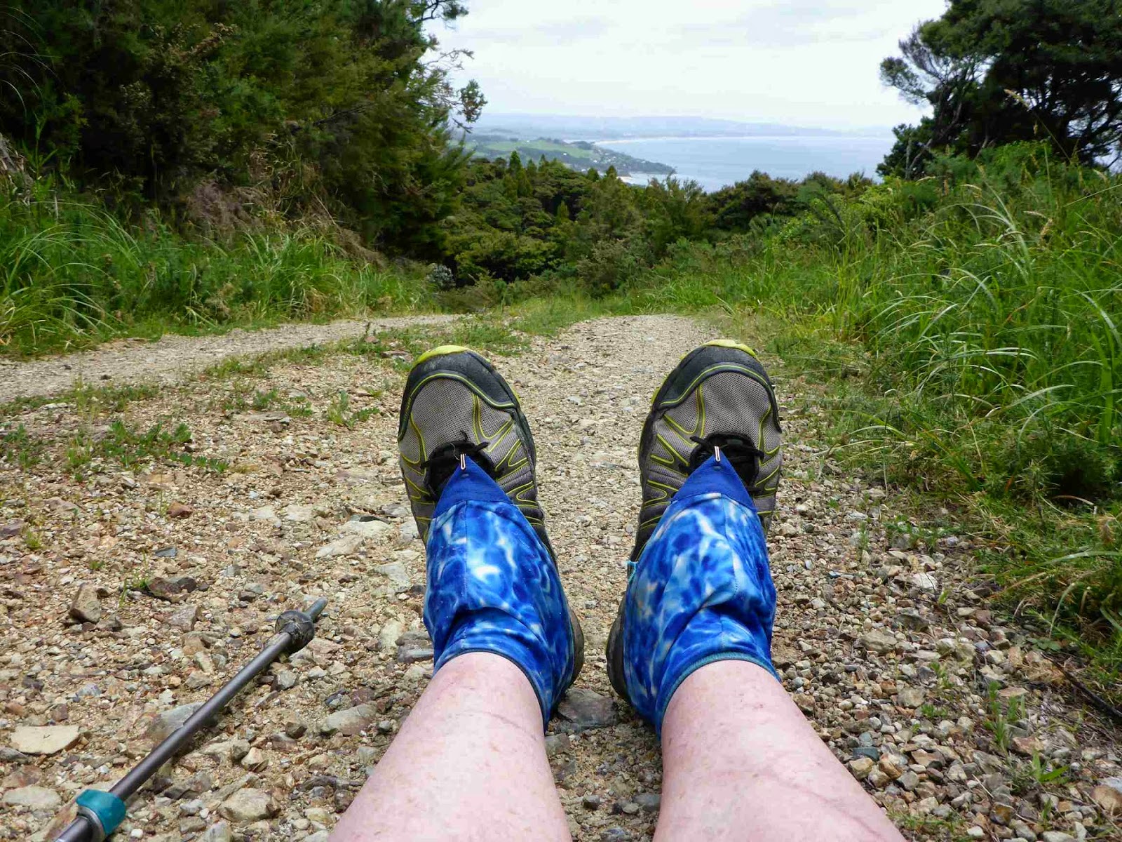
The track then continued down until reaching Cove Road. I could see the road 50 metres ahead but there was a tramping trail to the right which was marked as the route on the TA maps as heading off for 500 metres to the road and then following the road right back to the gate ahead. Hmm integrity time. Who would know if I just took the 50 metre shortcut? Well I would and it would nag at me if I did as i claimed I was doing this trail purist style – so I followed the trail. It was a 5 star trail at the standard you expect in a city Park. It looked really new but was well marked with orange triangles, not that it needed any markers. At the end was a lovely car park which for some reason had a no parking sign. What else would it be for?
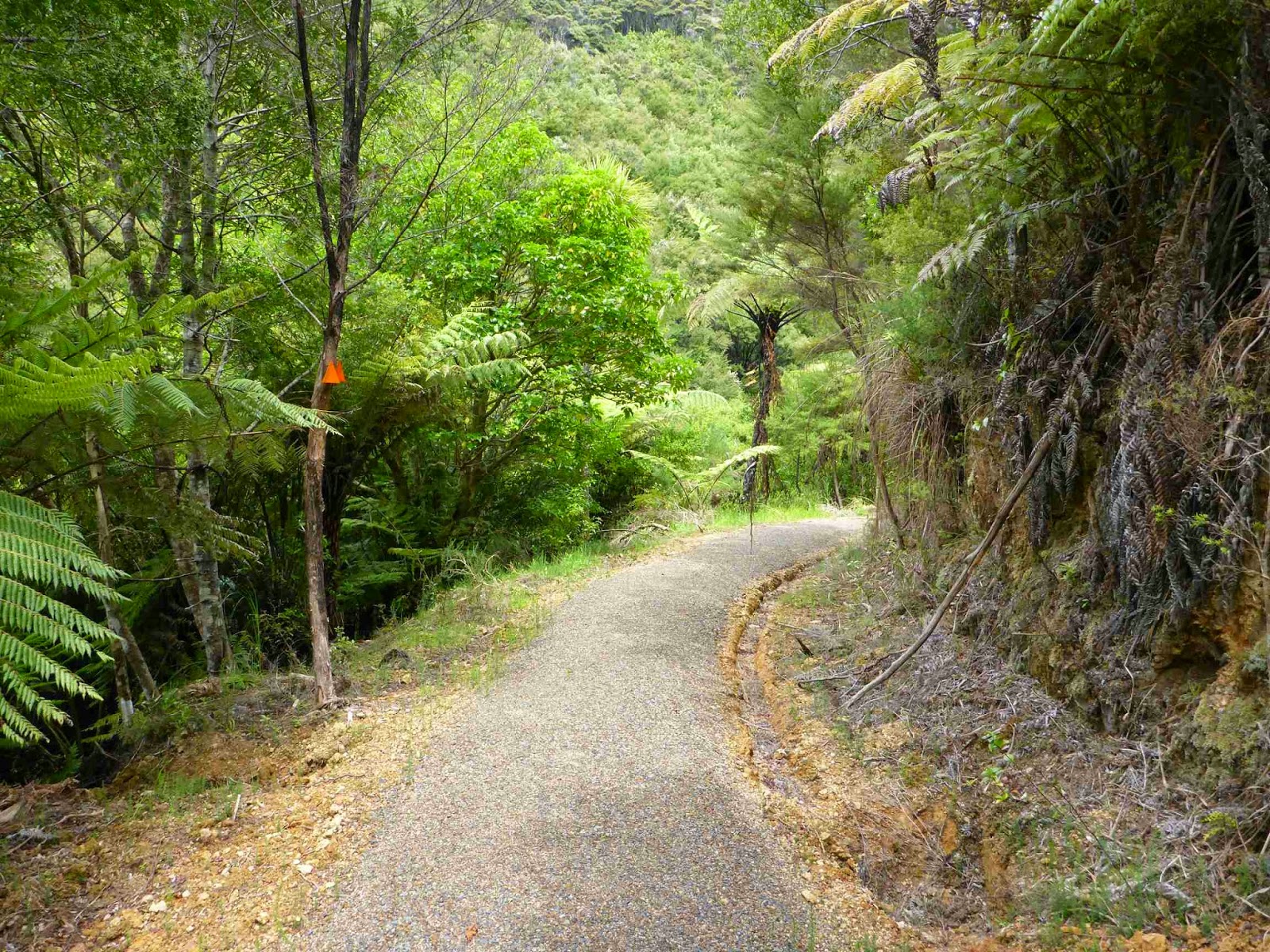
I then followed the road back down to opposite my decision point and I saw the trail sign complete with TA maker – arrgh.
From there it was up a gravel road and then onto farm tracks where I came up to what must have been a hand reared ram. He was so unafraid I had to shoo him out of the gate for me to get it open.


It was then through paddocks for a while until a big downhill followed by a step uphill that got my calves burning. I enjoyed the farm bits and looking at the views and sheep is a break from normal. It is great that there are some farmers still happy to let walkers though their farms. It is also a credit to the great Te Araroa Trail Trust team for all their hard work in negotiating the access. I think it adds to the appeal of te trail having such a wide variety of terrain to go through.


The trail was then onto DOC land and someone had mowed the path which was a nice luxury. This path then joined the Mangawai Cliffs Trail which was fantastic. Nice wide gravel path in good condition following a nice even contour above the ocean. I really enjoyed this part, especially the interesting old coastal trees and the shapes they had grown into. The ocean was clear and there were a few boats out fishing.


The track then descended to beach level via stairs. The beach was strange as it had both Black and White sand. The sand nearer the water was white and the inland and was Black. Black sand beaches are common on the west coat of NZ from volcanic eruptions in the past but I have never seen a beach with both types. I walked along the beach hugging the water to try and get firmer sand. The were a few rock outcrops in been the little beaches and heaps of people out enjoying the sunny , thought very windy, day.


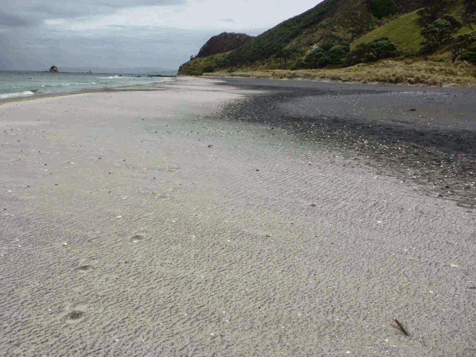


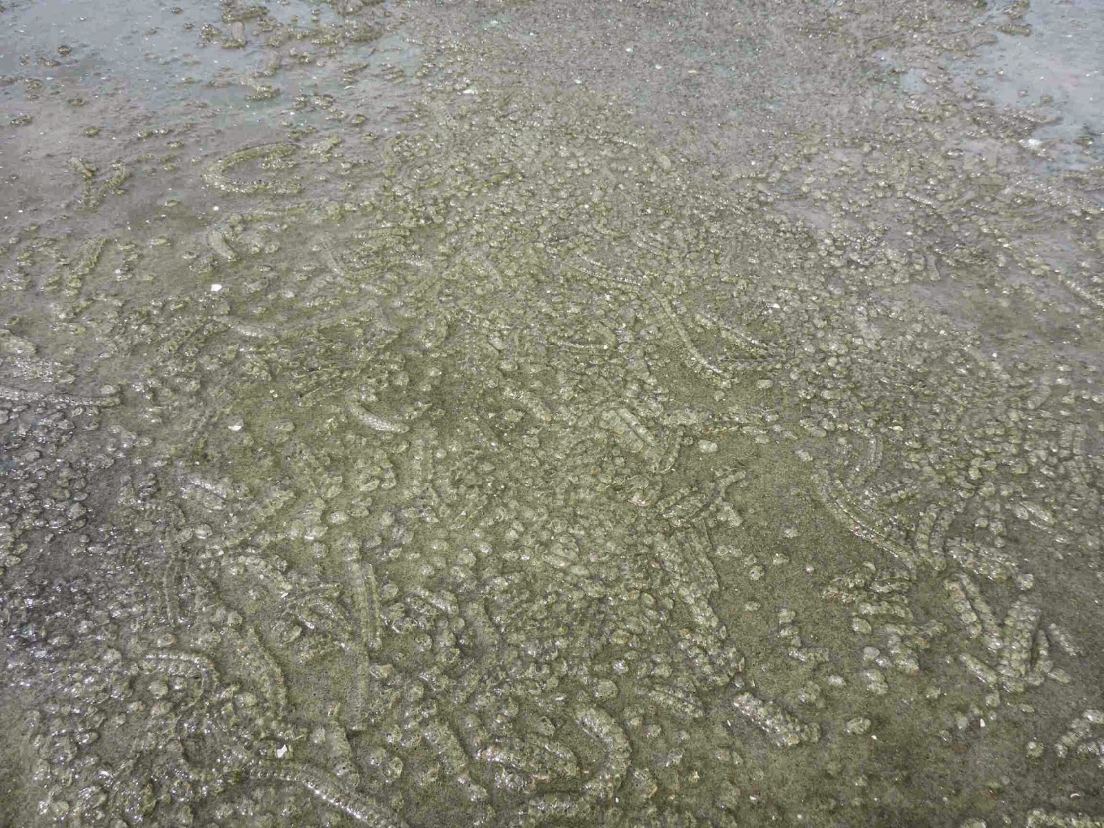

At the surf club I headed off the beach and there was a short road walk before heading back to the inlet where there was lovely grass to walk on past the Mangawai Heads Holiday Park and several nice batches (holiday homes) until heading away from the water and on the roads to Mangawai.
I was expecting the standard road walk for the 4 km between towns but was pleaseantly surprised by a nice gravel path between the two towns. It made for much easier walking than I expected.


As it was still early to stop I decided to bypass the two holiday parks on offer and head for the beach and forest. I intended to walk 1 km along the beach to a river that needs to be crossed at low tide and once across I would head into the pine trees to camp.


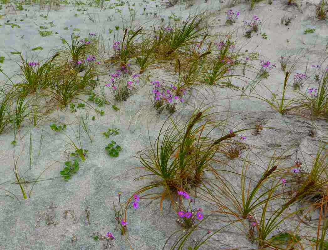

Well the plan first stage of the plan worked though I got sandblasted continuously as I was putting my shoes back on after the crossing site to the very strong winds. I could not belive how strong the wind was. As I now looked to the pines for a campsite I saw that all of the dunes are fenced off as it is breeding season for the Tern, Dotterel and Oystercatcher. This meant I had to keep walking down the beach until racing the end of the fenced off areas.
Eventually I could get into the dunes but as I climbed up I saw some Oystercatcher’s so I decided not to disturb then and that I would just walk to Te Arai Point where my trail notes said there was a basic campground and toilets. About now the rain started in earnest instead of the occasional showers this far. It was driving rain due to the high winds and not pleasant to be in. This continued for the next 2 km until I reached the Te Arai Reserve. On the way to the Reserve toilets I spotted some lovely sheltered spots for my tent but to my horror the was a large sign saying no camping at the toilet block. Either the notes are wrong or this is a recent development.
I had already walked much longer than I intended and I now I had to walk over the point and hope there was forest there. Keep in mind it was still raining and daylight was running out and my sense of humour was being tested. So over the point I went and thankfully there was forest and I was able to find a nice spot. This is the first time I have had to put my tent up in the rain and I managed this okay. After a quick dinner I feel asleep listening to the rain pattering on my tent.

So there was my longest day yet at 45 km and my body felt fine though I had developed a little blister on the side of the ball of my right foot.
1 comment:
-
Liza Williams 13 May 2017 at 01:46 Amazing photo review. I love such trips. I also love when I have a possibility to go to the beach. Thanks!
16 November 2014
Day 19. Ta Arai Point to Waiwhui Valley.
It rained all night and finally stopped around 0500. My tent held up really well with no leaks anywhere. There was a little condensation but that is because I had no breeze at all given where I tucked the tent. I had a slow morning routine knowing low tide was 0830. I left at 0830 exactly and went down a forest road for a few hundred meters then down onto the beach. It was lovely walking on the beach for the most part but this beach had an unusual feature of water appearing from nowhere and forming little streams, many of which I could not jump across so I had to walk back and go up the shore a little to get around.


I got to Poutawa Stream and took my shoes off for the short crossing. The water was only mid shin high but flowing very fast. I saw what i think was an Albatross. It was really big and flying above the waves. Fantastic.
There were heaps of Dotterel birds which are endangered in NZ. They are nesting and it is entertaining watching the different tactics to lure me away from their nests, even though i was making no move towards the dunes. The tactics were; look at me I am eating and haven’t seen you so I am easy prey, look at me with only one leg, look at me ruining in this direction for you to chase me. Entertaining as far as the beach went.

At around the 10 km mark there was a family playing on the beach. I spoke to the guy and he didn’t believe me when I told him where I was walking to. Another person who didn’t know about the trail. I wonder what we can do to publicise it more. Just after the family was some people riding. Apart from that the beach wasn’t too exciting but the 12 km seemed to go fast.

There was a final river crossing and then I was at the Pakiri Holiday Park where I grabbed some snacks and had lunch. I then did the next 3 km gravel road walk at an easy pace. The track then went onto farmland and went up very steeply. The climb was hard work but the views looking back were spectacular.

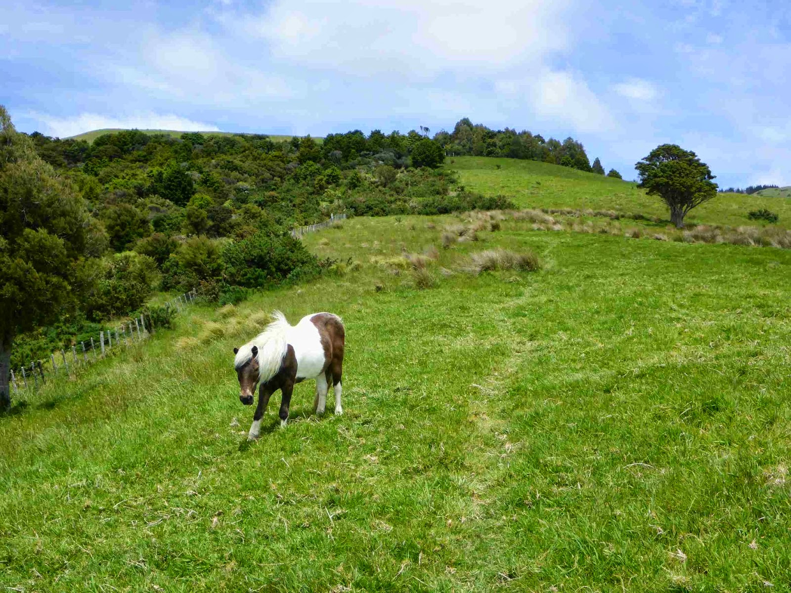
After lots of climbing on grass paths and sometimes vehicle tracks the trail went past some forest and then started down – steeply of course. This part of the trail was very slippery so I took my time. At the bottom we started coming back up – steeply of course. We then had a rare short period of flat where I fell for the first time. One minute I was flying along and the next I was doing a press up with my face mere millimeters from getting a free mud bath. I had to laugh that I survived Herekino, Raetea and the steep slippery descent only to fall on a nice easy flat bit. I was following the fence line and it turned a corner but right near the ground was some wire strung across just below ankle height as the perfect tripwire. Luckily there was some nice soft mud to fall into and I was holding my walking poles ski style which let them drop out of the way as I fell. I put some branches across the wire so others would see it.


Once into the bush the trail was lovely. I got a little worried as the DOC time was less than 2 km/h which usually indicates a difficult track.


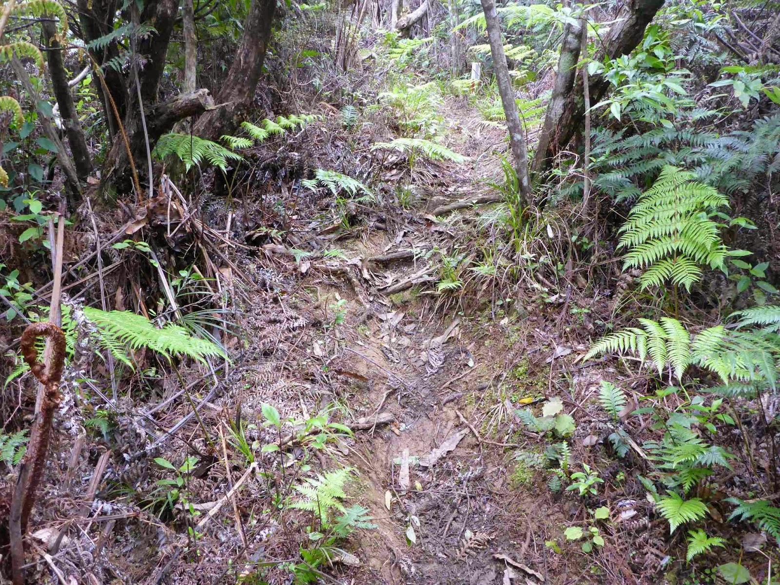

It was well marked easy walking with a gradual climb to the peak, though this got a little steeper closer to the peak. There was a trig at the top and a large wood platform which made a nice break spot.

The trail soon split and TA took what looks like a relatively new trail. It lead to a huge weather radar which was making some stange noises.

From there the track was fantastic and just how I like them. A little rough and not well used but it was marked well. I was flying and loving it.
I was having a little fantasy sparked by the boot prints that were quite fresh. I was thinking it would be nice to catch up to these people just before the car park where they would have a picnic and invite me. There would be a green salad with avocado and vinaigrette followed by fruit salad and cold flavoured drinks. This may have been the reason I was going so fast. For the last 15 minutes of the trail it deteriorates to narrow and slippery with limited foot holds. This must still be in development. I came out at the road much earlier than I expected.


It was now a 3 km road walk to the next track.
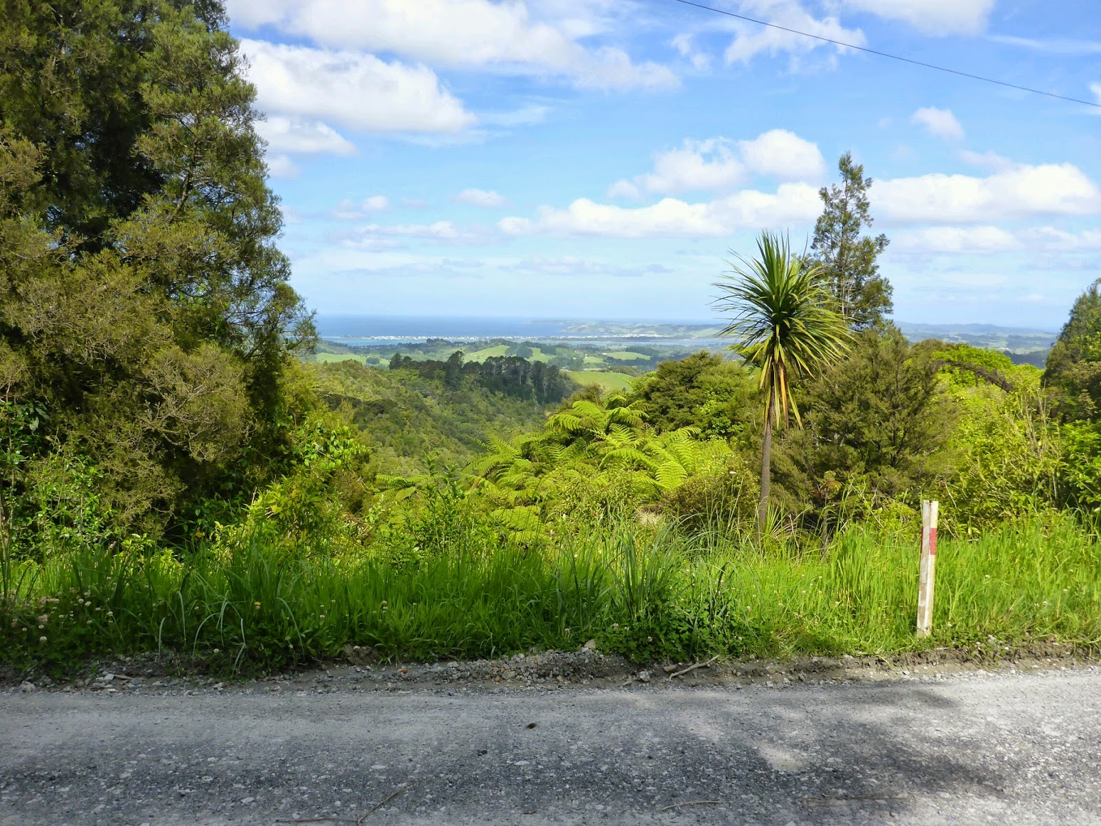


The track started as gravel then turned into clay before becoming single track through Totora Forest.

Tomorrow there is a restriction on part of the trail having to be done between 1600-0700 when the loggers were not working. This meant I either had a really long day today or a short day tomorrow. After a long day yesterday I didn’t want another so soon so I decided to stop early and I would also get a sleep in to make sure I didn’t get to the trail before it was open. My plan was to walk through the next bit which was open daylight hours only and then find a camp spot. Unfortunately once back on DOC land it was dominated by Totora Trees which do not make for good camp spots as the have many of their roots above ground. I stayed looking for a campspot at 1730 but could not find one as they were too steep, too wet or too many roots. I was frequently diving off the trail looking at likely spots but no luck. Eventually I decided to head to the bottom of the trail on the hope of a better spot. It was a steep and very slippery descent. At the bottom things only got worse as it was even more boggy and the vegetation had not changed. Grrr
Next decision was to continue on to the road 1.3 km away as there was forest there which makes for good camping. That 1.3 km felt more like 5 km. The track was rooty, boggy and constant up and down and felt like it would never end. I was starting to get a little tired now. The trail crossed the river where I purified some water and then finally there was the road. I walked a hundred meters then ducked into the pines and found a great spot to set up camp. I hope to hear a Kiwi tonight as I saw a beak hole near to where I set up my tent.

I let my tent dry to get rid of the last dampness from this morning while I got dinner ready. Dinner was chicken soup, Venison Cacerecce which is from Outdoor Gormet Freeze Dri. The flavour was okay but not big enough. Desert was Butterscotch Instant Pudding that set perfectly. I went to sleep with the sound of the river and thankfully no rain.
Visits: 3739
tink 5 November 2014 at 07:47 If your getting blisters try 2 pairs of socks, one thin inner and thicker pair on the outer