
5 February 2015
Day 100. Pakituhi Hut to Wanaka.
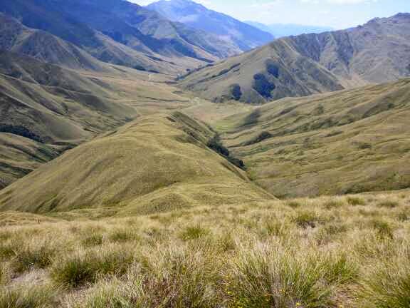
The first section was the most dramatic descent of the trail and despite my normal dislike of descents I enjoyed this one. It was steep and alongside rocky cliffs with views over Lake Hawea. The descent was 950 vertical meters over 3.5 km. Surprisingly my knees didn’t hurt until the last section where the angle eased off.


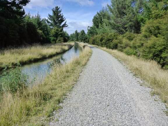
At the lake level I walked 1 km on a gravel road before heading for the Gladstone Trail along the lake edge. There was a toilet at the start that had toilet paper in it so I know that I am back in civilisation. The trail was easy to walk on for the next 7 m but was made challenging by the wind. I am sure if someone was watching me they would have thought I was drunk as I lurched along. I would be bracing into the wind when it would die off and I would now be off balance and stagger to the side. The same would happen when the wind returned and I was not braced for it. Surprisingly there were a couple of locals doing return daily walks.


In Hawea I was hoping to spot a shop to buy a pie but there none on the trail. Now after a 1 km road transit I was on the Hawea River Trail for the next 11 km. There were several mountain bikers and near a road crossing I watched a guy river surfing, or rather try to. The first 8 km went quickly but the rest dragged on, probably as I was in a flat but again with Albert Town in sight and not getting any closer. It started raining again and stopped after a couple of minutes but my jacket stayed on sure to the cold wind.


After finally arriving in Albert Town I went to the tavern for lunch of a bowl of hot chips, a cajun chicken pizza, cranberry juice and cupaccino. Delicious and friendly service.
Now pleasantly full I started on the Upper Clutha River Trail. I am not sure if it was the satisfied belly or the caffine choosing around Mt body but I really enjoyed this trail. It was not as manicured as the other shared use trails and had a huge variety of vegetation and geology in a short space.


After 4 km of bliss it was back to gravel road and manicured shared paths but I was still really enjoying myself and note had lake Wanaka to look at.


It seemed like no time until I was in Wanaka at the YHA Backpackers explaining that I was a day early. I had not taken into account that it was Waitangi Day, a public holiday, and therefore a long weekend. The YHA was full and so were the other backpackers which the guy at reception was good enough to ring for me. Finally the was a private room for $80 which I took at Matterhorn South. The luxury was complete when I saw towels were provided and the shower pressure and temperature perfect.
I went to the movie theatre Paradise Cinema to get tickets for Wild which is a movie about a lady doing Pacific Crest Trail, a long hike. They were sold out but I put my name down as standby. I then walked around town for a look and saw Fred and Nev. They were just about to head back out on the trail after a quick dinner.
I went shopping and then had dinner before relaxing with a book until 2050 when I headed back to the theatre and was in luck getting into the movie. It was okay and funny in bits relating to her being so unprepared for the trail.
Then back to luxuriate in my double sized bed.
6 February 2015
Day 101. Wanaka Zero Day.
Back at the backpackers I checked in and did bookings for Queenstown and Te Anau YHA. It is peak tourist season so it pays to book ahead. Already the central Queenstown YHA was full so I am in the lake front one 1 km away. I booked my shuttle around the lake yesterday.
I was impressed with my room. It is 4 bed and I was first in so got the best bunk. It was a large room with heaps of shelving, a couch and en suite. One by one my roommates arrived; a very talkative vietnamese, a korean and I am not sure the other but I think south America.


We talked until 1450 when I left to see the movie American Sniper. I love the movie theatre – instead of normal theatre seats they have different types of couches, first class airline seats and even a reclined dental chair. You can buy wine and beer to take in with you and they have intermission where you can buy fresh baked cookies as well as normal movie food.
After the movie I went to the sport shop where I brought replacement inner soles for my shoes as the ones I brought in Hamilton have worn out.

On my way back I picked up a wood fire pizza for dinner. The rest of the evening was watching tv series on my phone and updating my blog.
7 February 2015
Day 102. Wanaka to Fern Burn Hut.
I started back on the trail at 1015 and walked around the lakefront to the Glendhu Track. This was a shared mountain bike/walker track around the lake edge for 14 km to Glendhu Bay.


I was taking it easy as my legs were a little sore adjusting to the new inner soles. The outside of my upper to mid shins were hurting. I stretched regularly and took several breaks. It was a lovely track and great views walking beside the lake looking at the mountains with their fresh snow from the cold snap over the last 4 days. It started off cold but the heat of the sun soon overcame the cool breeze.
At 1230 I arrived at the Glendhu Campground and had an ice cream and a break. This is a huge campground nearly a km long. It was amazing to see some of the camp setups. They were definitely not roughing it.
At the end of the campground I climbed over the gate and walked 2 km up Motatapu Rd to the start of the track. The wind had disappeared so it was now getting really hot.

This track was put in by Shania Twain, the singer, as a condition of the sale of the land to a foreigner. The track started out flat following the river up and after 2 km I passed the 2600 km mark.


It then went through a patch of bush for 1.5km and it was nice to be in the shade. I had a late lunch of a savoury scroll at the start of the bush. The track through the bush started sidling on a nicely benched track and then started climbing.


At the bush edge the track was overgrown and from here it got more difficult. The track sidled above the stream but went up and down constantly and steep ups and downs. It continued to be overgrown making it hard to see what was under my feet and I was stumbling a few times. There were some exposed bits and I had to concentrate. After a couple of km of this there was a final climb up, down to the stream where I refilled my water bottles and then the last climb to the hut.


The Belgium couple, Jolein and Willem were there with a German NOBO and a Canadian couple who come to NZ every year for 4 months to tramp and avoid their winter.
We had good conversation at dinner with the focus being on the good and different things in NZ which I love hearing about from tourists. Just as we were going to bed another person turned up but didn’t speak as he saw some were already asleep.

8 February 2015
Day 103. Fern Burn Hut to foot of Big Hill.
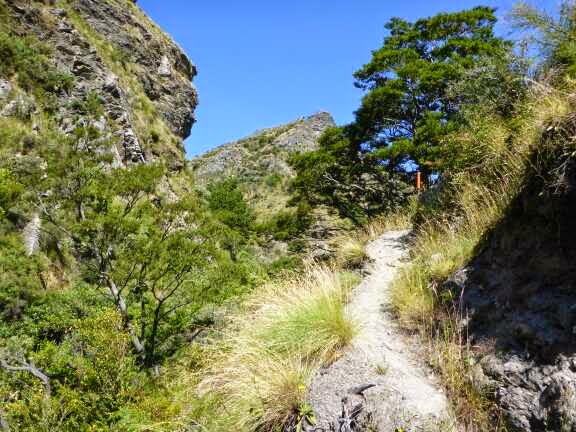
It was a cloudless day but thankfully I was still in the shade for the climb out of the Fern Burn valley. It was a 400m vertical climb which was a good way to wake up. The track started sidling up before settling into good honest straight up climbs. I was feeling really good and powered up to the saddle. From there it was a steep drop down a ridgeline to the stream then a climb up and sidle above some cliffs. At the start of this bit I met 3 northbounders. The track was a little overgrown on this part but with concentration it was fine.

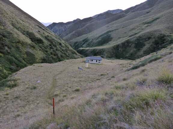


After sidling for a while the track climbed up to a ridgeline and started down the ridge. I could see a track to my right on the other side of a gully and wondered where it went. Not long after I could see the hut to my right and realised the track headed down the hill back the way I had just come until reaching the gully and crossing onto the track I had seen. Now it was a climbing sidle to the hut. I took 2 hours to get there which was quicker than my 3 hour estimate and 4 hour DOC time.
At Highland Creek Hut I took a break, ate a muslea bar and filled in the hut book.
The next section was described in the track notes as the most demanding section due to two big 400+ meter climbs and descents. The first was straight up and I could imagine the americans looking at it saying ‘you kiwis need to learn about switchbacks’. Personally I like the directness of the steep straight climbs.

After 30 minutes climbing I caught a Belgium couple just doing the Motatapu Trail. They had big packs with lots of things attached to the outside and were really struggling. I blew past at speed with a cheery ‘Good morning’ earning a look of disbelief. They didn’t seem to have any breath left to talk so I kept going. I had spotted Jory in the distance so ‘target aquired – go’ and I kept up my fast pace and quickly caught and passed him though with a quick chat before continuing.
Once at the saddle the track sidled over to a ridgeline then headed down quickly. The landscape was dramatic with no smooth surface anywhere and lots of rocky slopes. It looked fantastic with the shadows caused by the sun. Part way down I passed an american who was also loving the textures and taking lots of photos.


At the bottom was a patch of bush and I stopped for a break by the stream loving the shade and the green again. The American joined shortly after and we had a good talk making it a longer break than I normally have. Jory also joined us. Finally I got going again and it took a while to get back into rhythm after the long break
Now was the second big climb and I needed a few breaks on the way up this time. At the top were 4 more northbounders so I stopped to chat. I am surprised how many people are going north and starting so late. These four are only doing the South Island so not an issue but those doing the whole thing will have a wet and cold finish.


Now the track descended down a ridgeline for 400 meters and then across some farmland to the hut. This section took me 3 hours 40 minutes. I had lunch in the hut as it was cooler than outside and protected from the wind which had picked up. I had a savoury scroll and was still hungry so I had my last scroll, marmite and cheese, which was meant to be tomorrow’s but I can eat lunch in Arrowtown.
Now I had my last big climb of the day, another 400m vertical climb. Once again I needed a few rests to get up my fourth 400 meter climb of the day.


Then it was a long descent down a ridgeline to the Arrow Stream.


The last 5 km were in the streambed either in the stream, rockhopping at the edge or occasionally in the grass strips. There is a marked track but this is constantly up and down and steep sidles so the trail notes suggest make your own way down the river. With just over a km to go a vehicle track started which was easier walking but still constant river crossings. It took 3 hours 20 minutes to get to Macetown from Roses Hut.


Macetown used to be a mining town but it closed in the 1920s. There is not much left. You can see some of the ditches and tailings. If you want to walk you can see some of the mining construction (batteries) and two houses have been refurbished. Just as I was heading up the track I saw 4 people. One is the guy who offered me tea at Starveal Hut when it was misty. Two are northbounders. They had just had a wash in the river and were heading back to their campsite so I walked with them until I went to explore the refurbished General Store.


I then followed the 4wd track until it crossed the river and my shoes were drying nicely so I joined the mountain bike track that looks new and stays on the true right of the river so my shoes don’t have to get wet again. It looks to have taken a lot of work to build this cut directly into the rock cliffs. It joined back with the 4wd track a couple of times until the 4wd track crossed the river again.


Just as I was starting to think I had missed the turnoff I spotted a stile next to a gate and written on it was Big Hill so I assumed that this was the track. There were a couple of stream crossings so my feet were wet again – ugh. I checked out the old Soho Homestead with a view to staying there but it is a mess with rubbish and beer bottles, such a shame as it would be a great hut with some tidying and new mattresses. I decided not to camp outside as I originally intended and climbed up to a small plateau to camp.

My legs were fine today so I suspect partly adjusted to the new inner soles and partly the track had lots of variation in it so not as much effect.
9 February 2015
Day 104. Foot of Big Hill to Queenstown.
I trudged off in the rain and started my day with a big hill, only 350 vertical meters today on a track described in the trail notes as “light ground trail”. What this means is you can make out where to go but it is mainly overgrown. It wasn’t too bad but my shoes were quickly soaked from the wet grass. The temperature was ok until I got to the top of Big Hill Saddle when the wind picked up.


From the saddle the track improved apart from a couple of overgrown patches. The track sidles downwards gently and the trail notes said there were good views from here but all I could see was white mist and rain. The rain wasn’t boring, every now and again it would be really heavy before easing to steady. After 2 km the track entered a lovely patch of beech then more open then non native forest. In this last bit the rain eased off and there were constant smells of the pines (not the normal pinus radiata) and flowers. I met one girl and she said I was up early. When I explained I had camped overnight I nearly burst out laughing at her shudder at the thought of camping in the rain.


The track enters Arrowtown through the old Chinese Miners Camp and there was a bus load of umbrella weilding Chinese tourists I had to weave through. Talk about contrast from my isolation this morning.
I headed straight to the cafe for a big breakfast and cupaccino. I sat next to an older lady and eventually she got what I was doing. She struggled to understand it was a continuous trail. Once she got it she was very concerned that I was by myself. My breakfast had arrived and it was impressive; toast, poached eggs, mushrooms, home made baked beans, sausages, hash browns and bacon. It was a huge plate and I saw a few people watching me tuck in. Unfortunately my hands were still cold and I struggled to use my knife and fork properly and was forced to be very ham fisted. However I bravely persevered and conquered the meal and received a few comments of admiration. The waitress seemed very surprised I had finished everything.
Now warmed up and full I continued and the rain had stopped, replaced by blue sky. There was still a strong cold breeze so my jacket stayed on all day.
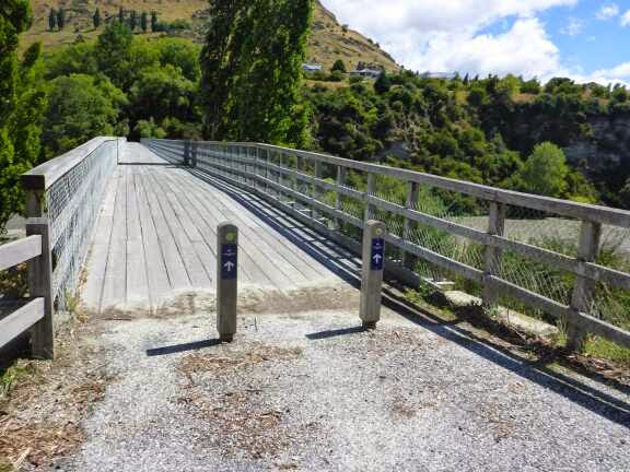
After leaving Arrowtown the track went through the Millbrook Resort and down to Lake Hayes. Here I followed around the lake on a trail funded by a local resident. It was then around a subdivision and along the Kawarau River and then Shotover River. The bridge over this river was recently refurbished after being used from 1915 to 1975.


The track went under the highway and then I got to a trackclosed sign with two bits of danger tape across it. After weighing up ignoring the sign, trying a possible road to the south or the highway I choose the later option. Luckily there was a wide shoulder and it was only a few hundred metres until the Te Araroa Trail came onto the highway anyway. After this point there was roadworks which actually worked to my advantage as the cones gave me a safe walkway for mosy of the km. The trail then turned off at the events centre and to the lake edge where a gravel path went all the way into Queenstown. I was pretty impressed that there was only 2.5 km of road walking between Arrowtown and Queenstown. Once again the recreation paths are excellent.


In Queenstown I went to the food court for a kebab and fries for tea then to the supermarket for snacks for the evening and 15 minutes later arrived at the YHA Lakefront Backpackers where I was in a 4 bed shared room. I think this is the first time I have actually arrived on the day I booked and not earlier.

10 February 2015
Day 105. Queenstown to Taipo Hut.
I was out of the backpackers by 0715 and walked back into town to the supermarket and then to a bakery to buy luxury lunches (compared to peanut butter on tortillas) for the next section. I had a pie for breakfast with a cupaccino. when I went to the pickup location Jolein and Willem were also there.
At 0800 the shuttle arrived and I asked the driver if I could sit in the front seat and he seemed surprised but was happy. I always try to get the front seat as it has the best view and it was a nice view driving up Lake Wakatipu.

We stopped in Glenorchy for 15 minutes and I got another coffee. We detoured to the start of the Rees Track to drop off a couple then headed to the Greenstone Track carpark. As the official Te Araroa Trail restarts by the lake I asked the driver to drop me off there rather than the carpark. I then road walked the 2 km to the carpark.

There were heaps of people sitting around I presume waiting for their uplift. This is a popular track. I started down the trail and it was great walk standard to the first junction.After 15 minutes I passed the couple that were in the same van as me. The track was wide and flat above the river. I crossed the Swingbridge and was now heading up the greenstone river. The track was narrower but still fantastic and fast though I wasn’t in the mood to push the pace. I was loving being in the bush which was mainly silver and red beech trees. There were several Robins, some Tomtit and some of the little birds I like which I think are some sort of wren.


Several times while walking I realised I was smiling because I was enjoying the trail so much. Though the trail was generally flat there were a few rougher spots to keep the attention focused. After a while in the bush and after passing several waterfalls the track came into the open which opened the perspective to the towering mountains around. There was one river to cross and you could go straight across and get wet feet or take a long way around to a bridge. I took the wet feet option as it just doesn’t seem right having dry feet. Then it was more bush until reaching Greenstone Hut.I had been worried I was going to take the DOC time but squeaked in in 2 hours 50 minutes.


The one frustration of this section was I was having a bad lace day. I couldn’t get my laces at the right tension. They would be too tight so I would loosen and then they would be too loose. This continued over and over.
I read the hut book while I snackedon a lovely walnut and caramel brownie. As I was about to leave Jolein and Willem arrived which surprised me but they said they stayed at the car park for a long time and I didn’t see them when I passed through.
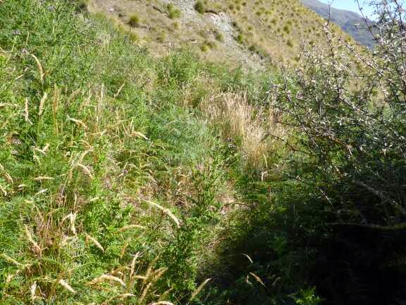
Within a minute of leaving the hut I had to walk through a swamp getting wet muddy feet which was an indication of what was to come. This track was a true Te Araroa standard track. It was rocky, rooty, wet, muddy and undulating and I loved it once again smiling often. I took a major tumble at one stage and when I grasped what had happened I laughed before righting myself, wiping off the dirt and continuing. I was lucky it wasn’t in a muddy bit. A few times I misjudged the depth of the mud and sunk to past shoe height.


After what seemed a long time navigating the wet bits and deadfall the track emerged into the open, firstly alpine shrubs, then grass and then tussock. The whole time water underfoot was regular. The track went along the side of the hill to avoid the swamp but then dropped down and I sloshed through the swamp. Once I was surrounded by tall tussock and couldn’t see the next marker as the track had only light to non existent ground trail. I ended up walking forwards hoping to catch a glimpse of the elusive marker and regularly looking back to make sure I didn’t lose sight of my last marker. After 50 metres I spotted the marker to the right. From then on the path was clear to see until reaching the hut.


I put my tent up straight away to dry it out from being packed wet yesterday. Chelsea, from Australia, was at the hut and she was admiring my tent. I went down to the river for a wash and to clean my shoes and socks. Chelsea is doing south island part of TA. We talked for a while and I munched on my luxury, short section, treat of salt & vinegar rice crackers. Jolein and Willem turned up and we talked while preparing dinner. As usual after 2100 we went to bed.
11 February 2015
Day 106. Taipo Hut to Mararoa River.
The first 2 km were flat and followed a single track and then old vehicle track. From there the track moved up to the hill and undulated along in tussock and swamp. I took sime time preparing the 2700 km marker and just as I finished Chelsea arrived and she took photos for me. She left and the other two arrived as I was eating a snack.


After another hour of the hill the track dropped into the flat and a vehicle track for a couple of hundred meters. There were two black helicopters flying around and eventually they landed by the river so I assumed that they were rich Anglers after trout.
The track cut across an old river bed and a swamp before joining another vehicle track which I stayed on until a fence with a very high stile. Luckily someone had put a rock as a step up to the stile. From here I saw 3 Anglers in the river presumably from the helicopter. Now it was back to single track for a few hundred metres and then 20 meters through tussock that was over head height and knitted together making progress difficult to a Swingbridge. Boundary Hut was a hundred meters away and I filled in the hut book. It took 3 hours and 10 minutes to get there. I was going to eat a pre lunch snack there but it smelt of urine. I suspect guys too lazy to walk the 10 meters to the toilet at night just going off the deck. I decided to move on instead. Chelsea did not come to the hut so was now ahead of me.


Now it was on vehicle tracks so fast travel except when having to avoid the large pools on the track. I made good time and caught up to Chelsea at an unmarked junction. We continued straight ahead which involved a climb above Lake Mavora which was now in sight.
We started chatting and kept walking together. Chelsea was walking a good pace on the road so I was happy for the company. We arrived at Careys Hut in 1 hour 15 minutes. The hut was right on the lake edge but the grass was wet and I didn’t want to have lunch in the hut so we continued until finding a nice shady spot by the lake. I was having luxury lunch with such a short section so I had some quiche, a savoury scone and a toffee and almond pinwheel. Lovely.
We continued on and though the track alternated between loose pebbles at the lake shore and short sections through the bush once at the bush line we still made good time to the Mavora Campground. Here Chelsea stayed to get a ride to Te Anau.


I continued past the campers to the start of the South Mavora Lake trail. I had to cross the Swingbridge but there was a guy on it. He looked over and saw me but just stayed standing in the middle. After a couple of minutes I had to ask him to move so I could cross. He walked my side and asked about what I was doing. It was a weird conversion. He asked me three times where I was staying tonight throughout the conversation. I gave my standard reply of “I am not sure, it depends how I am feeling how far I go”. The other thing he found confusing was me being by myself but talking about we when refering to the trail. The conversarion went “are you doing this by yourself” “yes but other people are doing the same trail””so you are walking with other people” “no I am walking by myself but I am following a standard route that other people also follow” “so you walk with other people” ” no I am walking by myself”. I tried to extract myself a couple of times but he kept following asking more questions. Finally I had to be a little rude to get on my way.


The track was a fantastic and fast track through beech trees. It was a wide clear track and flat. There were a couple of bits in the open which were a bit wet but overall a great track. The only bad thing was how silent the forest was which is not a good sign for healthy bird populations. At the bottom of the lake I expected the track to deteriorate but other than getting slightly narrower it was great. Three anglers were coming back up the track but I didn’t see any fish so I will be kind and say they were doing catch and release.


I continued on the track for another hour and a half then found a fantastic campsite on the top of a cliff overlooking the river going around a bend, bush and mountains in the distance. I am on thick even moss which is very comfortable. As well as the main river to my front there is a big stream in a gully to my right so I have the roar of water one way and the gushing water another. It was lovely watching the sky change colour as the sun went down.


3 comments:
15 February 2015
Day 110. Telford Campsite to Island Bush.
At 0820 I was off with sleeves down and wearing gloves. I could see the sun further up the valley so was walking fast to warm up and get to the sun. Unfortunately the track was through grass so my shoes got wet and then I had to cross a river so my feet were cold.

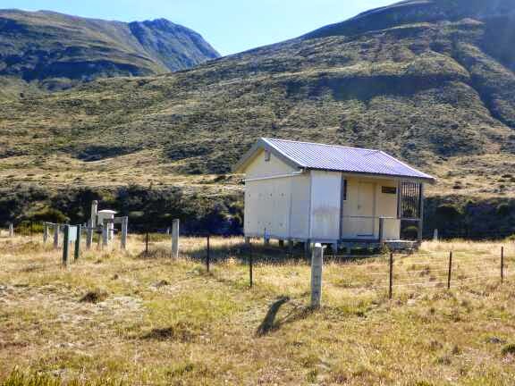
The track was now on a farm track so I was able to push the pace and reach the sun. After 2 km on the track I crossed a swingbridge and finally my hands were warm enough to take my gloves off. There was a couple of hundred meters following the fence then I popped up the bank near Rock Hut which is a musters hut though it looked more like a house than a hut. It is out of bounds to us.


Now it was 12 km on a nice gravel road farm track. The first 2 km was climbing onto the ridge and going up the hill I was passed by several vintage cars who all waved and blew their funny horns. This was not what I was expecting to see on a farm track. The last vehicle stopped to offer me a ride and explained that they had stayed at Rocks Hut.


At the top of the hill I caught up to Dan as he was having a break and we walked together. Once again he was a very considerate walking partner. He walked slightly behind me until he had worked out what speed I was walking. We mainly walked in silence with sparodic conversion.


At 1100 I stopped for a break and he kept going. We have quite different routines; I have a break every hour and a 20-30 minute lunch whereas he normally doesn’t take as many breaks in but has a longer lunch often drying out his tent during this time. During my break I sent a text to let my parents know I was still alive having forgotten to do so in Te Anau. I also rang a landowner for permission to cross his land tomorrow. This is the only time on the trail that we have needed to do this for which I am greatful but I don’t begrudge this as at least he is letting us through.
The road passed a memorial to a farm worker and then I left the road and followed a fenceline beside turnips. At the top I caught up to Dan and we descended following tracks made in the long grass by cows. I had a stare off with a bull who didn’t want to move but he was so intimidated by my immense bulk (for a stick) and moved off.

Because the road was so good we made good time to the road reaching it in only 4 hours 10 minutes. Now it was back to no track and following marker poles along a stream. Mainly it was on grass and easy going though there were a lot of thistles to go through and around. At one point we had to cross the river where one landowner would not let us through and once past this land we crossed back and headed back to the road.

After 100 meters we turned left into a Eucalyptus Forest where we walked up the edge. At the end of this we had lunch before heading across farmland on a route different from the map but well marked by orange marker poles. Then onto a grass track up a long hill. I managed to accumulate 17 sheep on the track ahead of me most of the way up the hill. I think they were a little tired by the end but good for me as they trampled the long grass ahead of me. I just had to pay attention to miss the presents they left on the track. I discovered that while Dan is faster on the flats and downhill I was faster up this hill.
At the top the views were great and I could see where I had come down the ridge yesterday.


Now it was 4 km downhill on good forest roads and then into Woodlaw Conservation Reserve on a nice bush track. At the first stream I gave a guy a fright as I approached. He was section hiking from Bluff to Queenstown. He had a massive Aarn pack. He was impressed how far we had come which we didn’t think was far. He asked times to the forest and the next stream which may not be useful as we gave him our times which will be much quicker than his. It is only when you meet normal trampers and Northbounders in their first few weeks that I remember just how fit I am and how distances that seem normal to me are actually quite far.
After a little more climbing we then descended quickly to a pine forest and out to a farm track.


We were going to make a decision to camp here or push on to the bush after the next daylight only area. However there was no water so the decision was made.
At the first house we came to we asked to fill our water bottles and the lady was very helpful, asking if we needed anything else. I am sure if we asked to stay the night or for food she would have said yes but I did not want to inconvenience her and was keen to push on.
My pack was now 3 kg heavier as I filled my drink bottles and 2 litres for campsite. This wasn’t too big a problem as it was a short walk on a gravel road then turning right onto another road for 1 km to the Island Bush Forest.
Unfortunately the sign here said daylight hours only and no camping so we could not continue. Luckily right beside the gate was a grass patch large enough for our tents and with a bonus great view. Unfortunately for Dan where he camped was hard to put his pegs in and I had to use my little pegs rather than my normal V pegs.


I had my normal dinner and then snacked as I read until it got dark. Thankfully the noisy birds shut up and it was silent, less the crickets, as I went to sleep.
3 comments:
-
Sally Billington 19 February 2015 at 11:40 All the best for your final leg.
-
Sally Billington 19 February 2015 at 11:43 Nearly forgot – I believe the best cheese rolls are to be found in Riverton. I think at Mrs Clarke’s Cafe.
-
MikeG 19 February 2015 at 16:39 Not far to go now. I guess you have mixed feelings as it will be great to finish but also, bugger i have finished and back to the real world. I have been enjoying your trip very much.
Saturday, 21 February 2015
Day 111. Island Bush to Martins Hut.
Today 35 km. Total 2888 km. 9 hours 20 minutes (0800-1720).
Last night was much warmer and it was a foggy morning which meant lots of dew on our tents. One great advantage of cubin fibre is I can just wipe it dry with a cloth as it doesn’t absorb water like nilon.
We set off at 0800 into the pine forest for a couple of km then across the farmland that I received permission for yesterday. Unfortunately the grass was wet with dew so my dry feet didn’t last long.
Morning Fog. Yes it is still summer – supposedly
Dan in Island Bush Forest
Coming down into the farmland
It was then a 2 1/2 km walk on a sealed road before turning into a gravel road. Dan stopped here to dry his tent and I kept going up this road for 7 km firstly through deer farm, then forest and finally through bush. From the forest it was a steady climb but at an easy gradient.
Road walk
Waxeye
Farm track
Heading up through Eucalyptus Forest
And now the sun is warming things up
I took a break at the carpark before heading onto a tramping track through the bush to Bald Hill. I was a little worried about how rough the track was to start thinking I might be doing the 2 km/h DOC time. However after a couple of hundred meters the track was in the more mature bush and improved. It was a great tramping track that required concentration to not fall flat on my face but was beautiful and well marked. I was thinking that the international northbounders were probably in shock at how rough this track was but the southbounders were probably loving that there was a track and thinking it was in good condition.
The track went through a swampy clearing, back into the bush where the trees were starting to get the goblin look where they go all twisty and bent with moss hanging off them. This usually happens above 800 meters but was a bit lower here.
9 hours for 20 km to Martins Hut – that must be a rough track
A little rough
But not too bad
Watch out for the hanging Bush Lawyer vine that will catch on
Goblin Forest
Fun track
Love this forest
Love this track
Video of walking through the Goblin Forest
After another 10 minutes I was into the open alpine scrubby plants and swampy climbing up to Bald Hill where there is a cell phone tower. I walked up to the trig only 30 meters off track and had lunch looking at the fantastic views. I could now see Bluff where I will be finishing in only a few days. Wilhem and Jolein were at the cell tower where an electrician was working and letting them charge their cell phones. Wilhem came up to talk to me while I had lunch and then I went down to say hi to Jolein before continuing. We were aiming for the same hut so would catch up more then.
Looking up at Bald Hill
Looking down from Bald Hill
Looking down from Bald Hill
Now it was a fast 4 km downhill on a road before starting the last track of the day. This track was similar to the last one but had some really neat sections where I was winding through the moss covered trees. It climbed to a clearing which once again was swampy. The trail was ok to follow but the markers would be hard to see in low visibility. Luckily I had a good day so had no issues.
From this clear bit I could see the ridge I would be on to the next hill and headed back into Goblin Forest and little swampy clearings all the way along the ridge and up to Longwood Range. It was now 3 km in the open following marker poles but someone had cleared a path through the alpine scrub with a weedeater so progress was faster than I was expecting. The slow bit was stopping to take photos of the fantastic views. I seem to be taking lots of photos all day. Maybe subconsciously I am trying to ensure my memories of this journey are captured in full. Probably though it is just because it is a beautiful and interesting scenery today.
The road down from Bald Hill
Back into the bush
Goblin Forest
Looking across at Longwood Range
Nicely cleared track
I can see Bluff
Tarn on Longwood Range
I hadn’t really been expecting much of interest south of Mavroa Lakes but I have really loved the trails since Te Anau. There had been great challenging but not frustratingly difficult tracks and a lot of variety in vegetation and terrain.
The final part of today was a muddy descent down through the bush to Martins Hut. I took my time hopping on roots and rocks to avoid the wet mud. I nearly tripped over once and ended up with my arm in a hole in a tree and thankful that I didn’t break it and that this is NZ where nothing dangerous lives in the hole.
I reached the hut in 5 hours 20 minutes from the Merrivale Road carpark and that was leisurely with lots of photo breaks and lunch.
Heading down
Very muddy track down
Martins Hut. 5 hours 20 not 9 hours!
Night 111
The TA trampers at our last hut of the trail. From the left Wilhem, me, Jolein, Dan
I didn’t like the state of the roof so decided not to use the rainwater tank and walked 5 minutes to the stream. I cooked dinner so I would be out of the way when the others arrived. Martins Hut is a very old hut and very dark but has recently had mattresses installed and is a great hut with character. It is cosy with 4 bunks and a little bench for cooking that is only big enough for one person cooking at a time.
Willhem arrived followed shortly by Dan and then Jolein. A lot of the focus of our conversation was memories of the trail and I asked for their advice for future TA Trampers to add to my hints and information blog that I will do once finished.
It is a little sad that this is the last hut of the trail but at least I know that I can spend more time in huts in the future unlike those from overseas.
16 February 2015
Day 112. Martins Hut to Riverton.
Today 42 km. Total 2930 km. 11 hours 40 minutes (0730-1910)
We were all up at the same time. I was ready in good time and was first one off at 0730 knowing I had a long day today.
Wilhem and Jolein at breakfast in Martins Hut
Dan at breakfast
I headed down hill on a bush track for 10 minutes before joining a forestry road for 5 minutes and then onto a gravel vehicle track for a km. I was just starting to get worried I had missed the turnoff when I saw a small footbridge over the river and a small orange triangle. I was surprised there wasn’t a DOC sign for the track but was confident this was the start of the Ports Water Race Track.
Heading down
Very big Beech Trees
Yay sun
This track ran alongside an old water race constructed by miners early last century. As a consequence of its purpose it followed the contour line meaning it was very windy following in and out of gullies and spurs. It was 22 km over what should have only been12 km. For some reason I had expected this track to be in really good condition and was actually psyching myself up for a boring walk so I was pleasantly surprised that there were several rougher parts and lots of streams that we had to climb down and up. I actually ended up enjoying the first 18 km and the time went fast. It was interesting to change through the vegetation from regenerating beech, scrub to mature forest of different types. Also it was great that there was a good amount of bird life with Tomtits being especially noticeable.
Once problem was because we were going in and out of so many gullies and crossing so many streams it was hard to know where I was on the trail. It was only at 16 km mark as one side opened into farmland that I was able to get a gauge on exactly where I was.
Wow what a easy track
Nice fast walking
Fun log crossings
Big drop down but rope assistance – luxury!
Another fun log bridge
Old mining equipment
The water race
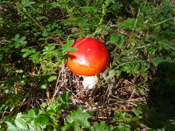
Toadstool
Punga with a moss haircut
Rougher section of track
2900 km
Old part of the water race
From there it was a little more open for a while then back into the mature bush until reaching the Long Hilly Track (not a spelling mistake) where I joined the walking track through the old mining and sawmilling area. There were some information panels and some other tracks that can be taken to explore the area but I had had enough by then and just followed the TA route out to the road.
Stream crossing
Water Race tunnel
Water Race by the track
On the Long Hilly walking track
Rope handrail
Getting close
Now it was 600m on a gravel road and then onto State Highway 99 for 4 km to Colac Bay where I headed straight to the tavern for a pie, chips and fruit juice. I was surprised on entering the outdoor seating area to see Jolein and Wilhem. They had had a rough time of the water race track, taking some bad falls and had decided to walk an alternate and shorter track to Colac Bay.
After getting an ice block for the road I continued down to the beach. I turned left and followed the road for a couple of hundred meters until my ice block was finished then jumped down onto the beach. The sand was nice and firm and had some fantastic patterns on it. Unfortunately after 1 ½ km the firm sand disappeared replaced by large pebbles that were deep and difficult to walk on. I tried walking at various places and they were all difficult though I did discover a track on the edge of the dunes that was soft sand to start but then turned into nice grass for a while before being forced back to the pebbles. This was starting to get tiring but I soon reached the turnoff to the gravel road parallel to the beach which I stayed on for 1 km to the start of the Coastal Track.
Colac Bay surfer
Bus stop at Colac Bay
It has been a long time since I have been on a beach – Colac Bay
Fantastic sand patterns
Colac Bay
Horrible Pebble walking
The coastal track followed markers over the headlands and on beaches. I found this part very tiring and a little frustrating as the track would walk on the beach which was more deep pebbles or deep sand then climb a short steep hill and walk on overgrown track for a little while before dropping back to a beach and this repeated over and over. I had already walked 35 km by this stage.
Beaches and headlands
Where I came from
Stewart Island
Overgrown track
Finally the track left the coast and headed uphill on farmland to the edge of a scrub area. This entry point was marked by a large orange triangle at a gate way. Once through the gate there were no more track markers for a while and the track started heading downhill and in a direction I was not expecting and I was beginning to think I had missed a turn. I was close to turning around and going back up the hill but decided to give it 5 more minutes and right on this time I came to a stile and a junction. There were no TA markers and a homemade orange triangle pointing over the stile was the only indication which way to go. A sign pointed straight ahead to the car park via the coastal track. I crossed the stile and was now on a gravel walking path heading uphill. There were a couple more junctions with no indications on which one TA took so I kept heading uphill until the top then directly downhill and I arrived at the car park. This was a lovely track with heaps of birds, evidence of the results of the local conservation groups efforts.
Heading up and over
Following the track – I think
Fantastic track through Mores Reserve
It was now down a gravel road into Riverton. There were some young boys jumping off the bridge which was a good height from the water. Once across the bridge I left the trail and walked down the main street of Riverton to the Globe Backpackers. There was no one there but I rang the phone number on the sign in the door and shortly after a lady drove up and let me in. She gave me my own room with a double bed for $25 and gave me a towel as she knew us trampers generally didn’t carry one. I was the only person in the entire backpackers which was a little strange.
Riverton
Night 112
I headed to the supermarket and then to the fish and chips shop for a burger and fries before heading back to my room. The internet was too slow to update my blog so I just read until going to sleep.
5 comments:
-
- Anonymous 22 February 2015 at 12:09 Wow, top effort!!! You’re just about done. I have throughly enjoyed following your journey from start to end and your blog has certainly helped me prepare for my own TA trip starting in Nov. Are you thinking of doing a final review of the whole trip? I’d be interested to see the gear you started with and what you ended up with; your highlights and lowlights. Mick
- Restless Kiwi: Walking the Te Araroa Trail 22 February 2015 at 19:46 Hi Mick. Yes I am doing a summary that will have some statistics and comments. I will also be doing a full gear review and will also do a page of Hints and Information for those who will do the walk in the future.
- Vivienne 22 February 2015 at 18:58 Absolutely incredible effort Kirstine and success. Congratulations! I too have been following your journey and beautifully visual blog since Annabelle and I came across you on the St James Walkway. You and Fred and Nev are an inspiration to me, so much so that, I am training to do Te Ara Roa later this year. Thank you for all of your information, writings and photos. Best wishes for your ‘where to next?’ Vivienne
- Restless Kiwi: Walking the Te Araroa Trail 22 February 2015 at 19:47 Hi Vivienne
Thanks for your comments. Well done on your decision which is actually the hardest part of the walk. I know you will have a fantastic time. - MikeG 22 February 2015 at 22:24 Nearly there. Ye ha
Sunday, 22 February 2015
Day 113. Riverton to Invercargill.
Today 32 km. Total 2962 km. 8 hours 05 minutes (0830-1635)
I woke early and just snoozed for a while. Then I ate my breakfast of hot cross buns (eaten cold) and some fruit. I left the Backpacker and conveniently passed a cafe so got a large cupaccino to go. I got back on the trail at 0830 and after passing though some sports fields and pine trees reached Oretei Beach where I stayed for the next 22 km. It was funny striding along the beach with walking pole in one hand and cappuccino in the other. The ultimate hiking combination.
The sand was firm on the beach but there was a lot of seaweed to pick my way through, though it didn’t slow my pace much. I was occupied with the mystery of who was in front of me for some time. There were two sets of boot prints that I did not recognize. One was a male and one a bigger female or smaller male. One was using two walking poles and one was not. This description did not match anyone that I knew walking at the moment.
Oreti Beach
Seaweed
Shellfish prints
Fantastic sand marks look like trees
Bright red seaweed
After 9 km I could see what looked like two people ahead but I couldn’t be sure it was not just driftwood. I got closer and closer and confirmed it was two people sitting down so hopefully the mystery would shortly be solved. Before I could get close enough to identify them I had to cross a stream which was slightly too wide to jump across. I went to the narrowest point and took off one shoe and sock and hopped across. While normally wet shoes are not an issue, and in fact are the norm, on a beach with sand wet shoes can lead to abrasion issues as the sand sticks to the wet feet and socks.
Now across the stream I walked up to the mystery trampers and it was an American couple walking southbound who have done the South Island only. I sat down and we had a quick chat before I continued down the beach.
Only a few km later I came to a river and spent a little time trying to find a crossing point. When I combined the notes and map I seem to have missed the comment about a tidal river crossing and as a result had been a little blasé about the tide timings. Apparently this river should be crossed at low tide to mid tide and I arrived only a couple of hours off high tide. I quickly realized that there was no dry undie crossing point and went back to the best point which I estimated would be hip deep on me. The American couple had caught up by then and they followed my suggestion on where to cross.
I did my deep river preparation of Personal Locator Beacon around my neck and emptying outside and hip pockets into the main compartment of the pack. As I had company I kept my clothes on this time. I plunged into the water and it wasn’t too cold until reaching undie level and then brrr. The current was strong enough to feel it but I did not need brace with my poles and was completely comfortable. Also it wasn’t quite as deep as I expected but it was lower hip depth. Once on the other side I watched the couple crossing and then asked them to take photos of me and convinced them back into the river for a photo of them. I stayed to dry my feet and put my shoes and socks back on while they continued ahead. By the time I had done that the area where we had walked across was largely under water and within another10 minutes I think the whole area would be a lagoon so I wondered how Jolein, Wilhem and Dan would get on as they were still not in sight on the beach behind.
Tidal river crossing a little deep
Definitely wet undie crossing
It wasn’t long before I caught them up and continued on my way. The tide was coming in and there was one area that had come up enough I was forced to walk on soft pebbles and dodge waves which was not easy walking. Luckily this was not for long and I was back on firm sand. From here the vehicle tracks increased which would be okay if they kept to a track but there appeared to be lots of people who come to the beach for playing with their cars and lots of donuts and drifting which cuts up the beach and is not as easy to walk on as the untraveled sand. I still made good progress though and was at the turnoff the beach at 1400.
Tide coming in leaving horrible pebbles to walk on for a while
Sea birds against Stewart Island
Beach road
Now it was a road walk for 8 ½ km. The good thing about this walk was wide shoulder and even a gravel path for a large part of it. Even better was the amount of refreshment options with a Café and campground after 2 ½ km, a bar and takeaways (with ice creams) another 2 km along and a liquor store (sells soft drinks) another 1 ½ km along. From here it was along straight on a cycle way above the road to the bridge over the estuary.
Leaving the beach
Nice gravel path or wide road shoulder – luxury
Invercargill has a wide range of clubs
Walkway to the city
Invercargill Estuary
I left the trail here to walk into Invercargill to the main street to Tuatara Backpackers where I stayed the night. There was a Pak n Save Supermarket 500 meters away so I stocked up on dinner, lunch for tomorrow and some treats.
Then I updated my blog and went to bed.
Night 113
18 February 2015
Day 114. Invercargill to Stirling Point – FINISH!!
Today 34 km. Total 3021 km. 6hours 45 minutes (0700-1345)
I woke to my watch alarm and was dressed and out of the room quickly. As I exited the backpackers I saw it had rained heavily in the night and was still spitting occasionally. It was still dark. I walked through Invercargill back to the trail eating Hot Cross Buns in one hand and drinking 1 l of Chocolate Milk from the other.
Central Invercargill as I start my last day
I reached the trail just after 0700 and began walking along the Estuary Walkway which was a gravel vehicle track for a while and then after crossing a bridge a wide gravel walking/cycling path along the water and then farmland and industrial areas. It continued raining lightly but then occasionally it would get heavier.
Gateway to the Estuary Walkway
Estuary Walkway
Estuary Walkway
Great bench
By the time I reached the main road it had stopped raining but I needed to keep my raincoat on to protect from the road spray as the trucks and buses went past. The traffic was heavy until 0900and then reduced significantly and it was mainly just trucks after that.
I had been dreading this final road walk but it was not as bad as I expected and I made much better progress than I had been planning. I didn’t seem to be walking faster than normal but the kilometers seemed to be dissolving at a rapid rate.
The long road section
The end is in sight just on the other side of this hill
Part of the time I was watching the drivers coming towards me. Though the road actually had a good shoulder most of the way (1/2 meter) I was still vigilant of the oncoming traffic. The best drivers surprisingly were younger drivers, older men and truck drivers (less Mack Trucks and Tankers). Many of the trucks would pull all the way over to the other side of the road and I made a point to wave at all the considerate drivers. The worst drivers were Mothers, Middle Aged Men and Old Ladies who had an unnerving habit of swerving towards me as they peered over their steering wheels at me.
The remainder of the time I was running a Te Araroa trail greatest moment’s montage. It was a nice time to reflect back on the trail in its entirely including the best and worst moments and the huge variety of landscapes and experiences I have had.
As I realized I was so far ahead of schedule I pulled into a park for a break and took my time. I texted my parents who were coming to meet me. I had told them I would be arriving somewhere between 1430 and 1630 and had thought 1430 was a very optimistic time but at my current rate I would be finished by 1330. Luckily they were arriving early, no doubt having realized that I am consistently underestimating the timings I would make. I still needed to slow down and take more breaks but I decided to keep my speed up until I was off the road and then slow down.
As I arrived at the turnoff to the track I saw another tramper there and as I got closer I was surprised that it was Chelsea. This was great luck as now we could take our time over the track and walk slowly. I didn’t really trust myself to slow down enough that I wasn’t waiting at the end for my parents to arrive. I had enjoyed walking with Chelsea last time and we picked up where we left off with constant conversation all the way to the end.
I was pleasantly surprised that the track was a nice basic path following faint tracks in the grass and orange poles. I was expecting a manicured trail. It was a lovely track to the coast and then along the coast looking out at Stewart Island and grassy hills covered in rocks. This continued for nearly 3 km before the track climbed a large stile and now it was on a Walking Track of smooth gravel through coastal flax and scrub along the ocean.
Crossing to the track
Chelsea finding it is not so easy with a big pack
The Foveaux Track
The biggest orange triangle of the trail
Great scenery to finish with
The final ‘why take the easy gentle track up the hill when you can go straight up the steepest bit’
Chelsea climbing up the steep bit
The last of the grass. The walking track is just visible in the scrub
Walking track to Stirling Point
On this smooth path there were several people out for day walks and then I spied two people walking towards me that looked familiar and it was my Parents coming to walk the last bit of the trail with me which was great as they have been so supportive of the adventure, and all my other crazy adventures and challenges I set myself. For Te Araroa they have also been in charge of my resupply packages which have all been waiting for me as I arrive at different places around the country, despite often short notice of what was needed and where.
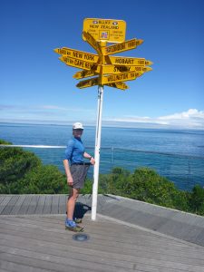
We walked to the famous Bluff signpost and spent nearly 30 minutes there taking photos. Chelsea and I had discussed the poses we wanted to do and played around with our different poses to get the perfect shot that summed up our feelings at finishing.
Finished
Amazing how great it is to get to this signpost
Tools of the walk
Chelsea and I
3021 km completed
My biggest supporters – my wonderful parents
Mission Accomplished
It was great to have my parents there to meet me as they know the scope of the achievement of completing Te Araroa. I feel sad for our overseas trampers who arrive with no one to congratulate them on their achievements apart from bewildered looking tourists who are wondering why these smelly trampers are so emotional about a signpost.
My feelings towards having reached the end were mixed. I was very satisfied with having completed the Te Araroa pure with no hitchhiking or shortcuts. I was relieved to have completed it with no injuries as this was my biggest fear at the start. I was also sad to have finished as I had loved the experience so much and wasn’t really ready for it to end. There is something comforting in knowing that all I had to do each day was walk, drink, eat, find a campsite and sleep. It is very peaceful without the pressure and stress placed upon us, often by ourselves, in our normal daily lives. No decisions to make, no one else to have to consider and no need to compromise what we want to keep within societies norms. I loved the constant little challenges of hills and rough tracks. I loved the constant reward of fantastic views, I loved the anticipation of finding out what was over the saddle, hill or around the corner.
Te Araroa was a fantastic showcase of the exceptional diversity of New Zealand. I will not claim we have the best mountains in the world, or the best beaches, or mountains but what we have is fantastic and so close together and taking everything into account I do think New Zealand is the most beautiful country in the world. Te Araroa has taken me along beaches, through jungle, through native forests, through pine and eucalyptus forests, through farmland, through desert, through alpine meadows and into the mountains. We have walked on roads, sand, dirt, mud (lots of mud), swamps, tussock, rock, snow, through rivers and oceans. We have been isolated for long periods and we have walked through cities and even through a city mall on the official trail. I have kayaked for 4 days on a river and crossed over active volcanoes. I do not think there are many trails in the world that can offer all of that in trail through one country.
In summary my journey on Te Araroa has far exceeded the expectations I had of it when I made the decision to do it. Despite being a New Zealander and familiar with much of the terrain it was fantastic to be absorbed fully into the varied environments and I learnt new things and saw things I never have before in New Zealand. I discovered that Through Hiking (Long Distance Hiking) is a completely different experience from normal Tramping (hiking) and I loved it.
Thank you to the Te Araroa Trust for making this possible. The volunteers in each region and the central trust do a fantastic job in managing and improving the trail.
Thanks to DOC for the fantastic tracks, huts and conservation work.
Thanks to my wonderful parents for supporting yet another of my crazy adventures and looking after my resupply parcels.
Thanks to the Trail Angels who are so generous with their time, houses and kitchens.
Finally thanks to my fellow Te Araroa Trampers for your companionship, support and advice. I wish you all luck in keeping what you learnt and achieved on the trail in focus as you transition back to real life.
I have been asked “what now” frequently leading up to the finish and more so now I have finished. I would love to do another Through Hike in the future but not for a few years as I do need to do a little work. Pacific Crest Trail in America appeals but I will leave that one until I am older and find some less developed ones to do while I am still young. In the short term I have decided to warm down from Te Araroa by climbing Mt Kilimanjaro on my way back to work in DR Congo.
For this blog I have three more entries; summary of my journey, gear review and a hints & information page for those doing TA in the future.
13 comments:
- Sally Billington 22 February 2015 at 18:41 I’ve felt every step of your trail since meeting you briefly at Lakehead Hut, Nelson. If only I was 20 years younger and without a dodgy hip… I did feel inspired enough from your effort to walk into Nina Hut and back one day last week. Good luck with the transition back in the big bad world. Thanks for sharing the TA experience.
- MikeG 22 February 2015 at 22:44 I too have loved the walk with you. I have not done any tramping myself but do feel more inspired to do so. Thanks for sharing your journey and for all the photos, details, inspiration that you have so diligently given. I hope all your other adventures go as great, injury free and as pleasurable as this one.
- Anonymous 23 February 2015 at 15:01 Congratulations! What a fantastic adventure. It’s been great following you from start to end and you’re a legend in our household. Thank you so much for sharing with us all. I can’t wait to start in Nov. Mick
- Anonymous 23 February 2015 at 19:26 Well done…we have also been following your blog ..loved seeing all the pictures too as we have done approx 80% of the South Island..done in sections..in between working……
- Wokkywalker 23 February 2015 at 22:05 Brilliant….I have followed you the whole way and have been totally absorbed. My wife and I (both in our 60’s) plan to do TAT this year or next (yep, better make up our minds pretty quick!) and you have generous with your comments and photos. All great stuff. Congratulations. I think that way back you said you are from Dunedin. We are, too, and it would be great to meet you, but I am unsure how to arrange that……
- Jujufans 24 February 2015 at 14:15 We have also been following your blog and just loved all the photos and details. You have done amazingly well and you are an inspiration! All the very best for the future. And if I ever bump into you I’ll recognise you from the photos!
- Anonymous 24 February 2015 at 15:17 I’ve also keenly followed your blog from start to finish. I went remote-camping in January and as soon as I got back to where there was reception I couldn’t wait to see where you’d been and where you’d got up to. I’ve enjoyed your clear descriptions of the trail, your sense of humour and have loved your photos. All the best for your future endeavours. PS Please do a blog when you climb Kilimanjaro!
- Allison Cooke 25 February 2015 at 03:33 Congratulations! I have loved reading your blog as you walked along, and it has inspired me to get out and walk more. I am eagerly awaiting Canadian summer so I can get some real tramping in. I wish you all the best going forward. ps. I laughed at the phrase ‘winding down by climbing Mt Kilimanjaro’. I find walking 10km a challenge, but you’re winding down by climbing a mountain. 🙂
- Anonymous 26 February 2015 at 07:56 Hi Kirsten. Thank you so much for your amazing blog, we loved every day of your comments and photos. My husband and I, NZers and in our fifties, are planning to walk the TA later this year and found your generous sharing of all your information about gear, tracks, general ‘kiwi’ sense and ‘sense of humour’ really helpful as well as inspirational – thank you. We look forward to reading your wrap up entries as we prepare for our own adventure. Congratulations on completing the TA and all the best for your future adventures, I hope you keep up the blogs…..:) Belinda
- Phatmandu 27 February 2015 at 19:06 Phatmandu Hi Kirsten CONGRATULATIONS Great effort T`is the best way to see youre backyard THANK YOU for a great blog Enjoy youre reentry ( TA TA TA i can hear it from across the paddock ) Happy trails Phats
- Anonymous 21 March 2015 at 13:21 Hi Kirsten, Congratulations on completing Te Araroa. I monitoried your progress down the South Island from when Paula and I met you at Misletoe Bay via the various hut books up to when I left TA at Arrowtown on 14 Feb. I have had a brows of your blog; a great record. All the very best for your other adventures and the bits between. Cheers Joe
- Blank Blank 19 June 2015 at 14:19 This blog is awesome, thanks so much. Congratulations on finishing the Trail and climbing Kilimanjaro in the same year. I’m section hiking the TaT myself and the information, comments and asides you have provided will be very helpful as I work my way along the trail.
- Jonas7 October 2015 at 22:36 Well done! A fantastic achievement with both the blog and the tramping!
If you’re still looking for new through hikes to do that are less developed I can give you a tip from my country, Sweden. There is something called the Green Ribbon (http://www.vitagronabandet.se/en-GB) that takes you across the Swedish mountain range. The terrain, plants and wildlife is very different from NZ (no dangerous animals just like NZ though). According to the “rules” you can pick your own route between the two points and even cross over to Norway for some sections. This means you have the possibility to skip the more developed trails and even go off trail if you want. Good luck in the future no matter what you decide to do!
27 February 2015
Summary
It is now one week after completing Te Araroa and I am busy relaxing and trying to put some weight back on. I am making good progress on this and am probably at the stage where I can resume a normal diet but it will be hard after indulging so much.
Some serious eating required to increase my weight again. These shorts were a little tight at the start
Thank you all for your messages of support throughout the journey and when I completed it. It is great to know people have enjoyed the blog and especially great where people are thinking about giving Te Araroa a go, or even just getting out in their own countries and walking.
I was spoilt by my parents for the first few days after finishing before they were shooed away on a well deserved holiday while I look after the animals. My new routine is up at 0730 and do the rounds of the animals feeding, scratching, patting, giving new breaks (moving electric fence to give them more grass). There are Ducks, Chickens, Budgies, Burks (small bird like budgie), Nubian Goats, Boer Goats, Miniature Horses, Welsh Horses, a couple of cows and 3 dogs. Then I have breakfast and settle in for a day of reading or researching my next adventure before evening rounds of the animals, dinner, TV and bed. All up I am walking around 1 km a day.
I have recently brought some hiking boots as the guides on Mt Kenya (I have now added that to my warm down) and Mt Kilimanjaro will not allow trail shoes and it will be too cold. It feels really constraining wearing them and they are heavy. I miss not being able to feel the ground as much and it is taking a lot of getting used to as I walk around wearing them in when I do the rounds with the animals. I intend to do a few longer walks to wear them in properly before leaving.
My body is free of aches and pains except my feet which feel a little strange. It feels like they are swollen even though they are not.
For a summary of my trail go to this page TA Trail Summary and Statistics
For the blog of my other adventures go to this page – Other Adventures
Visits: 933
12 February 2015
Day 107. Mararoa River to SH 47 (detour to Te Anau for night).
The day started great. I left my tent flap up so I could watch the sun come up and it was beautiful. It was another cold morning. I finished my morning routine with only 3 sandfly bites and was on the trail by 0740.
The trail continued to be the beautiful track through the beech trees for a while. It then briefly went into the open where the dew soaked my feet and back for some more bush.
At the Swingbridge there was the primary option to continue in the bush for another 3 km and then ford the river or cross the Swingbridge and walk down the fenceline. While the bush option would be easier walking the river was higher than I was comfortable with and there would be more tributaries making the river even bigger so I went for the chicken route and crossed the Swingbridge.
I was worried when I was straight into tall thick tussock but the track pushed through to shorter grass and there was a track, though faint in places, to follow. There were a few bits of Matagauri to push through and I had to cross the fence a few times where the river had washed away everything on my side of the fence and where the matagouri was too thick to get through. While it was not an easy path it wasn’t too bad.
On arriving at the primary option crossing point I was happy I crossed over the swingbridge. I probably could have crossed but I would not have been comfortable doing it.
I expected the trail to get better with more people walking it but it got worse. The next 16 km was hard work for no reward and to say I did not enjoy it would be an understatement. Normally when the trail makes us work hard we get a reward like a view or a hut. Today there wasn’t much of a view and there was no reward for the hard slog. Sometimes there was a clear track through short grass but these times were regretfully rare. Most of the time it was long tussock, long grass, dodging matagouri, Kelly Thistle, Scottish Thistle, the rose like thorny plants and spiky Spaniard put in some guest appearances. Mainly it was flat but there were frequent stream crossings and swamp crossings. The track markers were ok.
The trail notes did say that it was slow due to long grass but this would improve as we progressed. After a line of trees on the escarpment the track did improve and I thought it would be good from there but that was only a short repreive before it got worse. Near the end I completely lost my temper swearing (very unusual for me) and hitting the thistle and matagouri with my sticks. It was only the thought of breaking them that made me stop.
Then we were so close to the road when the track disappeared and I was forcing through head high tussock and matagouri. So close but having to fight for every inch of progress. I then forded Wash Creek and coming out tripped on some barbed wire that was strung at mid shin height hidden in the grass. Once again I had a little temper tantrum. Finally I fought my way to the road feeling mentally drained.
Now I could rest with a 3 km road walk that felt good despite the wind now picking up. After a trig and treeline I had a couple of hundred meters before there should be a Te Araroa sign and stile. At that distance there was an angler access sign but no Te Araroa sign so I kept going. When I got to a driveway I knew it was too far so I walked back searching for the sign or stile. There was nothing. I walked to the edge of the escarpment searching for a track or marker thinking I would just cut across but there was nothing. I went back to the angler access but there was no trail or markers so I looked back the direction I had come and a couple of hundred meters away was a marker. This meant the sign and stile were at the start of the tree line which is different from the map. I went to the marker to search for the trail or the next marker but could not see anything. I walked foward a hundred meters in two likely directions but still could not see anything. The trail notes did not say there would be no markers so I assumed there should be some.. I had now wasted 30 minutes and decided to take the road 3 km to where the track crossed it. I was mad at not being able to find the trail and at the lack of markers. The unfunny thing is that there were markers along the road where they were not needed. Someone needs to move them off the road and onto the track.
The road walk went quickly and I found the track where it cut the road. It started on a vehicle track and I was relieved thinking this next 7 km would be better. The river then stopped at the river so I looked around for a marker or track and nothing. More strong words from me shouted into the air.
There were no markers of any type for this whole section. I found a sheep track and followed this, occasionally losing it, thinking this is ok, at least the grass is short.Then the grass got long and the sheep track disappeared. I cut across nearer the river and found another sheep track for a few hundred metres until a stream crossing then it petered out. I headed back to the fence and after a couple of swampy creek crossings found another sheep track that wound through the gorse. I now got to be scratched by the 6th different prickly plant of the day. My legs were quite sore with all the scratches and I regretted sending my long gaiters home in Queenstown.
The track then turned into really long grass that was taller than me. I struggled through for a few hundred meters then there were sheep on the other side of the fence and they had eaten a strip through the fence which was nearly wide enough for me and was a lot easier than walking without the strip. Finally I could see the turnoff but the track made me work all the way to the stile as the sheep eaten strip disappeared 30 meters from the stile. It was such a relief to be finished with that track.
It was now 1 km on a lovely vehicle track to the main road. As I got closer to the road I saw there was another tramper there and I was a little annoyed as it would be harder to get a ride for two people. However when I turned up I saw it was Chelsea who had just been dropped off from Te Anau and was unsure if she was in the right place as the road to the next hut looked private and had sheep penned up on it. She had just decided it was when I turned up.
After a quick chat she disappeared down the road and I stuck my thumb out. Within 5 minutes a car and boat stopped. They were from Te Anau and had spent the day fishing at Mavora Lake. They dropped me off at the YHA Backpackers.
I checked in and rushed out to the camping store as the people who picked me up said the store stays open late but not what time to. For future TA trampers the outdoor shop stays open until 2000. I bought a gas cylinder as though my current one might last I would rather be safe than risk cold dinner.
I headed back to the Backpacker and had a shower that takes the prize for best backpacker shower of the journey. Fantastic pressure and temperature, clean, dry foot towel and lots of hooks. My room was a 3 bed and had heaps of room. My room mates were an Australian in his 50s motorcycling around NZ and a 19 year old doing the Kiwi Experience Bus around the country.
I sorted through my resupply parcel which included new (only worn 300 km) shoes. My current shoes have done 1100 km from the top of the south island through some very ruggard terrain. Not bad for lightweight trail shoes.
I then headed back to the main street and looked at the dinner choices. I ended up at the pub across the road from the 4 Square and had a Fiordland wild Venison Leg steak with fries, fried egg, salad and mushroom red wine sauce. It was fantastic and there was nothing but a clean plate when I finished.
I then went to the supermarket to buy lunches for the next section which is the last section. I also bought some fruit and treats as well.
At the backpackers I packed my food which was a little heavy but will last until Bluff. No more resupplys.
I chatted with my room mates as I ate an ice cream and fruit and lights out at 2230.
13 February 2015
Day 108. SH47 to Aparima Hut.
Feeling nicely full I walked a km to where the two exits from Te Anau meet. There was a guy there trying to hitch but for some reason he was standing at the end of the wide bit. I stood at the start of the wide bit which is against hitchhiker etiquette (later arrivals should go past current hitchhikers so they get first ride) but I figured he should stand somewhere better and I was not going to delay getting a ride due to his poor placement. Also as a female tramper I have a much higher chance of being picked up. Only a couple of minutes later two ladies drove past and after looking at me pulled over and picked me up. They then decided as they had picked me up they would also pick the guy, German as most backpackers are, too. The ladies were from Australia and driving up the country. I was the first hitchhiker they had ever picked up.
After being dropped off I had a 6 km walk on the most perfect gravel road. Gravel roads came in a variety of types which you really notice when walking. Most are higher in the middle and angle down each side with this angle being steep on some. This road was not raised and was completely flat.The surface is the next difference with some rocky, some hard as concrete and the perfect ones smooth with a slight layer of dust as cushioning. The final factor is the size of the gravel with the finer gravel the better. This track had even fine gravel.
It only took 1 hour 10 minutes to complete the 6 km despite taking it easy. Chelsea was still there having decided to take a rest day. We chatted about gear and other things as I repacked some things in preparation for rain. Dan Slattery who I had last seen in Tongariro Crossing start point turned up just as I was leaving.
The track was now in bush climbing a few hundred metres over 2.5 km to a saddle. It was a great tramping track standard. Rough enough to require full concentration but clear enough to allow good momentum. I really enjoyed it. I reached the summit in 1 hour and descended 2 km through the bush.
For the rest of the way the track alternated between nice bush tracks and challenging rough tussock or swamp with no tracks. Some of the swamp was ok with short grass and thick moss over water. Imagine walking over a waterbed as that is what I liken it to. The tussock was the hardest and I had to feel my way through for the path of least resistance, being careful of the frequent holes and waterways hidden from view. I stopped in a creek bed that had dry rocks to sit on and was sheltered from the wind to eat lunch which was hot cross buns.
At 1500 it started raining and did not stop. It got harder as I reached the junction with only 2 km to go and the temperature plummeted. Luckily from this point the track joined an old vehicle track and I was able to pick up the pace to keep warm and reach the hut quickly. I arrived at 1639 which was 5 1/2 hours from Princhester Hut.
I hung up my jacket to dry and made a hot sweet tea to warm up. I felt better after that and unpacked and settled in. I had the hot chocolate sachet I have been carrying since Taumaranui.
Dan arrived 30 minutes later. I had an early dinner of Beef Soup, Mexican Chicken Dehydrated meal and chocolate instant pudding. I then ate a packet of Delights salt and vinegar rice crackers.
As I was eating dinner Dan saw a mouse climbing into my pack!
It was cold in the hut and both of us were wearing our down jackets and hats.
Before going to bed we hung our food bags and packs as the hut book warned of mice and one was running around already. Sure enough we were unindated with mice in the night. One kept running around near my head, one decided to chew a hole in my toilet paper zip lock bag. At one stage Dan put our packs on the clothes line outside as the mice were climbing above our packs which were hanging on hooks on the wall and door and jumping onto them.
3 comments:
14 February 2015
Day 109. Aparima Hut to Telford Campsite.
I was wearing my jacket with the hood up for warmth. It was overcast but thankfully not raining. The track crossed a swingbridge then skirted a swamp for two km. As I started a plane arrived and started aerial spraying the farm nearby. It was an annoying noise that I continued to hear for the next 3 hours shattering the normal peace of the bush. Initially I was worried about breathing in the spray but it seemed far enough away to miss me.
The track now went into the bush for 9 km to a junction. The trail notes warned that the ground trail was light and care required to keep on track but I found it good. Like yesterday the DOC track markers were well placed and plentiful. There were only a couple of times I had to search for the next marker and these were going around deadfall. I really enjoyed the track. I had to concentrate and I thought about how amazing our brains are. Most of the time I was looking a couple of meters ahead and frequently I would scan further ahead checking the track condition and looking for the next marker. While doing this my brain kept the picture of the ground in front playing forward and adjusting my feet to land in the right place.
There was a good variety of colours in the toadstools including; white, red, purple and brown.
At approximately 2800 km I made a marker and took a photo. With only 200 km to go I find my thoughts drifting to the future though I try to stop this and concentrate on the sights, sounds and feelings of peace I am experiencing. I am trying to fix these in my head for when I am back in the real world and stressed about something.
By 1000 it had warmed up enough to take my jacket off but my sleeves stayed down. I reached the junction and the sign said 45 minutes for 3 km which is 4 km/h pace on a rough track. Without pushing too much i reached the hut in 45 minutes but the distance marker is wrong it is only 2 km.
Dan was still at Lower Wairaki Hut when I arrived. He was drying out his tent. I had lunch of tortilla, cheese, hummus and choritzo salami which is new and I really like. I finished it off with sour lollies.
I left the hut at 1400 before Dan. Now it was a 550 meter vertical climb up through the bush which seemed to pass quickly. After a very short walk on the ridge the track came into the open with fantastic views including first sighting of the southern coast. I took a break to have a snack and admire the view. I could see the ranges I would be walking over the next few days.
Now the track dropped down the ridge then off the side to the campsite. I could see the toilet from a long way off. At the campsite I checked out a few options and decided on the lower plateau under a tree for shelter from the wind.
I washed the mud out of my socks and shoes then made dinner. By the time I had finished the Sandflys had found me so I retreated to my tent. The Sandflys kept coming ambushing me everytime I left my tent. Once back in the next 5 minutes were spent clearing out those that snuck inside. By rough count I have 150 Sandflys at my front door and 40 at the back of my tent.
Dan arrived snd set up his tent next to mine.
I spent the rest of the evening reading and eating and occasionally talking with Dan.