
27 December 2015
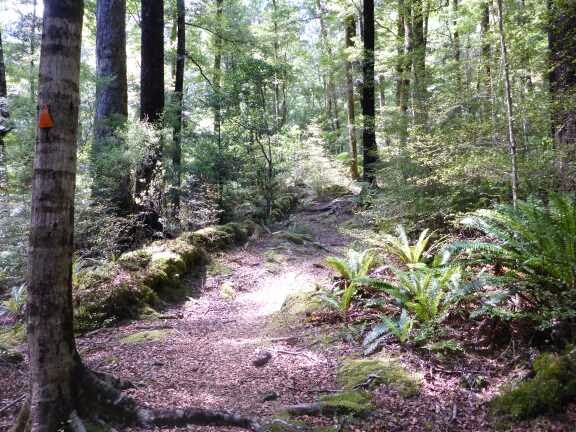
Day 60. Nichols Hut to Parawai Hut.
I had decided to sleep in as I thought it would be an easy day. Only 18 km starting with a bit of a climb before a large descent then relatively flat.
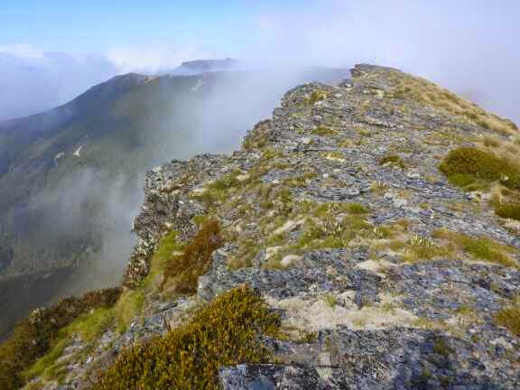
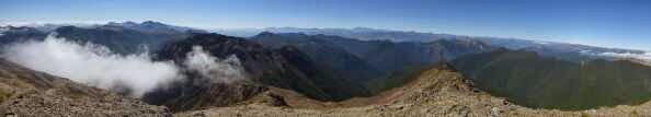
I was on my way at 0830 and enjoyed the climb up through the mist. The wind had picked up and it was too strong to keep my hat on but not enough to blow me around. There were a few bits of rock climbing which was fun. I love being in the mountains when the visibility is so limited, it makes you concentrate on the trail more and notice the alpine life right on the trail.


I reached the summit of Mt Crawford and laughed at the marker, a short length of metal pipe hammered into the ground which I imagine is the only thing that will survive the ferocious winds regularly encountered.
It was then a bit of open ridge travel before starting the long steep descent in the bush. This was really tiring and hard on the legs. There were several bits too high for me to step down or jump down so I had to hang if branches and roots to get down. I dislike downhills and tend to be quite slow as I am very careful. One mistake can have very serious consequences.
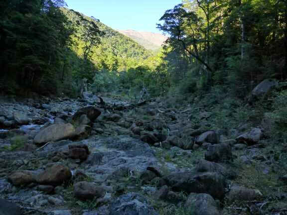
Finally I was down and then a swingbridge crossing of the Otaki River and following the river for 5 minutes and I reached the Waitewaewae Hut (pronounced YTYY). It had taken 4 hours from Nichols Hut which was the DOC time. Not good for morale to be doing DOC times. Usually I am well under their times.


Thinking there was only an easy 10 km to go I had a leisurely lunch of nearly an hour.
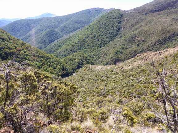
Once back on the trail I was really frustrated at going so slow as the track was really rough due to roots and rocks and constant up and down. The few flat spots were bog. I wasn’t enjoying myself much though I did perk up when a Falcon flew in front of me and landed in a nearby tree.


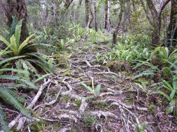
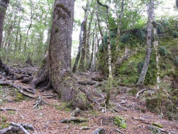
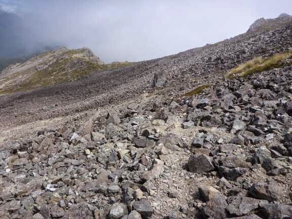
Finally we started climbing up to The Plateau and this was reasonably flat and easier travel except the frequent bogs. After crossing a few streams the track then turned onto a new track recently cut to avoid a large slip (landslide). It was called the “sidle track”. To sidle is to walk along the side of a hill which in NZ terrain us a really difficult way to travel. This track has not yet had any work done onitexcept for cutting the vegetation, digging a few dirt holes as steps and putting markers up. Part of it were good but large parts were very difficult. My main issue was there were lots of places the drop fown was too big for me to step down or jump down and there were some places without roots to hold on to to lower myself down.
Along the way I met 4 trampers, 1 older guy and three younger ones. The younger ones seemed pretty tired and said the track was a bit harder than they expected. They seemed blown away when I told them what I was up to and that they were likely to meet another 6 guys on the trail doing the same thing.
Near the end of this new track I could see some work was being done to improve it. Once back on the main track it followed an old tram line which meant it was wide and an easy gradient. It was nice to stretch the legs out and make a decent speed.
The track emerged from the bush and stayed high above the river before finally dropping down to a Swingbridge. This section seemed to take ages.


Once across the Bridge it was a short hill and along a grassy track. There was a junction without signs and I went straight but found out going right here is a shortcut. It was then 1 km to the hut through several junctions. I did hesitate when the signs were pointing to Parawai Lodge and not Parawai Hut. To me lodge has very different connotations than hut, namely expensive and flash. Luckily it was just a plain hut.
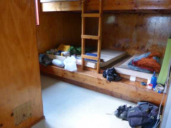
I waa the only one there so I settled in. As the hut is near a car park there were a couple of groups doing a short walk who visited. On couple were tourists and I played tour guide by giving them a tour of the hut and explaining what the roitine and etiquette of huts were. About 15 minutes after them a coupke and their daughter arrived and they were fascinated with what I was doing. They asked if I minded them staying in the hut that night and I said no problem. They walked off to talk to the caretaker. 20 minutes later the lady returned saying they would not be staying but she gave me three apples (mentioned in our earlier conversation as things I missed when on the trail). She also offered to help with my carbohydrate intake and produced a beer. As I am a rare kiwi who doesn’t like beer I declined but thanked her profusely for the apples. I ate two straight away.


I cooked dinner and was reading when to my surprise Joey turned up looking very hot as he had run the last km to just get the day over. Joey, Geoff and Zac (Romain had a sore knee and was road walking around the Tararuas) had stayed with the kiwis at Dracophyllum Hut last night. The kiwis Fred and Nev were kind enough to let them sleep on the floor of the tiny 2 bunk hut.They had lost Julien along the way when he turned the wrong way at an intersection. They were surprised he wasnt at the hut when they arrived (Julien usually walks ahead of the group and waits for them to catch up). After a bit of worry and luckily getter cell phone coverage they found out he had ended up getting to the end of a track and walking to the town.
So the guys decided to push for a long day to link back up quicker.
Next Fred and Nev arrived and 20 minutes later Geoff and Jack who had taken a scenic detour as they didn’t have the maps.
So it was now 6 in the hut which made for a nice evening of conversion. When it got dark we went to bed.
28 December 2015
Day 61. Parawai Hut to Waikanae.
Today 30 km. Total 1606 km. 9 hours 10 minutes (0740-1650).
I was up and ready to go after a relaxed morning routine. It is a different routine in a hut and it will take a little while to get this sorted.
I was the first one off at 0740. Once acrossthe swingbridge there was a 1.5 km road walk to warm up then onto Fence line Track which is a beautiful walking track thay zig zagged up the hill in the bush. I then turned off this onto Pukeatua Track which was a little narrower but still a great track and this continued climbing the hill. It was a steep climb but the gradient was perfect to climb quickly without those tiring step ups which are higher than can be done easily.
Once on the ridge it was a bit more open and I could see some lovely views though not where I was going as this was in the clouds. The trail followed the ridge in the bush to Pukeatua (812m) and I loved this section flying through quickly. It was a well maintained open track where I could stretch out. There were a few muddy bits but there were roots and logs to get over most of these and many were drying out.
A little more substantial bridge than normal
Fenceline track
Pukeatua Track
Some open bits
Some muddy bits
Climbing into the clouds
The summit
The summit was in mist so no views above the bushline. I sat for a while as I had internet coverage to check the location of the house I would be staying at tonight with an old army friend who had offered to put me up in Waikanae. While I was sitting there 3 trail runners arrived and we talked about the track, TA and shoes.
I then continued and the track got even better making for a fast descent. The bush changed to pine forest for a while then onto a vehicle track for the last km before the carpark.
Now it was 11 km road walk. As I got up from taking a break in a bus shelter after 5 km Fred and Nev caught up and rapidly disappeared into the distance infront.
Lovely track through the pines
On the road. Points for effort
Wood Pigeon
Waikanae River Trail
Night 61 (after I stripped the bed in the morning)
The last 5 km had more traffic and they were travelling very fast and not giving me much room when they passed.
In Waikanae I had lunch (Subway) and continued on to the river trail that I followed for 4 km before leaving the trail. It was great to see so many people enjoying the fantastic track.
I then walked a short way to reach Scotty and Mel’s house. They were welcoming and being keen outdoor people themselves knew my priorities; shower, laundry, drink and food. Scotty’s parents were visiting and they are keen trampers so there was no shortage of conversation. Scotty and Mel prepared a great dinner if BBQ and salad which I had a couple of helpings of. It was an enjoyable night. When Scotty’s parents, Di and Barry, found out I was planning to stealth camp in a park in Wellington they offered to pick me up fron the trail and I stay with them which was great.
After they left we kept talking and it was great to catch up with the army gossip and what they had been up to. At 2330 I went to bed.
Note there is no photo of Scotty as he is still serving in the army.
29 December 2015
Day 62. Waikanae to Porirua.
Today 37 km. Total 1643 km. 9 hours 30 minutes (0830 – 1800).
It was lovely to sleep in a big bed and I had a great sleep. I had breakfast with Scotty and Mel then Scotty dropped me off near the trail which was great.
After crossing the Bridge the track followed the river for a short while then went through the Waikanae Estuary Scientific Reserve which was a pretty trail through to the beach.
Waikanae River Trail
Waikanae Estuary Track
Waikanae Estuary Track looking towards Kapati Island
Emerging onto the beach
Kapati island
For the next 8 km I was on the beach and this went quickly as there was lots to look at. This is a popular beach so there were lots of people an a few boat launching points. Kapati island, a bird sanctuary, was along side for a while then the view was of the beach, the bays I would be passing through later and I could see the South Island.
Jellyfish
1610 km
(I forgot at 1600)
Parking for all the boat trailers
Tractor driving tour boat out
The beach
Neat Tree House
After 8 km the trail left the beach, and traveled through the sand dunes on a trail that meandered through them going up and down, up and down continuously. It was nice to give my muscles a change of pace from the flat of the beach.
Tram at QE2 Park
Through the dunes
Through the dunes
Clear markers
Pohutakawa Flowers
At the end of the dunes was Paekakariki where I walked along the beachfront before heading inland on the main road. I stopped for lunch in the shopping area and had Pizza and a lovely berry cake. The lady asked if I would like cream or yoghurt and seemed surprised when I said both please.
Now happily full I had the worst part of the day which was a 5km walk along Centennial Highway which is a stretch of SH1, the main route through NZ, which had the highest accident rate of anyway as there is no passing areas and people are distracted by the lovely views and tend to cross the road into oncoming traffic. There are now barriers in place to stop this happening but it is still a narrow section of road with constant traffic. There was a footpath for me to walk on and the ocean was immediately to my right. While the view was pretty it didn’t change so I occupied myself by doing statistical sampling of the traffic. Toyota vehicles make up a quarter of all vehicles. Mazda is second and Mitsubishi third. After that several manufacturers are similar. Male drivers made up 85% of all drivers and female drivers only were driving males in about 20% of the vehicles.
I would get bored of this and would just look out at the ocean getting a crook in my neck from constantly looking to the right. To make it worse it was really hot and there was no shade at all. Luckily this section passed without a car running onto the footpath and crushing me and I was able to escape to a 4WD track that shortcuted to Pukera Bay Beach. This was really full of people and it was entertaining watching one woman trying to get her puppy to go into the water. It kept refusing and then picked up one of her Jandals (flip flop) and ran off down the beach with it.
Beach at Paekakariki
Centennial Highway
Pukera Bay
At the end of the beach the trail went up Goat Track which by the name was pretty accurate with a steep but short climb. Once on the top it was a couple of km road walking to come back to SH1. There was a shop there so I was able to get a cold drink and ice cream to cool me down and give me energy for the next section.
Between Pukera Bay and Plimmerton is a shared walking/biking trail which is downhill most of the way. In a few years the trees may grow enough to provide shade but now it is exposed to the sun and dark tarseal so it was very hot walking.
Heading down to Plimmerton
Track to Plimmerton
In Plimmerton there was some more shops so I had a chocolate thickshake and continued through the town to the Coastal Pathway which had lovely views. I passed the busiest beach I have seen yet.
Great artwork in rail underpass in Plimmerton
Busy (for NZ at least) beach
Coastal Pathway
Bird in city pond
The trail crossed the Puatahanui Estuary by bridge and then we went into an underpass to a train station and then over an overpass over the motorway and followed some quiet roads to Aotea Lagoon. This is a great recreational area that was packed with people enjoying the great weather. There are paths around the lagoon, playgrounds and gardens. I was tempted to camp here but it was too busy to I pushed on to some pine trees I had been eyeing up for some time. At the exit from Aotea lagoon the trail crosses a road and it was here that the pine trees were. I ducked into the trees and climbed to the top of the hill and found a fantastic campsite protected from view from all directions. It was quite neat being so near all the traffic and people knowing no one knew I was there.
Aotea Lagoon
Night 62
After dinner I did some resupply planning and sent some instructions to my Parents for the big resupply to Pelorus Bridge. I really want to stop carrying extra food as I have been most of this journey but still need to factor in a couple of days possibly stuck in huts if the weather is bad in the mountains.
I went to sleep to the soothing noise of heavy traffic and police sirens.
30 December 2015
Day 63. Porirua to Thorndon, Wellington.
Today 31.5 km. Total 1674.5 km. 7 hours 50 minutes (0830 – 0900, 0940-1540, 1600-1720 breaks due to shopping).
I had a bit of a sleep in today as I wanted to be sure the shops would be open when I went through Porirua. After emerging from the forest I rejoined the trail which went through the Historic Gear Homestead (butcher who became millionaire) and Adrenaline Forest which is a high ropes obstacal course through the trees.
Gear Homestead
Adrenalin Forest
It was then on a pathway beside SH1 and then crossing over and into Porirua. I wanted to get some shoe putty to give my shoes a little more protection in the place they were wearing so I stopped at two supermarkets and trolled up and down the aisles to no success. To get over this frustration I detoured to MacDonalds for a big breakfast.
Once back on the trail there was a walkway between a school and some industrial areas. This seemed to have been recently upgraded to mountain bike quality hardpack gravel road. Part of it went through a tiny part of swamp and bits of bush and it was a nice little trail.
SH1 walkway
Porirua River Walkway
Trail through Porirua
Trail through Porirua
Trail through Porirua
It was then on the road for a few hundred meters and onto the track up to Colonial Knob. This was a good solid climb up through bush on a walking trail. Even though it was overcast it was muggy and I was completely saturated with sweat by the time I arrived at the first lookout. It was good to see so many Polynesian teenagers on the hill exercising. One girl was looking absolutely exhausted and told me this was her first time up this hill. I said to her I was very fit after walking for two months and I was finding it hard and she seemed to pick up. At the first lookout there was fantastic views over Porirua and the bays. As I was coming down the girl was coming up so I congratulated her on making it.
The trail was then in the open following a farm track up to Colonial Knob. Once at the top I got average views through the mist and then it was down through farmland to a forest. At the stile there was a sign warning that the track was a temporary one and could be muddy and sturdy shoes required. I must say I would love to have a track of this “temporary” standard as it was wonderful. Nice and smooth and easy gradient. There was a strange smell though that I struggled to identify but later saw on the map there was a landfill nearby which may explain it.
Track up Colonial Knob
Lots of stairs on the way up
View from the lookout over Porirua
The track up to Colonial Knob
Heading down now
Looking over Tawa
Great track through Spicer Forest
Huge Toadstool. That is the tip of my walking pole for scale on the left
At the bottom was a 6 km road walk before heading up Old Coach Road which was – wait for it… once a coach road. Love these original road names. This track gently wound its way up to the ridge. At one point was a cow and calf lying on the side of the track and they were completely unconcerned as I passed, not even bothering to get up which slightly annoyed the carnivore in me.
Great letterbox
Cow and calf completely unconcerned
On the ridge it was then following a mountain bike trail and then 4WD track along the ridge and up to Mt Kaukau. Unfortunately Mt Kaukau was in cloud and I was only able to get brief glimpses of Wellington below me. I continued down the other side in the mist until turning off down Bell’s track. This was a steep track and I quickly made the transition from wilderness to city.
Views from the Skyline Track
Transmitter on top of Mt Kaukau
View from platform on Mt Kaukau
Descending back down, still in mist
The junction from the country to city
It was fun following the map and notes through the city, like a treasure hunt. I am glad I had the notes overlaid to my map as I think it would be frustrating referring to the two though it is actually possible to just use the trail notes from this point on and not the map. The trail partially followed the Wellington City Council Northern Walkway and then City to Sea Walkway. It was fantastic to be moving across the city barely ever venturing onto roads for long. This is why I love Wellington as a city, it is full of parks. You can be working in the center of the city and within 10 minutes be running through bush.
On the whole the trail was easy to follow with arrows pointing the way and the descriptions in the track notes clear. There were a couple of minor detours because I was taking the notes too literally. One thing that I should have been expecting given how hilly wellington is, is the amount of up and down the trail was doing. The good thing though is every new up gave a great view from a new perspective.
I loved this little sculpture on someones roof
Hard to believe that I am in the middle of a city. This is Trelissick Park
Te Ahumairangi Park
Life and death continues in the city – I was impressed with the size of spider this insect is carrying
Looking down at “The Cake Tin” the home of Wellington rugby
I was feeling tired so when I hit Thorndon just before 1730 I rang Di and she and Barry came and picked me up. Just as I was getting in the car I saw Fred and Nev so I said a quick hello. They were going to push on a bit further.
Once we arrived at their home they were fantastic. I watched the News on TV for the novelty of it and it was more of the same depressing news as normal. I then had a shower and we had a lovely dinner and desert with great conversation. Barry and Di are keen trampers and had some really entertaining stories of their travels so it was a fun evening.
I retired to bed and made the most of being able to sprall out on a queen size bed.
Trail Angels Barry and Di
Night 63
31 December 2015
Day 64. Thorndon to Island Bay – NORTH ISLAND TRAIL END.
Today 11.5 km. Total 1686 km. 4 hours (0930-1020, 1130-1440).
Di and Barry gave me a lovely breakfast and then dropped me back off on the trail. Being the pedantic hardheaded purist I walked 3 meters back to where I left the trail then back again to start for the day (I also had received an offer to drop off my pack with Pru and Andrew my hosts for tonight but declined for the same hardheaded stubborn purist reason).
Once again the trail was going from park to park up and down lots of hills. It started through the Botanical Gardens and to the top of the Wellington Cable car.
Wellington Cable Car
Pathway on the trail
It was then back down again and as the trail passed near the city I did a detour to Bivouac Outdoor shop. I wanted to replace my top as the shoulders had worn down to the degree that I was getting sunburnt through my shirt. I also was not happy that my shoes had a tiny hole in them after only 200km (admittedly through the Tararuas) and while the manager would not replace them as he said TA was not normal usage he did offer half price on another pair which I accepted. I plan to reinforce the wear areas with Shoe Glue and wear the new ones through the Richmond Ranges and until they wear out and send the old ones I will repair back to my parents to forward on when the new pair are dead. Unfortunately they did not have the same top as I wanted but phoned the IceBreaker store for me and they had it so I walked there to buy it.
Once back on the trail it was up near the university. Here I had the first unintended detour as I took the notes literally when they said to walk past the cemetery instead of through it. This was a 5 minute continuing up through the university and emerging at the road that did not match the notes so I backtracked and turned at the Cemetary. It was then back down again to another little shopping area and then back up another hill through some bush and past a community garden before going back down again and through Central Park which was lovely.
Emerging through Central Park I had my next unintended detour. The trail notes said to go to the top of Bell Road so I did, not seeing the proper trail at the bottom of the road and seeing, but going past due to lack of markers, another trail to get to the top of the Road. Bell Road turned into another road and at that point there was an old vehicle track as described in the notes. I was surprised how overgrown it was and after only 50 meters it dead ended and was obviously not the right one. I headed back to the track I had seen and took this which emerged onto a street. As my maps are 1:50,000m scale shrunk down to A4 size they do not have enough detail for street navigation so I just followed instinct and kept following paths back down and eventually came upon a trail marker for the City to Sea trail that I should be on and I was back on track.
The trail wandered through bush, forest and open grass past various sports and social clubs and playing fields to the Golf Corse. It then started climbing up through a Trust’s Land to a ridge. I was surprised as I started the climb to see goats as I would have thought this close to town the pests would be controlled but a little further along saw a sign saying they were using the goats to eat the exotic plant weeds and thin out the vegetation. Once they had done this they would be removed and replanting would occur.
Looking at the city through the drizzle
Pohutakawas were everywhere in the numerous little parks we passed through
On the ridgeline I started to get excited as I was getting close to finishing the North Island. While I had passed the physical half way point several days ago for me wellington is the emotional half way mark.
There was a really strong wind but the views were great as I descended down the ridge to Island Bay. I headed through the village and had two more misdirections before finally finding the end point, a plaque in Shortland Park on the coast.
There I met Andrew Simm who is the Trustee of the Te Araroa Wellington Trust. He and Pru had messaged me inviting me to stay with them in Wellington which I readily accepted as it would be great to meet one of the unsung heros of the TA trail, the trustees who put in countless volunteer hours to fight though land access, build trails and maintain the trails that we walk on.
Andrew took my photo at the TA North Island end Plaque then we walked across the road so I could touch the sea.
Poor Cabbage Tree battered by the wind on Tawatawa Ridge Track
Ocean in sight coming down the ridge
These blue Tsunami lines are all over the city
NORTH ISLAND FINISHED!!
The Te Araroa Plaque marking the end of the North Island
We drove back to his place and I met Pru who was incredibly welcoming. I had a shower and then sat down with Andrew and Pru with cake and tea while we talked.
Andrew has done extensive tramping in New Zealand and has done the PCT with a friend (Trail Name Flying Kiwis) and has been active in the Te Araroa Trust in wellington. They are working hard on opening new tracks to remove some of the road walking and it is exciting to see where they are intending to take the trail. It is great to hear the background on what is required for this.
Pru has had an interesting background and I loved hearing about her time as a flight attendant with Air NZ way back when things were very different.
Andrew and Pru had a New Years Eve Party to go to and invited me along but I chose to just chill out and ended up watching the Edinborough Military Tattoo on TV.
I went to be at 2230 as I was too tired to stay up until midnight.
Night 64 & 65
1 January 2015
Day 65. Wellington Zero Day
Andrew also explained some of the work the trust was doing to reduce the road walking and the new routes they were working on looked really good. If they are successful this will mean almost no road walking from the Tararuas south.
They then let me use their laptop and I was able to type up my blogs which I had got a little behind in due to so much social activity. It was great to be typing so fast compared to the very slow typing on my phone. Even with swype and preditive text it is still much slower than a proper keyboard.
Pru made a lovely lunch and then I went back to updating my blogs. Andrew and Pru left mid afternoon to a friends 40th Wedding Anniversary. I had really enjoyed talking with Andrew and Pru and was really appreciative that they took me in and looked after me so well.
I spent the afternoon reading the books Andrew had shown me and I phoned my parents to catch up and talk about resupply. I then spent the evening watching TV.
It was a nice relaxing day.
Accepting such amazing hospitality from people has been difficult for me. I am fiercely independent and do not ask for help for anything but I decided at the start of the trail that I wanted to accept whatever happens. I decided that while I would not ask for anything, except filling water bottles, I would not say no to anything either. This has let to meeting some fantastic people and having some great experiences. Meeting Pru and Andrew is an example of this and I really enjoyed their company. I also enjoyed the time alone in the comfort of their house they trustingly left me alone in.
I am disappointed I didn’t get a photo of these Trail Angels before they left but I will try to get one to post later.
A day in my life – Camping
Just for something a little different here is a rundown of a typical day for me when I am camping.
0530 Get woken up by birds in dawn chorus.
0630 Wake up properly. Open the valve of my mattress so my body weight helps deflate it. While this is happening I finish waking up and deflate and fold up my pillow.
Boil 450 ml water. Pour into mug with my Complan and Milk Powder mix to make a hot drink. Drink this drink while packing my sleeping bag into its Dry Bag and folding my Mattress and placing into stuff sack with pillow and plastic bag used to inflate mattress.
Clean Mug and brush teeth. Dry mug and pot and pack away.
Put on socks, gaiters and shoes (gaiters before shoes which I forgot a few times early on).
Put everything into my pack and move to the side. Ensure tent is clean and sweep out if not.
Take down Tent and put into Pack. Readjust walking poles to 110 cm.
Fill in toilet hole and do final sweep to ensure I have not left any sign of my presence.
0730 start walking.
Roughly every hour but depending on how I feel take 5 minute break and eat either some scroggin (Peanuts, Cashew Nuts, Macadamia Nuts, Sunflower Seeds, Dried Cranberries, Dried Otago Apricots), muslea bar or fruit leather. I drink continuously as I go which is why my drink bottles are so easy to access.
1230 ish. 2 x Tortilla with either peanut butter (longer sections) or cheese, Salami and hummus. Followed with some biltong (beef jerkey) and a couple of lollies.
20 minutes to an hour later start walking again. If taking a longer break or my feet are wet I will take off my shoes and socks to air my feet out.
Continue snacking throughout the day. Stop to filter more water when I only have 500 ml left (I carry 1 litre normally unless going on a ridge for an extended time).
1700 assess how I am feeling to determine if I need to start looking for water source to fill up another 1.2 litres for camping requirements and to look on map for likely campsite.
If feeling tired stop around 1730-1800. If feeling good stop around 1900.
Assess campsite for flatness, under trees if possible (no dew, reduced condensation and shelter from wind and rain), likelihood of waking up in lake or stream if it rains, prettiness and view.
Clear tentsite from big sticks and rocks (due to my fantastic mattress and groundsheet (polycro commonly sold in NZ in hardware stores as Window Insulation Film) I do not need to be too worried about clearing everything as the groundsheet protects my tent from punctures and the mattress is thick enough to not get things digging into me like roots or rocks when lying down.
Adjust tentpoles to 123cm and 80 cm. Unroll tent (always rolled with door to the left so I know which way to unroll it to face the right direction). Stake out front corners. Insert Walking Pole to front and stake out. Insert Walking Pole to back and stake out. Stake out back corners. Stake out ends.
Empty pack contents into tent and prop tent under tent flap.
Dig toilet hole.
Sit in tent and remove shoes (placed beside pack), socks and gaiters which are hung from line above my tent door.
Boil 700 ml water. Pour water into Zip Lock Bag containing meal of the day, seal and place in foil pouch (BackCountry Cuisine Packaging). Pour water into mug with soup mixture and drink. Pour cold water into Instant Pudding/Milk Powder small Zip Lock Bag and stir. Put Replace Sports Electrolyte Powder into one waterbottle for the next day.
Inflate mattress using plastic bag (take plastic bag, cut of bottom corner, place hole over mattress nozzle and fix with rubber band. Collect air in rubbish bag, roll top and squeeze air into mattress. This reduces the amount of moisture that gets into the mattress from using your breath which reduces mold build up.
Inflate pillow and take sleeping bag out of drybag to let it fluff up.
Review route for the next day.
Eat dinner which is now cooked followed by Instant Pudding which is now set.
Clean Mug and pack away stove.
Eat one lollie while writing Blog on phone.
Toilet then sleep usually around 2100 – 2130.
Tent setup inside
Full setup
6 comments:
-
- Allison Cooke 3 January 2015 at 05:35 I started reading your blog at the right time – no sooner did I finish but you updated the next morning (for me, anyway!). I’m loving reading your adventure. It’s not sating my wanderlust as I had hoped – making it worse, actually. (One day I shall visit NZ and walk part of Te Araroa!) Congratulations on completing the North Island and good luck on your adventures in the South!
- Restless Kiwi: Walking the Te Araroa Trail 5 January 2015 at 21:41 Hi Allison. Thanks for your comments, I am glad you are enjoying it. Beware the scenery is going to get better now I am in the South Island and you may find yourself wanting to come to NZ earlier than you planned.
- Rob Harborne 5 January 2015 at 07:59 Well done on completing North Island; your blog is one of the best I’ve read. We’re all looking forward to your adventures on South Island.
- Restless Kiwi: Walking the Te Araroa Trail 5 January 2015 at 21:43Thanks Rob. It is always good to know people are enjoying reading my blog. I will try to keep you entertained for the next couple of months.
- MikeG 18 January 2015 at 13:44 Con grades on completing the North Island and keeping the purest in me satisfied as you do for your self. I was wondering how you include so much detail and guess you input on your phone as you go.Well done 🙂
- Getawayaway Outdoors 17 March 2015 at 10:27 Wow, you have a very efficient schedule! Well, I guess that comes naturally after camping for a while. It will help refine your discipline in a lot of aspects. And in most cases, it can help campers regulate their sleep-cycles according to nature, not to mention provide a lot of exercise for your whole body. Anyway, good luck on completing the trail and your future camping endeavors. Have an amazing day!
2 January 2015
Day 66. Wellington to Picton Zero Day.
The ferry sailing was smooth and I got a window seat with a power point so I finished updating my blog then spent my time eating and reading. I arrived in Picton and was a little concerned when my walking poles were not there but as soon as I asked about them they arrived.
I walked 5 minutes to the Villa Backpacker and check in went smoothly and the staff were helpful. The rooms were big. I was in a 6 bed room that most other backpackers would squeeze 10 people into. My room mates were all polite and no one snored.

3 January 2015
Day 67. Picton to Camp Bay.
I walked to the Beachcomer Cruises office to check in and pick up my track pass. Beachcomber offer a discount to Te Araroa trampers. They replied to my email enquiring about this really quickly and the staff were really helpfull.
I had 20 minutes to fill so I had another coffee.


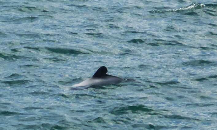
At 0900 the boat departed. This sailing was on the bigger catamaran. The 0800 sailing is on a smaller boat. I was happy to be on the bigger boat as I could sit inside for the journey out of the wind but when I wanted to take photos I could go onto the open top deck. The captain was friendly and gave interesting information as we went. We were lucky and saw some little Hector Dolphins.


There were two stops on the way to Ships Cove. Once we arrived I looked at the information panels and had my photo taken in front of the memorial. Ships Cove is where Captain Cook, who discovered NZ, first landed and spent the most time at in NZ on his subsequent visits. He established a peaceful relationship with the Maori who lived there.


At 1110 I was on the trail and what a beautiful trail it was. Apart from the first 5 minutes which were uphill almost steeply the rest of the track was an easy gradient. Most of the time I only realised I had been climbing was when I started going downhill. It was also a great day for my ego as I flew past everyone.
It was hardly fair having a fit TA tramper on the same track as people who probably haven’t walked more than 10 km in years if ever. Imagine a couple who had massive packs with things hanging off every attachent struggling up a slight incline as I prance past with my conditioned legs and relatively light pack. The mournful look on the couples faces as they admire the bulging calf muscles and what to them must look like a tiny pack makes me glad that I refrained from skipping past as that may well have been the last straw for them and would just have been mean.
Seriously I was feeling fresh after my two days off and had to keep telling myself to slow down. It was mainly people with day packs on the trail with a few with full backpacks.
The track was in beautiful condition and I was moving at a good pace. I saw two people coming towards me who had a TA look about them so I made a comment to them and they were. They were SOBO but doing just Queen Charlotte Track northwards.
In this area or is a mast year which means the native trees, and especially beech trees, flower more than normal which creates more fruit which the rodents love so their numbers explode. That is why the traping and poison was so intense on the track.


I stopped for lunch at some picnic tables overlooking the water with about 10 other people. There were 2 Weka there which was good entertainment to see what they would try to steal. After 40 minutes I continued on.


Not long after I saw Dan Slattery coming towards me and he asked if Bluff was in the direction he was going. He was also doing Queen Charlotte Track northwards but would switch back once finished.
I was stopping a lot to take photos and in one spot did a video just to capture the noise of the birds. This meant one lady who was walking a good pace kept passing me then I would pass her again.


At 1400 I came to Furneaux Lodge and decided to stop for a cupaccino, just for the novelty of being able to do so while in the middle of a tramp. After I sat down at a table the lady I kept leapfrogging arrived and she sat next to me and we started talking. She was just doing a day walk and catching the boat back that afternoon. She ordered some chips and when they arrived there were a lot. She asked me to help finish them so to be polite I took a few going with my philosophy of not turning down offers. She then cried out that she couldn’t eat anymore and pleaded with me to finish the bowl so she didn’t have to live with the shame of ordering too much and wasting food. Well what else could I do but sacrifice myself to forcing the hot crunchy salty chips into my protesting body, valiantly eating to rescue the distraught woman from her shame because that is the person I am – always thinking of others. I persised in the difficult quest and finally (30 seconds at most) with a cry of triumph downed the last chip and just to ensure there was nothing left to add to the traumatised women’s pain I wiped all remaining salt from the bowl. The area erupted in cheers as everyone realised magnitude of my sacrifice for the woman and the difficulty of the challenge.
Ok maybe there was a little caffeine in my sytem when I composed this while walking along. It was my third coffee of the day when I am not used to caffine anymore. In more sedate terms – the chips were nice.

I then continued on and encountered several trampers over the next 30 minutes then no one for the next 2 hours. I have been surprised all day at how few people are on the trail given it is peak season.


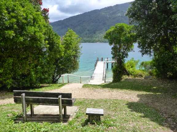
I arrived at Camp Bay 1720 and met the Camp Host. After paying the $6 fee I found a nice spot and set up my tent. I was a little disappointed there was no sea views but at least there was nice bush.
When I was filling up my water I met Thor (Germany) who is also doing TA. After a quick chat I went exploring to look at the beach and nearby lodge. $30 for fish and chips was a little steep so I was happy to head back to the campground. Thor’s other half, Katherine, was there now so we chatted. We brought our cooking gear down to the table and ate dinner together. At the late hour of 2030 we retired to our tents.


4 January 2015
Day 68. Camp Bay to Mistletoe Bay.
They may look cute and innocent but really they are commandos with excellent tactical skills. They even run in short bursts like trained soldiers. They start with a deception plan by approaching warily as if they are scared of you and so you don’t think they are a threat. Really this is their reconnaissance to sus out if there is anything worth stealing and their angle of attack. They will then withdraw to discuss their battle plan. “Rangi did you see she had bread at the front right of the tent”. “Yes I did Jane and there were some muslea bars in the pack pocket”. “Right we will go for those, she seemed observant so lets go for the distraction from the right and grab from the left”. Roger give me 2 minutes to get in place, moving now”.
In the meantime I have started packing my tent and notice a Weka approaching making a bit of noise. Knowing they are usually in pairs I spot the other approaching my pack and yell at it and they both withdraw.
Once they withdraw – “Jane did you hear the accent?”. “Yes Rangi she is a Kiwi, lets move on and find a tourist for easier pickings”.
5 minutes later further up the hill “stop give zat back” he he.

I left at 0900 and today was a little harder as there were a few more hills and it was really hot- as in 30 degrees celcius. There were a few open bits and I really felt my energy being sapped in the heat. I took heaps of breaks and took it easy. It was a day of beautiful view after beautiful view. I took the option to go up Eatwells Viewpoint and it was worth the extra 1.5 km (according to the sign but I am sure it was only 500 m each way.


I had lunch on a rock in the shade looking towards Picton.
After Torea Saddle was a big climb up to 400m and the track narrowed and was a bit rougher but still good relative to TA average. I decided it was too short a day to stop at the DOC campground at Torea Saddle and the next one was another 16 km away which was too long so I stopped at a private campground expecting a horrendous price so was happy it was only $16 – still way more than I prefer to pay when in my tent as I prefer stealth camping for free but that is not allowed on this trail. If you ignore the power pole right by my tent it is ok.


As I was preparing my dinner two trampers walked past and knowing that I got the last spot I told them I was happy to share. 5 minutes later Joe and Paula returned and set up their tent behind mine. Joe is section walking the South Island though he is doing all the way to Arrowtown so it is a huge section and he will be just as fit as the thru hikers by the end of that. He has done a long distance hike in Australia a few years ago that was over 600 km long and had 27, 000 meters of climb, who knew Australia had that many hills. Paula is just joining him for this section. We sat and talked about hiking, gear and backgrounds until dark then went to bed, or rather I should say mattress.
5 January 2015
Day 69. Mistletoe Bay to Havelock.
The track climbed steadily for the first few km but the gradient was so gentle it barely felt like climbing. The trail continued to be easy to walk on and the views great. I was feeling good and caught up to Joe and Paula at a beautiful picnic spot.


I then carried on until Davis Bay. There was hardly anyone on the trail and today 4 mountain bikers to add to the three I saw yesterday which is way less than I was expecting to see. I must have timed it right with everyone still recovering from New Years keeping the trail nice and empty.
At Davis Bay I realised I should have pushed on two more hours yesterday because this was the campsite I was expecting on this trip. Camping right on the waters edge. Never mind.

I continued on and from Davis Bay to Anakiwa there were heaps of day walkers. 30 minutes later arrived in Anakiwa and was disappointed to learn the was no shop here. I had been anticipating a pie and chocolate milk for morning tea.


Once through Anakiwa there was a track below the road and above the sea for while and then a gravel track beside the road. Unfortunately this ended one km into the walk on the main road so that left 2.5 km on the road in the blazing sun. There was a holiday park and I went in to see if they had ice cream but no luck. Just some fizzy drinks that I don’t like when walking. Thankfully there was a service station just short of Mahakipawa Arm so I was able to get an ice cream and drink.


It was then 2.5 km road walking on a narrow winding road but luckily the views were great and the traffic considerate where they could. On some of the corners I went right off the road when I heard a car as there was no way they could see me in time to give me room otherwise.
There was a short section of bush track and then more road walk to Mahakipawa Hill Scenic Reserve. I had seen this hill and the track up it from a long way off and unlike usual this track did not appear easier the closer I got.


For my mutton head challenge of the day I decided I would go all the way up without stopping. That was a great thing to say from the bottom but was not so fun as I went up. I started by thinking it was not too bad but the steepness was consistent and the sun hot with no shade. Within 5 minutes I was drenched in sweat and getting annoyed with it running into my eyes. There were several false summits and every time after turning the corner to see more up I had to tell myself I was nearly there and not to stop, as well as telling myself how stupid this no stopping challenge was in this heat. It was a 400m climb in just 1300 meters!
Eventually I reached the top and I was surprised that it had only taken 17 minutes as it felt much longer but I succeeded in my challenge and didn’t stop all the way up. My legs and arms (from pulling myself up with walking poles) felt like jelly but after a quick drink I felt good again. I spied a TV Mast further up the hill so I decided to keep going up to see if that was the top but it was surrounded by gorse and there were no views so I came back down. With the fitness I have now recovery is really quick and the climb up to the TV tower felt like I was just starting to climb.
The track headed straight over the hill following the powerlines down. I was much slower going down taking my time. I know some people will bound down that hill but with the punishment I gave my knees when I was younger I know I would suffer if I tried. There were a couple of bits where I couldn’t use my walking poles and it really highlighted how much pressure they do take off my knees going downhill.


At the bottom it was a short walk to Havelock. Though it was still early there was no reason to push on as it was half a day to Pelorus and it is unlikely my resupply parcel will arrive before tomorrow.

I had heard good reviews from Blue Moon Backpacker but they were full so I went to Rutherford Backpacker, formerly a YHA but now unaffiliated. The reception was closed until 1500 so I headed to a cafe for a pie and smoothy (apple and fijoa). Back at the Backpacker reception 1500 came and went. Finally 15 minutes later a lady turned up with no appology for being late. I cheched in and the room was ok but would be crowded if full. It did have a couple of couches and I was the only one there.
I had a shower and did my laundry before sorting through my photos and reading for a bit.
For dinner I went to the Mussel Pot as I thought being in the World Greenshell Mussel capital I better have some. I had a lovely dinner and was surprised by how many mussels I got. I was definitely full at the end.


After dinner I worked on my blog and read.
6 January 2015
Day 70. Havelock to Pelorus Bridge.
There was a road walk for a couple of km that I really enjoyed as the views were great and there was a decent shoulder to walk on. At one big bend there was a nice gravel path over the barrier.


At Te Hoiere Road there was a decision point. The trail notes said to keep on the main road to Daltons Bridge but the map showed going over farmland and the river then following a gravel road. I went with the map option as there was a TA marker and it avoided the main road. It was actually a gravel road not farmland and was a lovely road. I am not sure if it was the caffine still in my system from breakfast but I felt really good and was zooming along. It was great to be road walking with no shin pain. My pack was the lightest it has been for ages, though still 5 days food less lunch.


After 2 hours 15 minutes I finished the road walk and now it was onto Daltons Track which was through farmland next to the river. This meant lots of stiles and electric fences to climb and the grass was long meaning I had to lift my feet more than normal. In one part I walked through a turnip field and these are hard to walk on. Imagine someone has scattered hundreds of tennis balls in long grass and you now have to walk over this.
As I had heaps of time today I was noticing the little things and took the time to photograph them today.


I felt like the pied piper of bumblebees today. I am used to them hanging around occasionally as they like the colour of my top but today was ridiculous. I don’t think there was a time during this part of the walk where I didn’t have at least one bumblebee hanging around. At one stage I had 4 of them following me. I don’t mind them flying around as they are not aggressive but it is unnerving when I know they have landed on my shirt and I can’t see where. I am always worried about squashing one by mistake when this happens.
The track started heading into bits of scrub to cross streams and then went into bush. It was such a relief to be out of the blazing sun that I just stood there for a little bit absorbing the shade and the sights, smells and sounds of the bush. There was a good sign explaining the Mast and how this effects rodent numbers. Also this bush is home to the Long Tailed Bat which along with the short tailed bat are the only mammals native to NZ.


After 900 meters I was at Pelorus Bridge. There were heaps of people swimming and the Cafe was full. I brought some drinks and food, picked up my resupply parcels and checked into my campsite. I met Mike and his wife while having lunch and they were asking lots of questions about the trail.


I walked down the road to the campground and was happy with my site. Shady and close to the toilets but not in the path to them. After setting up my tent I sorted my food. It seems a lot and is really heavy. I have 7 days supply which allows for a wet weather day but have some leftover so actually have a little more so will have to eat it quickly.

As there was no Internet I just relaxed and read which was great. I talked to a couple of Swiss guys doing TA but they struggled with my accent and conversation was not easy. I headed back to the cafe for some coffee and spent the rest of the day vegging out
7 January 2015
Day 71. Pelorus Bridge to Rocks Hut.


After 3 hours and 15 minutes I arrived at the trail head. From here it was a lovely walk beside the river which was beautiful, crystal clear and slightly greenish – nice green not dirty green. the Swiss guys I met yesterday at the campground caught up to me as I was taking photos at a swingbridge. I then overtook them 15 minutes later.


The track was a little rougher than I was expecting to Emerald Pool Picnic area and this area was just a picnic table though if you went down to the river it was pretty. As I got back to the track I saw the Swiss just in front of me and I quickly caught them going up a hill but rather than pass I took a break to eat a snack and key then get further ahead as I much prefer walking without other people around.
The track then climbed away from the river and sidled around the hill before dropping back to the river. The bush was a mixture of trees but there were large parts if beech which I love walking through. Just 5 minutes from the Hut I passed the Swiss guys as they were getting ready to have lunch.


After 2 hours 45 minutes from the road end I reached Captains Hut which is an older 6 bunk hut. I filled in the Hut Book before continuing. The hut book is a green Hardback book either called a Visitors Book or an Intentions Book depending on its age. These are in every Hut. They should be filled in by everyone passing the hut even if they are not stopping there. The reason for this is Search and Rescue use these books as their main tool to narrow down where a person went missing when they have been reported lost. Also DOC (Department of Conservation) use thesr to see hut usage and determine maintenance priorities or whether to dismantle huts that are not used.

I continued on and after 5 minutes found a fantastic spot to have lunch in the shade looking over the river and a little waterfall.


From there the track sidled first up one side of the river crossing a stream by swingbridge before crossing over a swingbridge over the main river and sidling on that side crossing a stream by swingbridge and climbing a short but steep hill. Here I met Nina from Guatemala struggling up the hill with a very heavy pack. She was doing the South Island part of Te Araroa so was just starting to get her trail fitness.


The track then flattened out to a fast stretch before reaching Middys Hut. It took 1 hour 15 minutes (time at lunch deducted but all other breaks included).


As I opened the hut to fill in the Intentions Book a wave of heat wafted out so I was out of there quickly. I made use of the toilet and as I was putting my pack back on I got savaged by Sandflys. They were latching on even as I was walking off. I am glad I didn’t have to stay at that hut.
The track then crossed back over the Pelorus River and started climbing. It was 600 meter climb over 4 km so constant but not too steep. Thankfully there were now some clouds so it cooled off but it was still hot. Near the top I saw a weka and it was nice to see one in a more natural environment. The trees changed as I gained elevation and near the top were some big rock outcrops.


I reached Rocks Hut in 1 hour 45 minutes from Middy Hut. The hut was a modern 16 bunk hut with the luxury of flush toilets, very unusual for a hut. There were two other people in the hut.
Lisa lived in Nelson and had mountain biked up the Dunn Mountain Trail to Copper Mine Saddle, hid her bike, then walked 1 hour to the hut. Kevin is section hiking TA and started in Anakiwa and will walk to St Arnaud. He was keen to look at my gear and talk about ways to lighten his pack. He was struggling on this walk due to having no trail fitness and got the impression he was not happy with himself about this, especially when he found out how quickly I was moving. I tried to emphasise how much my 2 month trail fitness was responsible for this and he should give himself time to adjust and not rush.


After we had finished dinner Nina arrived and I was able to see why her pack was so heavy. The mysterious bottle of dark liquid I had seen in the pocket of her pack was Soy Sauce – 500 ml of it!
We chatted about travel and tramping then as it got dark went to bed.
8 January 2015
Day 72. Rocks Hut to junction Old Man Hut/Rintol Track
I was making good speed on the track but was having to concentrate as there was lots of rocks and roots. At one stage there was a crashing in front of me and there was a huge deer running off. The track headed downhill but at an easy gradient so it was a quick drop. It took 3 hours to get to Browning Hut.


From Browning Hut the trail followed the river, crossing it a few times. Near the junction to the Harper Road End I came across a large group of 15 to 20 mature trampers. I was surprised to come across such a large group in the bush. At talking I learnt they were a tramping club fit over 50’s.
From the junction the trail headed uphill and them downhill and it seemed to take ages for the last 15 minutes. The DOC time for this section was very tight for the average tramper as it took me the full 1 hour to Hackett Hut.


I walked across the Bridge from the hut then took a break by the junction. As I was sitting there two mountain bikers went past. They asked which direction I was heading and when I pointed to Starveal they cringed and said good luck.
The track followed the river for nearly a km crossing it several times. At each crossing there were plenty of rocks to use to go across and in one place a log to use as a bridge. This meant I was able to keep my feet dry which Iwas greatful for later on the day. The trail then left the river and started climbing – 900 vertical meters in 4 km. The climb was constant but not as hard as I was expecting. At 1000 meters altitude I entered the cloud layer and it was neat walking through the misty trees.


Through the mist the hut appeared and there was a big red tent set up. As I approached a man emerged from the mist with an armful of wood. We went inside the hut and it was toasty with the fire going. The guy was also doing TA with his girlfriend and they were staying a couple of days at the hut. I was not sure why they were staying in their tent when they had the hut so comfortable with the fire going. It had taken 2 hours 15 minutes to get to Starveal Hut from Hackett Hut.
I filled in the Hut Book and then ventured back into the mist. The mist was now really heavy abs visibly was varying between 10-20 meters. The track was now above the trees and it was fantastic walking through this barren landscape airline by mist. It made me focus on the small area around me. I had to concentrate on reading the ground to tri and discern where the track was as I could not see the markers. The track went along the side of a hill and then over some rock outcrops and over some shale. It was dead silent as there were no birds without the trees so I noticed the sound of my footprints. The was the crunch over the small gravel like walking on firm snow. Going over the shale it sounded like walking over broken glass. As I descended into the tree line the green of the moss seemed super bright amongst the muted colours caused by the mist.


I paused for a break and add I sat there a Tomtit came and was flying around me getting closer and closer. I love these birds as they are round bundles of feathers and really inquisitive.

After climbing a few hills the track came into the open and descended through tussock to the hut. It took 1 hour 50 minutes to Slatey Hut. There I met Joe (from Queen Charlotte Track) and another guy whose name I forgot (sorry). I cooked dinner there as there was no water until Rintoul Hut which I would reach tomorrow, unless I wanted to go to Old Man Hut which was a 250 metre vertical drop from the track that seemed a waste of energy. I filled up with just over a litre of water over my normal 1 litre to last me for a final drink that evening and breakfast tomorrow.


I walked back into the mist and started a big climb. The misty started clearing as I descended down and I started to get a perspective of the landscape around me and it was great. I stopped to take some photos and take in the views. It was a little intimidating looking at the hill I needed to climb but it was nice to see into the distance. I started walking again and in the distance I saw two goats with identical dark brown coats. It is unusual for goats to be the same colour, usually they are a motly collection of colours and markings.


After 15 minutes the mist came back again and it was hard staying on track. I thought it strange that the big hill I had seen didn’t seem to appear. It must have been a gradual climb. The track veered off to the right snd as I had no visual cies to my location I though I had missed the junction but this was the direction I was meant to go in so was not worried. The track went through bush for a short stretch then back into the open which matched what I was expecting. I climbed the hill and was surprised how high it was. There was no way to know if I was on track but occasionally a marker pole would appear through the mist so I was happy. At the top was the junction I thought I had missed so I had to reassess my location and continue on. From here the wind picked up and the trail got a little scary. I could see enough in the mist to know there were large steep, and sometimes sheer cliffs to one side as I was scrambling up rocks. Some of these I felt like I was rock climbing as I had to let my poles dangle and use my hands to crip the rocks, and I was gripping tightly with the drops below me. I was really relieve to get through this part amd into the trees. I walked past the first junction to Old Mans Hut 2 hours 50 minutes from Slayey Hut. From here I started searching for a tent site, though I didn’t expect to see one until after the next junction bases off the map contours. Sure enough I arrived at the second junction with no suitable sites. Only a minute after this I found a suitable site. By the time my tent was up I was cold so I had a hot drink and OSM bar and snuggled into my sleeping bag and quickly went to sleep.

Answer: moss on rock

-
MikeG 18 January 2015 at 14:23 Sounds a bit scary with the drop offs and not actually able to see the track. Good on you for keeping going though.
-
Restless Kiwi: Walking the Te Araroa Trail 22 January 2015 at 08:54 Hi Mike. All part of the fun.
9 January 2015
Day 73. Base of Rintoul to Mid Wairoa Hut.
I woke up at my normal time but as it was cold and misty I decided to stay in bed in the hope the sun would burm the mist away. Eventually I decided it would not happen and packed up. I was cold by the time I was done so was glad to get moving to warm up.
The track headed up through the trees for 15 minutes before emerging into the open and a sunny cloudless day. As I climbed it was great to look at the mist below blanketing everything. The climb was steadily up but fast going. I got into a good rhythm and was up Little Rintoul quickly. I spent some time there taking in the views and taking photos. It was a little intimidating looking at what I was climbing next, more so looking at the descent to get there which was 250 vertical metres in about 800 meters.


The descent off Little Rintoul was extreme and I took my time. It was very steep and the surface unstable. A few times I felt like I was trying to balance on marbles.
I was very glad to have that finished and start the climb up Mt Rintoul. Just as I came around the corner to start the climb I spotted people ahead. They must have always been just around the corner for me not to have seen them earlier. With targets acquired my competitive streak was ignited and with a hill in front of me this time I could not reign it in. I stormed up the hill and caught two of them just short of the top. Dave and Rose had camped just a little bit further up the track last night. I have been following their Hut Book entries and was keen to meet more kiwi TA trampers. The other guy had stayed at Old Man Hut so started his day with 250 metre climb just to get back to the track. He had walked past my tent while I was lazing in bed.


After sitting for a while absorbing the fantastic views I started the descent. This was one downhill that I did enjoy. The surface was easy for the first part then there was a scree slope that I could bound down. Scree is loose rock that is deep so you can jump on it and you slide a little before stopping. The technique for descending this is to bound down digging your heels in it letting yourself slide as you are taking the next step. It is a fast and fun way to descend. At the bottom of this it was into the tree line for a short time and then I arrived at the hut, scaring two goats who were there. Start to Rintoul Hut 3 hours 10 minutes.


I signed in and was off. 5 minutes from the hut was a large area of storm damage and fallen trees. The trail disappeared so I decided to go around it and pick up the trail and followed the logical route to the left and picked up the track quickly. From there was a big climb up Purple Hill.


The track descended and then sidling around Bishop’s Knob and down , up, down etc along a ridgeline. Coming down I saw the water of the Tarn (mountain pond) before arriving at the junction. I headed down to the tarn and then followed it around to the right to the hut (3 hours from Rintoul Hut). Tarn Hut was not righ on the tarn but onlt 20 meters away through the trees. The tarn was much bigger than I expected and personally I would call it a lake.


It was only 1530 so I decided to push on to the next Hut. After climbing back up to the ridge I followed this to a junction then sidled around the side of a hill before descending down to the Wairoa River. This section took longer than I expected (2 hours and 30 minutes) I was happy to reach the hut.


At Mid Wairoa Hut was a french man who was intending to do Te Araroa South Island nut was having to head to the nearest town as he had run out of food. He was staying in his tent. Also there was a British guy, Nick, who came to NZ regularly to go tramping who I talked with while preparing and eating dinner.
As it got dark we put our food away as the hut book warned of mice. I packed everything into my pack and put it on a bench next to me. As soon as we were in our sleeping bags the noise started. There were two mice. One was scrambling arount in the rubbish people had left in the fireplace. The other one for some reason liked the sleeping platform. I could hear it moving over my pack and then up past my head to the sleeping platform and back and forth between nick and I. Worried that they would chew through my pack I got up and hung it high. The mice stayed noisy and it was not a great sleep.
10 January 2015
Day 74. Mid Wairoa Hut to Porters Hut.
Nick had already said he would be awake so it was nice not to have to try to be quiet. I was on my way at 0700 and it was cooler to start but soon warmed up.
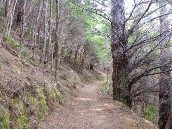
The trail notes say this section is challenging and they are right. I am glad I decided not to push on last night as this section required concentration and no tripping. The track followed the Wairoa River upstream and as this was a narrow valley that meant sidling most of the way. Unfortunately not much effort has gone into creating a flat path along the hill so a lot of the way it was a narrow ledge and frequently there was a good drop off do to the river. There were a few times my adrenalin was going.


Occasionally there would be a flatish spot where I could relax. Just as I was climbing out of one of these nice bits I was in a good mood. I could see the sun was shining on the hills above which meant I would get good views, the river was pretty below, the birds singing and AARRGH! I look down and there is a wasp with its rear end stuck into my leg gleefully pumping poison into me going “take that he he he, take that he he he” cue evil laugh ” ma ha ha ha”. Eventually it decided I had been punished enough and disengaged, flying off to continue its business and I am sure laughing at having such fun and glad it is not a bee.
In its defence I think that it got caught behind my knee as I was stepping up and was being squashed.
So now the top of calf just below back of knee was very sore. Luckily I am not allergic.
I continued on tiptoeing above the river until the track headed up out of the trees to the pretty Top Wairoa Hut. The hut has been renovated and is in its original Forest Service colour of bright orange with the hut number painted on the roof. It took 3 hours 30 minutes to get to this hut. I only stopped long enough to fill in the Hut Book and then up to Wairoa Pass.


This track gains height more gently than I expected but is hard work due to the rockhopping through large boulder fields.


From the pass the track followed the ridge and then sidled along a hill on a scree slope. Then it was a few more boulder fields and some tussock to the point where the descent started. I stopped for lunch here as I wanted to keep taking in the amazing views. In one direction was the ocean. In all of the other directions was mountains as far as I could see. There was not just one mountain in each direction but mountains stacked behind each other. Absolutely fantastic.


I dragged myself away from the views and started the descent. Normally I don’t like downhills but this one was easy with grippy gravel and then in the trees the track was nice. From the junction in the middle of a rocky clearing the track started to drop steeper but I was still finding it okay. Unusually the treeline stopped and the rest of the descent was in the open. This is due to this being part of the Nelson Mineral Belt whuch contains some unusual minerals but not enough of the normal ones to allow normal vegetation to grow. The terrain looked more like desert than what I would expect and the change was nice, though hot with no shade. Also the hut was in sight early into the descent despite still being several km away.


By the bottom of the hill I was really hot when as the track crossed a streamand I saw a lovely pool I dropped my pack and jumped in, shoes and all. It was time my clothes got a rinse after the continual sweating up the hills.

Feeling nice and refreshed I followed the slightly overgrown track along the river then uphill to the Hunters Hut (4 hours 25 minutes). Already there was Fred and Nev who I had met in the Tararuas and a friend of theirs who was joining them for a section. I feel sorry for this guy trying to keep up with trail fit people. While the hills are hard work that is only due to the speed I am climbing them and once at the top my recovery is really fast.


I left there after a snack for the final section of the day to Porters Hut. The trail notes describe this section as “undulates” which is correct if you call 100 meter vertical climb and descent over and over undulating. The scenery continued to be amazing and this section covered a wide variety of terrain including tussock, scrub, boulder fields, scree slopes, beech forest and open moon like terrain.


As I came over a saddle the hut came into sight in the distance. The bright orange really stands out. Unfortunately I couldn’t pick up the pace as the track was too rough but it didn’t take long to reach the hut (3 hours 20 minutes from Hunters Hut).


The hut was nice and clean but there was no water. All huts have a water tank fed by rain on the roof so I was surprised that this didn’t. There was a 20 litre container that had about 5 litres in it. I decided to leave that to someone arriving late and followed the directions in the front of the hut book to fill up my water bottles.
I was happy to have the hut to myself for the first time in the South Island. I had fun reading the hut book while eating dinner.
Knowing I would have mice tonight (from the hut book) I hung all my food out of reachand humg my pack as well. I then looked at all potential noise producing items and put them out of mouse reach or outside. Unfortunately I couldn’t stop the noise they were making inside the fire. They were pretty brazen and came under the door before it was even dark.
11 January 2015
Day 75. Porters Hut to St Arnaud.
Just after the hut on to of a small hill was the 1900 km mark so I took a photo and then was on my way.


The trail went up and down a bit, though not as big a climbs as yesterday, until reaching the Maitland Creek and then it sidled above the river heading down and up again as streams joined from the side. The track was generally ok and I was even able to stretch out in a couple of bits. On one side of the river was nearly normal bush but on my side it was the desert like vegetation. luckily the sun was at my back so it wasnt too hot but I was still wetting my hat at every stream to keep my temperature down. in all the river crossings I had kept my feet dry but near the top there was a swampy atea that was impossible to jump across so I not only had very feet wet but muddy too so the next stream I washed them.


.jpg)


Eventually the track came to the top of the Creek and I refilled my water thinking you couldn’t get much closer to the source. As I came over the rise the hut was in sight over a tussock field.


After filling in the hut book I was on my way down a vehicle track all the way down to the valley floor. When I started hearing sheep I knew I was near the bottom. At some derelict buildings the track became a trail through some bush to the road and then only 10 km to the bright lights of St Arnaud.


I was 2 days early for my accommodation booking and the backpackers was full so I was forced into the luxury of a standard motel room which I wasn’t really that upset about. The upside was I was here on a Sunday for the famous all you can eat BBQ.
I settled into my room, had a shower and put my clothes and sleeping bag liner into the laundry. On my way back I spotted two ladies who looked like trampers. This was Isobel and Moi who did Te Araroa North Island last uear and were doing the South Island this year. Unfortunately Moi had hurt her knee so they were unsure what to do. While deciding they were going to walk round Lake Rotoiti.
At dinner I sat with them and I devoured two full playes of delicious food. On my way back with the second serving I ran into one of the guys I had met in the Richmond Ranges but when I went to where they were sitting after dinner they were gone. The waitress then twisted my arm (asked if I wanted to see the desert menu) so I had two scoops of ice cream and a fruit salad.
I then sorted through my photos and went to sleep.
12 January 2015
Day 76. St Arnaud Zero Day.


13 January 2015
Day 77. St Arnaud to John Tait Hut.
I checked out at 1000 exactly and headed to the cafe for a breakfast with everything. At 1115 I was finally on my way.
The trail started behind the hotel passing through a gate to a nice track beside a stream all the way to the lake. At the lake I took a photo of the jetty which is stunning then joined the lake track which was walking track standard for the first km then very good tramping track to the lake head. The only detraction from the stunning scenery and track was the annoying noise of the boats racing around the lake.


2 hours 20 minutes after starting I reached Lake Head Hut- another naming that required great imagination. In the hut was an older couple who were asking about TA and my gear. I noticed the lady holding her poles in an inefficient way so showed her my method. They took a photo of me to show others my gear.

I continued on up the valley largely in the open with amazing scenery. Steep rugged mountains around me and meadows of flowers to walk through.


After a while it was back into the bush. I saw two people the whole day. One had earphones in both ears listening to music. I understand listening to music on road walks but cannot understand why you would do this in the bush. I love the sounds of the bush, birds chirping, streams gurgling, rivers roaring etc.


After 3 hours 30 minutes I reached John Tait Hut. There was a family with mid teenage son and slightly older daughter. They were interesting to talk with so the evening went fast.


2 comments:
-
Sally Billington 21 January 2015 at 18:43 Thanks for advice on using my poles. Much appreciated on the track back to St Arnaud. Enjoying your interesting blog and will watch your progress to the end. Would love hear more about your other life adventures, but how to get in touch.From ‘the older lady’ at Lakehead Hut.Restless Kiwi: Walking the Te Araroa Trail 22 January 2015 at 09:08 Hi Sally. Not a problem with the poles. I am glad you feel an improvement. You can message me from one of my posts on Facebook Te Araroa group page. I will update the blog to put your name.
14 January 2015
Day 78. John Tait Hut to Blue Lake Hut.


I heard a loud roaring and then there was Travers Waterfall which was pretty impressive and worth the 1 minute detour.

Near Upper Travers Hut two trampers came towards me – not TA. They said the hut was close and 5 minutes later I arrived, 2 hours 20 from John Tait Hut. There were two Germans in the final stages of packing up but I was in and out quickly just filling in the hut book and eating a snack.


From here it was into the open and the track was tussock and rocks and went uphill with a few steep bits and some flats. I could see I was at the head of the valley but all I could see in front was large steep mountains and no obvious track up. Then the track curved to the right and we started climbing up a place which has been out of view. The track was now steep all the way to Travers Saddle.


Near the top the tussock changed to scrubby plants and more rock fields. I was looking out for geckos as there are alpine geckos here but all I saw was lots of crickets in all sizes and colours. I was amazed at the variety and huge numbers of them. There was snow patches on the nearby mountains and the scenery was spectacular no matter which direction I was looking. The mountains were much closer and higher than the Richmond Ranges.
After 1 hour and 450 vertical meters I reached the saddle and it was now a nearly 1000 meter descent that had the legs aching. The final part was steep and was a switcback (zigzag) but I am not sure the European and North American trampers would call it a proper switchback given eack leg was only a meter.


In 1 hour I reached the bushline and the descent kept going until reaching the East Sabine River. There I met two ladies who were recovering from the descent before continuing. They were doing the Travers Sabine 5 day circuit and finding it harder than they were expecting.
I continued along the track which for nearly 100 meters was perfect then there was a swampy section and it got rougher with more roots. We crossed over the river which had turned from a normal stream to a narrow but really deep canyon which was crossed by a bridge. The force of the water through the narrow canyon was really loud. The track then climbed a bit and sidled aling a hill. Along here were heaps of huge Dragonflies. They were nearly 15 cm long and 1.5 cm wide. There were also lots of tiny birds about the size of a small mouse that I hadn’t seen much before. Through the trees I could make out a huge waterfall on the hill opposite.


I arrived at West Sabine Hut and there was a family with two teenage boys just leaving. I filled in the Hut Book and saw the family were heading to Blue Lake Hut as well. It had taken me 3 hours 40 minutes from Upper Travers Hut.
From the Hut I crossed the Swingbridge and 5 minutes later found a nice lunch spot. A lot of people have lunch in the huts but I prefer to have them away from man made structures when the weather is nice to take in the sights and sounds of nature as even after 2 1/2 months I still haven’t had enough. I was also hoping some of the small birds would come as I haven’t managed to get a photo of one yet.
After 20 minutes I carried on trying to estimate how quickly I could catch the family in front of me. I estimated 1 1/2 hours but managed it in 40 minutes. The track was steadily climbing and was rough with lots of roots but I was able to move at a good pace without rushing. I saw my first TA NOBO (Te Araroa Northbounder, going opposite direction to me). Nathan was wearing a distinctive Aarn pack with the big pockets in front. He recognised me as a TA tramper.


I arrived at the hut at 1635 which was 2 hours 15 minutes from the last hut. Fred and Nev were there. Their friend stopped in St Arnaud to rest his injuries so Fred and Nev were back to full speed. They left to walk to the other end of Lake Constance to camp there to make the next day easier. I was slightly tempted to do the same but I had walked further that day and decided despite it being early I would stay at the hut. Also in the hut were a family with 2 girls and a boy that I would guess were all under 12. Pretty impressive walking for young kids. They didn’t come the same way as me but still came a long way. Thankfully the children were very well behaved and the parents fun to talk with.
I walked down to the lake. Blue Lake is the clearest lake in the world and only fractionally away from the theoretical clearness of distilled water. To keep it this way, and for cultural Maori reasons there is no washing in the Lake, though the stream below is fine for this. After lots of photos I headed back up and the family I passed was just turning up.


I wanted to really be hydrated for tomorrow so I was having lots of hot drinks. Before, during and after dinner.
The family with teenage boys was doing a 9 day tramp over 4 passes and some rugged terrain, some of it untracked. They were really interested in my food and gear so I did a show and tell and their reactions were hilarious at the weight of things.
After another social night it was bed time as it got dark.
15 January 2015
Day 79. Blue Lake Hut to TA km 1991 (5 km south of Caroline Bivy).
From the Hut it was a steep climb and looking back I could see all of Blue Lake and with no wind it was mirror smooth. It was a nice view to start the day and make the hill seem less. At the top of the hill Lake Constance came into view and it was also very pretty.


The track went to the right of the lake climbing above the bluffs. I had read and been warned that this was very tricky and dangerous so I was ready for anything but after the Richmond Ranges this was pretty tame and I wasn’t concerned at any stage. I guess if you are not experienced it could be scary but not for most TA trampers. While on this bit I saw a Kea fly past and later on I could hear one in the rocks below but couldn’t see it.


Once back at lake level the track followed the shore to the Lake head and then headed up the valley crossing a few streams. Like yesterday I knew I was at the valley end and had to climb but every side looked steep.
I saw what looked to be the track up high but the track started heading away so I started searching the other slopes but then the track turned again and started up a scree slope heading where I thought it was going. Scree is loose rocks and is fun coming down but not so fun going up as every two steps up you lose one sliding back down. Thankfully there was a narrow grass strip and this was easier climbing. It was a long way up and I had to stop to take photos a few times (this is a sneaky way to get a rest though the scenery was deserving of multiple photos.


At the top I was surprised to see some snow still there given the scorching temperatures we have been having. I had to stand in it so now I have stood in snow on the official TA trail in both Islands (Tongariro Crossing was the other).


Once again I had heard a lot of stories about the nightmare descent so was braced for a challenging descent but I was pleasantly surprised that it was actually ok. There was one small bit that did require hands and some easy rock climbing but the rest was great. While it was steep the surface was firm. It is the descents with slippery gravel or mud that I hate. I took my time going down and my knees were a little sore but nothing like after yesterdays descent.


From the bottom of the steep part here the track followed a river down through tussock and then scrub until reaching the bush.


Here I crossed the river by jumping across rocks. The track crossed several boulder fields and I found this more tiring than the Waiau Pass I had just completed. It was hot and this was gaining my energy so I took a long lunch. The trail was along the river sometimes in the bush, sometimes the river side in the rocks and sometimes over boulder fields so it was slow going but then the valley opened up and the bush tracks became nice and there were grass meadows which had a lovely track through it. I finally reached a stream I couldn’t jump across so wet feet now.


I reached Caroline Bivy which is a tiny two bunk very basic but designed for emergency shelter.

I signed into the hut book, on the inside cover as it was full, and continued on. I quite liked having the freedom of stopping where I wanted and when I wanted again. While huts are great they tend to draw me in and I either end up doing a short day or a much longer day than planned to make sure I get to a hut. There is no need for this as I love my tent but it is hard to resist a hut. Today Caroline Bivy does not have the same attraction and the next Hut is 28 km away so I am going to camp at around 1730 wherever I am.
From Caroline Bivy the track was largely in the open across Meadows and sometimes through bush. It was quite fast going. There were a few stream crossings so just as my feet were drying out they got wet again.


Close to 1730 I entered some trees so I started looking for a campsite and found a lovely site looking down on the river and up at a mountain. Being higher it took the Sandflys nearly 10 minutes to find me by which time I was safe in my tent. They are persistent though and glued against my netting. I sometimes breath my lovely CO2 at them just to tease.
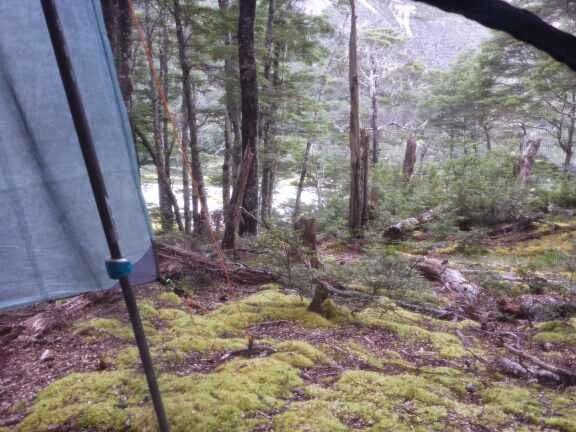

It is nice to be back into my tent routine and not have to be considerate of others.
Visits: 1406
4 comments: